Strict Standards: Non-static method nggGallery::get_theme_css_file() should not be called statically, assuming $this from incompatible context in /home/themeso/public_html/blog/wp-content/plugins/nextgen-gallery/nggallery.php on line 373
Latest Chases « High Plains Drifter

High Plains Drifter


disclaimer:  "The meteorological views/forecast thinking expressed are those solely of the author of this blog
and do not necessarily represent those of official National Weather Service forecast products,
therefore read and enjoy at your own risk and edification!"

June 30, 2010

Chase Account 31 May 2010 Pritchett-Campo, CO [Part 3 of 3]

Filed under: Chase Accounts,Latest Chases,Storm Chasing — Mike U @ 7:30 pm

Strict Standards: Non-static method nggGallery::get_option() should not be called statically, assuming $this from incompatible context in /home/themeso/public_html/blog/wp-content/plugins/nextgen-gallery/lib/shortcodes.php on line 47
The long-lived, significant tornadic supercell of 31 May 2010 will go down as probably my most thoroughly and successfully documented significant tornadic supercell in my 13 years of storm chasing.  There were three distinct phases of this storm chase, and as such, I will document this account and share my images in 3 parts.  The first phase (Part 1 of 3) was the time frame from roughly 2:45pm to 4:30pm which included a 20-minute tornado southwest of Pritchett, Colorado.  The second phase was a long period from 4:30pm to about 7:00pm when the supercell was non-tornadic but still cycled through several significant occlusions, one of which was very close to being tornadic (Part 2 of 3).  Lastly, the Campo, Colorado significant tornado, the hallmark moment of this supercell, will be documented in Part 3 along with the post-tornado sunset structure as the storm rolled southeast into the Oklahoma Panhandle northeast of Boise City.

Part 3 of 3. 7:00 to 9:00pm CDT (The Campo Tornado)

(times CDT unless otherwise noted.  numbers in brackets refer to the image number in the embedded image album at the end of this post)

Once I reached Hwy 287 again after spending some time just east of there on County Road C, I decided to just find a nice viewing area along the highway and pull off to watch the structure evolve to my north.  I was actually observing the new lowered area directly up the road to my north initially… and not the more occluded area behind it and to the west a little bit [1,2].  The occluded area behind was showing a marked increase in rotation and just moments after noticing thing and it catching my interest, a nub funnel had developed [3].  Well in just 10 to 15 seconds, this initial nub funnel cloud continued to stretch, becoming a much more formidable funnel cloud [4-7], and eventually a fully condensed funnel all the way to the surface.  Initially, I was shooting with just my D3 and the 14-24mm ultra wide lens, but once I saw the funnel develop, I grabbed the D200 with the 18-70mm lens and and both wrapped around my neck to shoot with.  I didn’t realize until after the fact that my D200 was about a minute and a half ahead of my D3, which made chronological sorting my images in Lightroom a challenge.  I remained at this location for the first 10 minutes of the tornado, and little did I realize the first 6 or 7 minutes that the tornado was closing in on my location.  The first stage of this tornado from about 7:09 to 7:11 or 7:12 featured this absolutely glorious, tall elephant’s trunk that angled slightly to the west from cloud based [9-14].  This offered wonderful composition opportunities at around 50 to 70mm, both vertical and horizontal.


Times on map are Mountain Daylight Time.  Numbers refer to image numbers in the embedded album at the end of this post.

At around 7:13pm or so, it finally kicked up a nice visible dust cloud at about the time the condensation funnel widened and become ever so slightly truncated near the ground [15-24].  This stage lasted until around 7:15pm or so and then a very dark, dusty debris cloud formed as the tornado was approaching Hwy 287 to my north-northwest [25-29].  Since the tornado was getting a little closer, the condensation funnel was becoming a little more spectacular.  As the tornado was approaching the highway, there were more and more chasers bailing south, and since I stayed put a little bit longer, I got a number of wide angle images of the tornado with storm chaser (and non chaser) vehicles going south on the highway.. as well as the green highway mileage sign “Springfield 29, Campo 7″.  At around 7:17pm or so, the tornado crossed Hwy 287, and around this time, a huge surge of dust from the field in front of me blasted across the highway in a 60-75mph west RFD [34,35].  In image 35, you will see a vehicle’s headlights totally immersed in this RFD dust advancing east immediately ahead of the tornado itself.  I was still outside of my Jeep photographing all of this just right up the road, and after Image 35, I bailed ass south about a half a mile, but not before getting in on some of that dust.  The wind was so strong, I could hardly open my driver side door and my glasses wanted to blow off my face.  I estimated the wind to be about 65 to 70 mph or so.  This was just a narrow RFD jet, and I got out of this RFD surge only about a quarter to half mile south on the highway, where I stopped again.


Times on map are Mountain Daylight Time.  Numbers refer to image numbers in the embedded album at the end of this post.


The tornado was now getting into a bit better light as I photographed it just east of the highway to my northeast [36-40].  At times, the foreground lit up in brilliant saturated greens/yellows with a wonderfully contrasted white/light gray tornado condensation funnel in the background complete with a dark brown dusty debris cloud.  This was just simply amazing!  Soon, though, another big RFD surge can rotating around the tornado and I got blasted again with 60 to 70mph wind gusts from the west-northwest.  This time, I had to take my glasses off and just carry them in fear of them being blown off onto the highway and break.  This wind was damn strong, slightly exceeding the crazy inflow winds I experienced with the Bowdle supercell on May 22nd.  I am guessing the peak wind gust there where I was at was near 75mph.  It was time to move south again.  The tornado either dissipated or completely wrapped in rain, and I stopped again a couple miles south before re-emerging again shortly after 7:30pm to my east-northeast as a white tornado somewhat wrapped in rain with a rainbow off to its south.  I had totally filled up my compact flash cards, mainly due to the fact that I still had some images from a previous chase on there that I forgot to delete off a couple of the cards.  I finally lost sight of the tornado shortly after this time and I made my way down toward Boise City then drove east to catch back up with the storm.  Sunset light was simply amazing with beautiful hues of gold, orange, and pinks as the high-based supercell continued to march east.  I finally ended the chase as I approached Hwy 136 and made my way back home…completing the most amazing high-based tornadic supercell intercept in my 13 years of storm chasing.

This SimpleViewer gallery requires Macromedia Flash. Please open this post in your browser or get Macromedia Flash here.
This is a WPSimpleViewerGallery

June 27, 2010

Chase Trip Day Ten and Eleven (June 26-27) Summary


Strict Standards: Non-static method nggGallery::get_option() should not be called statically, assuming $this from incompatible context in /home/themeso/public_html/blog/wp-content/plugins/nextgen-gallery/lib/shortcodes.php on line 47

Day Ten (June 26th) — HP Supercell from Tripp to Freeman, South Dakota

After dropping Evan off the day before, I decided to make one last go at a decent chase setup on Saturday, June 26th, which was my second to last day of my vacation.  I left KC around 7:30am hoping to get up into the Yankton-Sioux Falls area by early to mid afternoon which would give me plenty of time for repositioning if needed (say, farther west deeper into South Dakota).  I reached Vermillion and decided not to go any farther north as an outflow boundary was pushing slowly south from early day elevated convection north of I-90 in east-central South Dakota.  The thermal nose and highest dewpoints (mid 70s!) were pointing to a location from Lake Andes to Tyndall, SD, so after lunch in Yankton, I decided to head to Lake Andes.  I drove about halfway to Lake Andes when a surface-based cumulus field was developing along the outflow boundary.  For fears of overshooting possible chaseable surface-based storm development, I decided not to drive any farther west and just hung out around the Tripp-Parkston area.

A storm rapidly developed to my west-southwest and I was perfectly positioned.  I noticed on SpotterNetwork I was the only one out here close to this new rapidly developing storm as most other chasers were staging in Sioux Falls.  As expected, visibility was fairly poor given the very high dewpoints.  I didn’t really like this, from a photographic standpoint.  This was NOT a structure chase, I was totally in “tornado photography” mode at this point, and pretty much told myself that once this storm became outflow dominant or an “HP” beastie, I would most likely jump ship early.  I stopped southwest of Parkston watching the storm develop, and it had that very nice “constant grumbling” sound that signifies a very healthy updraft.  The storm was rather elongated and it was also moving fairly quickly once it developed.  I didn’t like this.  Upper level winds were not all that strong, so the storm would have to become “anchored” in order to put on a nice show of tornadoes without much precipitation screwing things up.  That was not the case.  The storm was moving fairly quickly, and since the anvil level flow was not that great, the storm-relative anvil flow was meager at best, and thus given the tremendous dewpoints, the storm quickly became an HP.  I had to navigate some county roads east of Parkston since Hwy 44 was blocked about 15 miles east of Parkston.  I drove first north of Hwy 44 to Milltown then south of the highway in hopes of getting a better view of the storm.  At this point, the storm re-organized and appeared to perhaps right-turn a little bit.  There is a county road along the James River (County Road 11) that I thought would be a great road to take to get southeast of the updraft area, but after a couple miles of this road heading southeast, it was blocked as the Wolf Creek was flooded over it.  So much for that idea.  Now I had to retreat back to Hwy 44.  Fortunately, I passed a local along the county road and asked how much of Hwy 44 was closed and he told me that if I just went a quarter mile east to the next section line road it would take me back to Hwy 44 where it wasn’t blocked.  Whew.  So I got back to 44 and continued east.  By this point, all the chasers were on the storm, most of them on Hwy 44.  A big nasty outflow surge was pushing east along the Hwy and an occluded area was noted to the northwest where there could have been a tornadic circulation.  It was so poorly visible and wrapped in rain it was hardly worth taking the camera out of the bag.  Nevertheless, I did take a few images.  This was around the 5:25 to 5:30pm or so, which was near the time that Andy Gabrielson reported a brief cone-shaped tornado as he was much closer.  I took a look at his youtube video, and yeah, there was probably a weak, brief tornado in there, but I couldn’t see it from my perspective.

That was it.  Shortly after this as I continued east on Hwy 44, the storm became less and less interesting as it was becoming a big wind and rain machine with a huge wet RFD taking over the storm.  Another small storm developed behind it which I was tempted to chase briefly back west.  I then just decided to head south, semi-blowing off the rest of the chase in favor it driving in the direction closer to home.  A more isolated storm was approaching Yankton, and I went after that.  I entered Yankton from the north and got into the core of this storm in Yankton with some half-dollar size hail exploding on the main north-south road in town.  There was a very brilliant double rainbow as I entered town, and I should have stopped to photograph this, as this was the most photogenic thing I saw all day.  I continued east a little bit on Hwy 50 to Gayville which was the farthest east I would go and ultimately blew this storm off too given the very poor photography potential.  This was essentially the end of the chase.  I grabbed a crappy Applebee’s dinner in Norfolk (par for the course for the day, I suppose) then continued on to Kearney.  I didn’t get into Kearney until about 2:15am since more storms formed very near me along the advancing cold front… and with the full moon out… provided for some interesting late night photography.  Nothing outstanding, but did get some distant lightning/moon illuminated storm structure north of Grand Island, NE.

Start:  Overland Park, KS
End:  Kearney, NE

Day Ten mileage:  848 mi.
Chase Trip mileage: 4800 mi.

20100626_172526

20100626_172826

20100627_001057

20100627_002201

20100627_004025

—————————————–

Chase Trip Day Eleven (June 27th) — Drive Home

There was a slight temptation leaving Kearney, NE this morning of chasing later on this afternoon/evening in eastern Colorado as the NAM model was fairly aggressive with storm development.  Meager CAPE was an issue and the overall wind shear was not all that great either.  As I was driving south into Kansas, I made the ultimate decision to just head on home, as the setup was way too marginal to chase given I would have to drive back to Dodge City after the chase since I was due back to work Monday morning the 28th.  I got back to Dodge City around 3:00pm or so.  Photographically, this was a fine chase trip… certainly not the best ever, but it was fun to spend some time with my good friend Evan Bookbinder for a week on the road.  This will conclude organized storm chasing for the 2010 season as summer sets in.  There will probably be a few more spot chases from July to October to complete 2010, as in year’s past, on days off work perhaps.

Start:  Kearney, NE
End:  Dodge City, KS (home!)

Day Eleven mileage: 313 mi.
Final chase trip total mileage:  5113 mi.

June 23, 2010

Chase Trip Day Six (June 22) Summary


Strict Standards: Non-static method nggGallery::get_option() should not be called statically, assuming $this from incompatible context in /home/themeso/public_html/blog/wp-content/plugins/nextgen-gallery/lib/shortcodes.php on line 47

Evan and I intercepted a fairly robust supercell which had its origins north of Cheyenne.  This storm moved northeast along the Hwy 85 corridor and was undercut by a fair amount of cool outflow from significant precipitation core to the northeast.  A new updraft emerged northeast of the original updraft and we were immediately caught behind and had to reposition.  We did so by blasting south to I-80 to Burns, WY then east along I-80 with an incredible view of the supercell cumulonimbus and cumuliform anvil with overturning convection.  Even from a distance we could tell that the storm was still riding its own outflow.  We drove east all the way to Potter, NE between Kimball and Sidney where we headed north to get closer once we caught up to the southeast side of the storm.  We stopped briefly about 7 miles north along Road 77 and photographed the amazing supercell updraft… probably the best supercell structure of the trip so far.  The convective overturning at anvil level was simply amazing with a well developed inflow tail to the north.  We then drove east on a very dirty farm road and had near-zero visibility in RFD dust as the wind was parallel to the road we were driving.  Fortunately, we finally got east of this dust, but by the time we finally reached Hwy 385 near Gurley, the storm was shrinking and becoming less interesting to pursue.  We drove down to Sidney and then back west again on I-80 to hopefully photograph some new storms forming northeast of Cheyenne, but north of the outflow boundary.  We enjoyed some nice evening photography along a farm road north of Bushnell, NE before we ended the chase and headed to Cheyenne for the night.

Start:  Goodland, KS
End:  Cheyenne, WY

Day Six mileage:  571 mi.
Chase trip mileage:  3022 mi.

20100622_175601

20100622_183005

20100622_204936

20100622_205155

20100622_210231

June 22, 2010

Chase Trip Day Five (6/21) Summary


Strict Standards: Non-static method nggGallery::get_option() should not be called statically, assuming $this from incompatible context in /home/themeso/public_html/blog/wp-content/plugins/nextgen-gallery/lib/shortcodes.php on line 47

Photographed a number of supercell storms on Day Five.  We targeted the Fort Morgan area and a storm had already developed out near Boulder on our drive to Fort Morgan.  When we arrived at Fort Morgan, we decided to hang out there as there was a growing towering cumulus field to our south.  We ventured south on Hwy 71 to near Woodrow then east about halfway to Hwy 63 southwest of Akron.  The first storm that went up showed nice signs of organization but failed to make it to the next level and ultimately died.  We then watched a cool looking anorexic tower go up to our immediate southeast which had a neat anticyclonic swirl to it.  Finally, we decided to bail on this area and head west toward the original “Boulder” storm which at that point had moved east to between Prospect Valley and Hoyt.  We briefly photographed a shelf cloud from the storm that developed rapidly immediately northeast of the “Boulder” storm.  We dropped south to get to our final position to photograph the southwestern most storm now our west… west of Woodrow.  This storm cycled through a couple decent occlusions with the main updraft area finally catching up with the original outflow boundary from when the storm was previously very outflow dominant.

The problem was the storm to the northeast was sending a wad of cold outflow ultimately wrecking our storm.  Ugh.  We then decided to just blast east and south to get distant structure of the whole mess that seemed to be unfolding.  The big HP-supercell that finally emerged from this mess was moving rapidly east-southeast and it was a major chore to try to keep up.  We never got east of the inflow notch area like we wanted… so we followed it all the way east along Hwy 36 and got pinched off before we could get to Idalia.  The velocity signature was incredible with a wet RFD surge of inbound winds 80 to 100 knots from Goodland’s radar approaching Idalia.  We didn’t want to mess with that so we just bailed south on County Route V/40 (Bethune road).  A distant left-moving supercell was becoming increasingly visible and photogenic to our southeast and we stopped a few times to shoot some images of the incredible Cb structure with overshooting top.

We found a wind farm near this highway and we stopped there to photograph the distant left-mover.  As we were doing this, another storm formed to our north-northwest which quickly grew into a nice LP supercell behind the HP beastie.  We sat there and photographed this storm for awhile then headed east to Hwy 385 north of Burlington where we decided to head north and get a little closer to it for sunset shots.  We pulled off on a high spot a couple miles east of Hwy 385 north of Burlington and photographed the LP to our northeast now which formed a beautiful corkscrewing updraft with well established inflow tails from the south.  There was an outflow boundary collision almost exactly where we were at…perhaps a few miles to our southeast…where the final supercell of the day grew rapidly.  After sunset, this storm put on an awesome Cb lightning “zit” display above and to our southeast.  Cool outflow from this storm then blocked our view and we had to get south again on Hwy 385.  We found a nice spot to photograph from again just off Hwy 385 about 7 miles farther south… and to our east was this majestic supercell, glowing with intracloud lightning and amazing convective looking backshearing anvil structure that was beautifully formed.  There was just enough astronomical twilight left to get good images of this beauty looking off to the east.  After having fun with this for awhile, we continued east toward Goodland to see if we could do some more photography, but as we approached Goodland, the storm died.  At the Goodland McDonald’s we saw storm chaser Mark Farnik who was with two of his chase partners and we enjoyed shooting the breeze there while we ate and in the parking lot for some time.  This was a very fun storm photography day despite no tornadoes observed.

Start:  Colby, KS
End:  Goodland, KS
Day Five mileage: 442 mi
Trip mileage: 2451 mi

Preliminary images from Day Five chase:

20100621_195752

20100621_203630

20100621_213356

20100621_214258

20100621_221143

20100621_221716

June 21, 2010

Chase Trip Day Four (6/20) Summary

Filed under: Late Chase Trip 2010,Latest Chases,Storm Chasing — Mike U @ 10:47 am

Strict Standards: Non-static method nggGallery::get_option() should not be called statically, assuming $this from incompatible context in /home/themeso/public_html/blog/wp-content/plugins/nextgen-gallery/lib/shortcodes.php on line 47

Well… Evan and I chose….. Poooorly (with respect to tornadic supercells).

I thought for sure the fog/stratus would really pinch off the Laramie Range opportunity…. but it did it’s thing exactly in the small sliver of instability that developed at the edge of the stratus/fog, within 10 or 20 miles of the interstate. Congrats to all those who were up there. My WFO DDC colleague Jonathan Finch (who is on the final stretch of his own chase trip with his wife) intercepted the Bill, WY supercell which was apparently a beautiful LP with a tornado visible 25 miles away. And then there was that Billings, MT event.. Ugh-Ugh-Ugh~!

Our target of Phillipsburg failed and failed miserable for discrete supercells. We recognized this was going to fail pretty early after initiation, so we bailed early. We headed west and caught sub-severe single cell stuff west of the main severely outflow dominant activity. We were rewarded with a couple interesting left-moving, small anticyclonically rotating cells close to sunset. The most picturesque one was northeast of Oakley at sunset with a nice overshooting top at times. The light was excellent at sunset.  We then photographed lightning and moonlight illuminated storm structure from Levant, KS looking north.

Start:  York, NE
End:  Colby, KS
Day Four mileage: 556 mi
Trip mileage: 2009 mi

Images from Sunday, June 20th chase in Northwest Kansas:

20100620_210426

20100620_230007

20100620_230246

20100620_234854

20100621_000129

June 20, 2010

Chase Trip Day Three (June 19) Summary


Strict Standards: Non-static method nggGallery::get_option() should not be called statically, assuming $this from incompatible context in /home/themeso/public_html/blog/wp-content/plugins/nextgen-gallery/lib/shortcodes.php on line 47

Written by my chase partner Evan Bookbinder:

Day 3 of the chase trip (June 19th) played out pretty much as we expected this morning, targeting north central Kansas once again (High Plains Magic will have to wait one more day). After checking out a few storms along highway 24 (including ping pong ball hail near our favorite town of Osborne), we got on an HP supercell just north of Beloit. This storm served up some amazing structure, including one of the most aqua green skies I’ve ever seen, and filled with cloud to ground lightning. It made several attempts at wrapping up, but after clearly becoming outflow dominant we dropped south for some distant shelf/structure shots before letting the bow echo overtake us. Additional upstream elevated storms provided a great lightning show well into the evening, but the flooding is getting quite bad across this region back toward Concordia. We are headed toward York and I-80, ready to bust west for tomorrow’s show.

Start:  Denver (Westminster), CO
End:  York, NE
Day 3 mileage: 648 mi
trip mileage: 1453 mi

Images from Day 3′s chase:

20100619_191306

20100619_194300

20100619_194712

20100619_195952

20100619_200619

20100619_222850

June 18, 2010

Chase Trip Day One (2010 June 17) Summary

Filed under: Late Chase Trip 2010,Latest Chases,Storm Chasing — Mike U @ 11:02 am

Strict Standards: Non-static method nggGallery::get_option() should not be called statically, assuming $this from incompatible context in /home/themeso/public_html/blog/wp-content/plugins/nextgen-gallery/lib/shortcodes.php on line 47

Supercell,  mammatus, lightning, colored sky, and heat burst — North-central Kansas near Osborne

Evan Bookbinder and I had a fun evening of storm photography across northern Kansas along the Highway 281 corridor around the Osborne, KS area.  At 10:00pm, we experienced an awesome heat burst which rose the temperature to 95 degrees with a 45 degree dewpoint.  Winds were out of the south gusting to around 50 mph at times.  Below are a few photos from this storm chase shoot.

Begin:  Lee’s Summit, MO
End:  Hays, KS
Day One miles: 435
Trip miles:  435

20100617_191610

20100617_203619

20100617_210208

20100617_210152

20100617_215756

June 14, 2010

Chase Account 31 May 2010 Pritchett-Campo, CO [Part 2 of 3]

Filed under: Chase Accounts,Latest Chases,Storm Chasing — Mike U @ 7:58 pm

Strict Standards: Non-static method nggGallery::get_option() should not be called statically, assuming $this from incompatible context in /home/themeso/public_html/blog/wp-content/plugins/nextgen-gallery/lib/shortcodes.php on line 47
The long-lived, significant tornadic supercell of 31 May 2010 will go down as probably my most thoroughly and successfully documented significant tornadic supercell in my 13 years of storm chasing.  There were three distinct phases of this storm chase, and as such, I will document this account and share my images in 3 parts.  The first phase (Part 1 of 3) was the time frame from roughly 2:45pm to 4:30pm which included a 20-minute tornado southwest of Pritchett, Colorado.  The second phase was a long period from 4:30pm to about 7:00pm when the supercell was non-tornadic but still cycled through several significant occlusions, one of which was very close to being tornadic (Part 2 of 3).  Lastly, the Campo, Colorado significant tornado, the hallmark moment of this supercell, will be documented in Part 3 along with the post-tornado sunset structure as the storm rolled southeast into the Oklahoma Panhandle northeast of Boise City.

Part 2 of 3. 4:30 to 6:55pm CDT (Non-tornadic phase)

(times CDT unless otherwise noted.  numbers in brackets refer to the image number in the embedded image album at the end of this post)

After the south of Pritchett tornado dissipated, the supercell entered a non-tornadic phase, which lasted from roughly 4:30pm until about 7:00pm.  After photographing the tornado, I drove east about a mile and a half then south two miles photographing the storm structure at various points along the way through 4:50pm.  The storm appeared to be taking on a high-precipitation supercell structure with a large mass of precipitation descending from near the main updraft area looking off to the west [1,2,3,4].  I was expecting the storm to approach my location… but it simply wasn’t doing so.  It was moving straight south.  So instead of just sitting there waiting for the storm to approach, I decided to head west again and then drift south.  I sat for awhile at a county road intersection as lightning activity was increasing abruptly.  I set up the tripod with the D200 in hopes of capturing a cloud-to-ground (CG) flash with the storm structure to my west northwest.  I didn’t capture any CG’s, so then I went south.  There is one county road that goes into the far western Oklahoma Panhandle to Black Mesa Park, and I was seriously considering taking this road considering the storm motion straight south… so I made my way south and west through 5:15pm, stopping along County Road 13 about 5 miles north of the Oklahoma border.

I photographed some of the high-based storm structure from here [5] and then drifted back to the north to the road intersection with County Road G where I met up with a group of Canadian storm chasers.  We sat here at this road intersection for a good 10 to 15 minutes or so [6,7,8].  It was at this time that the storm appeared to be making more of a southeast track instead of the due south track it had been taking.  The decision now was to head east back to highway 287 at Campo.  I was in no hurry, though, since the storm was still just crawling at around 5 mph.  At around 5:45 to 5:50pm or so, a high-based rear-flank downdraft clear slot was developing to the north [9].  I drove about three miles east or so and stopped to photograph a new wall cloud to my north-northwest.  This wall cloud in the RFD occlusion was classic [10], and I was preparing for another tornado, setting the tripod up with my D200 zoomed in to about 70mm for some up-close images [11,12].  Right at about 6:00pm, a laminar funnel developed within the tightening wall cloud [14,15,16], making up the tornado cyclone scale rotation.

It came very close to producing a tornado here, and it is quite possible there could have been unseen ground-based rotation beneath the laminar funnel.  I could never confirm a tornado, nor did any other chaser that I know of.  About three or four minutes later, this laminar funnel became a little more stretched out and diagonally oriented [19] as it began to dissipate.  The whole wall cloud area then became wrapped up in rain around 6:10pm [20,21], and I continued east toward Campo.  There were quite a few people from town, including local spotters, watching the storm from the west edge of town on County Road J.

At 6:20pm, I reached Hwy 287/385 and headed south from Campo about 3 miles before stopping along another county road adjacent the highway.  I met up with the College of Dupage group at this location and photographed the structure with some wildflowers to the northwest [23,24,25].  I photographed from this location for about 10 or so minutes before continuing on.  At this point, I was quite content with the chase and decided not to get too cocky in positioning.  It was all about finding the right light at this point since the sun was getting lower.  I didn’t want to shoot into the light to the west.  I took a county road (County Road C) east about a mile or so and found a high spot to shoot from.  There was a fairly well-developed high-based “swirl” marking the new mesocyclone to my northwest [26,27,28].  I sat here for about 10 minutes as well watching this feature approach.  Time was about 6:45 to 6:55pm or so.

With the light pretty harsh to the west, I got tired of shooting to the northwest, so I went back west to Highway 287/385 then south about 1/2 of a mile or so before stopping again along the shoulder of the highway.  Again, up to this point, the chase day was going perfectly, and I was very content with what I have seen up to this point.  Little did I know what I was about to photograph from this very location.  Details of this… the so-called “Campo Tornado”… in Part 3!

This SimpleViewer gallery requires Macromedia Flash. Please open this post in your browser or get Macromedia Flash here.
This is a WPSimpleViewerGallery

June 9, 2010

Chase Account 31 May 2010 Pritchett-Campo, CO [Part 1 of 3]

Filed under: Chase Accounts,Latest Chases,Storm Chasing — Mike U @ 1:25 pm

Strict Standards: Non-static method nggGallery::get_option() should not be called statically, assuming $this from incompatible context in /home/themeso/public_html/blog/wp-content/plugins/nextgen-gallery/lib/shortcodes.php on line 47
The long-lived, significant tornadic supercell of 31 May 2010 will go down as probably my most throroughly and successfully documented significant tornadic supercell in my 13 years of storm chasing.  There were three distinct phases of this storm chase, and as such, I will document this account and share my images in 3 parts.  The first phase (Part 1 of 3) was the time frame from roughly 2:45pm to 4:30pm which included a 20-minute tornado southwest of Pritchett, Colorado.  The second phase was a long period from 4:30pm to about 7:00pm when the supercell was non-tornadic but still cycled through several significant occlusions, one of which was very close to being tornadic (Part 2 of 3).  Lastly, the Campo, Colorado significant tornado, the hallmark moment of this supercell, will be documented in Part 3 along with the post-tornado sunset structure as the storm rolled southeast into the Oklahoma Panhandle northeast of Boise City.

Part 1 of 3. 2:30 to 4:30pm CDT (Pritchett, Colorado tornado)


(times CDT unless otherwise noted.  numbers in brackets refer to the image number in the embedded image album at the end of this post)

I left Dodge City shortly after 11:00am and decided to head toward Springfield, Colorado.  I deliberated for quite awhile… even up until I had to make the turn west of Dodge City… whether to fully commit to the far southeast Colorado target or to head to Lamar first before re-evaluating.  I ultimately decided to take the new South Bypass to get on Hwy 56 and eventually 160 (instead of staying on Hwy 50 to go to Lamar).  Looking at the visible image and seeing the low stratus across southwest Kansas, eastern Oklahoma, and the eastern Texas Panhandle… with clearing to the west — while there was an absence of thin morning stratus farther north — was a clue to stay south (better, deeper moisture).  This was the good kind of morning stratus — the thin stuff the burns off fairly easily by mid-day.  Thin, broken stratus on the western plains is a good sign for late day severe weather when there are southeast surface winds and westerly flow aloft… in late May.

Before I even reached Ulysses, KS, towering cumulus was developing in the target area of far eastern Las Animas County between Kim and Pritchett.  Instead of taking a leisurely stop and eating lunch, I just grabbed some fast-food and continued on my merry way west to Springfield.  I reached Springfield around 1:45pm with a small storm to my west near Pritchett.  The initial storms would develop and dissipate only to reform in the same spot.  After a quick pit stop in Springfield, I continued west on Hwy 160 to Pritchett.  My first stopping point was a couple miles northwest of town on an unpaved county road, where I sat there and watched the genesis of the soon-to-be supercell [1].  I sat there from roughly 2:15 to 2:45pm watching the storm updraft mature to my west a few miles.

Shortly before 3:00pm, I observed the first of two distinct funnel clouds with the initial mesocyclone occlusion looking west from about 4 miles west of Pritchett [2]:

  • “persistent well developed funnel cloud about 1/3 to surface from cloud base.  too far away to tell if it was a tornado or not, but it was in the cyclonic shear side of the RFD occlusion… it just dissipated at 1:55pm mdt… lasted a couple minutes”

After that SpotterNetwork report, I drifted south and observed the next funnel cloud [3], with its condensation funnel reaching a bit closer to the surface than its predecessor:

  • “another funnel cloud at 2:02pm mountain looking west-northwest from my position… 1/2 way to surface possibly a tornado cannot see debris cloud”

A secondary cell was developing immediately south of the original updraft which was producing the funnel clouds..and its rain core was beginning to come over me while on the unpaved road.  I made it a point not to go very far off of Hwy 160 just in case it started raining… also making sure that the unpaved road I was on was a hard-surface, well-graded road…which it was… so I made my way east a couple miles to Hwy 160 where I continued south.  The time between 3:15 and 3:30pm or so was when the storm was really beginning to blossom with that southern cell now merging with the former cell and essentially taking over.

After a brief bout of nickel size hail and rain, I re-emerged into the inflow sector and was greeted to a nice broadly rotating cloud base lowering to my west.  I noticed Roger Hill’s tour group at the corner on 160 south of Pritchett, and I set up shop probably 1/4 of a mile south of him.  I sat there from 3:30 to 3:45pm or so before continuing south.  In that time, I photographed the storm structure [4,5,6] with, at times, well-developed rotating wall cloud to my west northwest.  Inflow at my back facing the wall cloud was sustained 30-40 mph at times from the east-southeast.  I had to stand in front of my tripod just to make sure it wouldn’t fall over in the inflow.

I drove south a couple miles to County Road U where I then continued east about one mile in order to get a better view of the overall structure of the supercell.  The area of rotation to my northwest a few miles was becoming a little more consolidated [7,8,9] with some semi-transparent precipitation falling in the RFD area of the supercell to the southwest of the wall cloud.  At around 3:58pm, a nice laminar funnel developed [10] from the wall cloud which hovered around a third of the way to the ground.  In a matter of a minute or two, this funnel was likely making ground contact, although I could not confirm this for sure, but the motion in the funnel cloud, the well-established tip of the condensation funnel and the overall organization of the clear slot… all were a pretty good clue that this was likely a tornado.  It was also persistent.  [11,12]

  • “looking northwest, fairly stout well developed condensation funnel over 1/2 to the surface from my perspective about 5 S Pritchett”

At 4:03pm, the tip of the condensation funnel reach over halfway to the surface from cloud base [13]…and by 4:04pm, a fairly large triangular-shaped condensation funnel was established.  I photographed both wide-angle (14 to 18mm on the full frame D3) [14,15] to capture the entire structure with the tornado as well as zoomed-in 50 to 70mm on the DX sensor (Nikon D200) to focus on the tornado itself.  Finally, condensation whisps were visible beneath the bowl-shaped condesation funnel at around 4:05pm [16].  At 4:07pm, the tornado was a large bowl-shaped funnel cloud with a small tip condensation funnel with numerous condensation and/or dust whisps looking to the northwest [17].  This then evolved into a more classic truncated cone shape [18,19] with condensation filaments at the tip of the funnel with a small debris cloud beneath at around 4:08pm.  The rear-flank downdraft/occlusion was classic from the southeast vantage point…with a hint of aquamarine color around the occluding tornado cyclone at cloud base [20,21,22].


I called the Pueblo NWS office to give them an update on my observation.  Right as I was making this call, looking off to the west was another very impressive funnel cloud/likely tornado (given the size/laminar shape of the funnel) [25,26].  This was probably 3 or so miles south of the main tornado looking to my northwest.  I believe this was an anticyclonic tornado given its position on the anticyclonic shear side of the rear-flank downdraft.  Shortly after I hung up, I posted another SpotterNetwork report:

  • “two tornadoes.  main tornado looking northwest about a mile or two… and another slender tornado to my west.. photographed both in one frame.  main tornado has been periodically on the ground for a number of minutes… perhaps up to 10… it’s a cigar-shaped funnel now with debris whisps observed at times.”

At 4:10pm, the main tornado to the northwest was a vertical cigar-shaped funnel with continued periodic suction spot spin-ups at ground level [29].  I was easily able to capture both tornadoes in one frame with my 14-24mm lens on the D3 [27,28].  The anticyclonic funnel/tornado lasted until about 4:12pm before it finally dissipated.  Meanwhile, the main tornado was still in progress to my northwest.  The entire storm was moving at a snail’s pace, and I was still sitting at the same location as I was 15 minutes prior watching and photographing this entire event unfold.  By 4:15pm, the entire condensation funnel was beginning to shrink and stretch more.  Briefly, the condensation funnel reached all the way to the surface at 4:15pm [31,32,33].  The tornado finally dissipated about a minute or so after that — for a total of just under 20 minutes for this tornado.  After this tornado dissipated, it was time to reposition.

Part 2 of 3 will document the non-tornadic phase of this incredible supercell storm between 4:30pm and 7:00pm — the moments before the Campo tornado.

This SimpleViewer gallery requires Macromedia Flash. Please open this post in your browser or get Macromedia Flash here.
This is a WPSimpleViewerGallery
June 7, 2010

2010 June 6 Northeast Colorado chase

Filed under: Chase Accounts,Latest Chases,Storm Chasing — Mike U @ 8:45 am

Strict Standards: Non-static method nggGallery::get_option() should not be called statically, assuming $this from incompatible context in /home/themeso/public_html/blog/wp-content/plugins/nextgen-gallery/lib/shortcodes.php on line 47

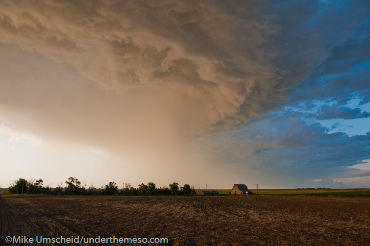
Marginal supercell storms, high-based, across northeast Colorado.  Taken with point and shoot camera since I didn’t have my Nikon DSLR gear with me as I was coming home from a bowling trip in Reno.

20100606_173240

20100606_180358

20100606_192900

20100606_194648

Older Posts »

Powered by WordPress