High wind event in progress. 69 mph peak wind gust at 10am CDT in Dodge City. I have already had to clean up torn off shingles off my roof as well as one of the downspouts to my gutter that came off. The sun is beginning to make an appearance and as a result, deeper mixing will ensue resulting in likely more aggressive gusts, and perhaps more frequent gusts exceeding 55 knots. The RUC Wind Gust field has done a fairly good job in its prediction of the magnitude of wind gusts. Below is a 9 hour forecast of Surface Wind Gust valid 15z (10am) with the verifying observations overlayed:

Frequent wind gusts are expected to remain in the 50 to 55 knot range…and perhaps a few gusts approaching 60 knots…through 22z (5pm CDT), as is shown by the 14z run of the RUC model:
Winds already getting underway over northwest Kansas and eastern Colorado. Observations at 7pm CDT indicated 40 to 45 knot wind gusts at Springfield and La Junta, CO as well as Goodland, KS. The image below shows the RUC 2-hour forecast for wind gust valid 00z (7pm) with 7pm observations of wind barb and gusts (red values, knots) overlayed:

The image below is the 18-hr forecast from the April 14th 22z run of the RUC valid 16z April 15th…showing 54-58 knot gusts (62-67 mph) all across Southwest Kansas by this time with a very deep 825mb low to the east:

It’s always windy in Dodge, but… What we have coming our way on Friday, April 15th will likely be a wind event the likes of which we haven’t seen in several years around Southwest Kansas. To complicate matters — it has been so dry so far this year, and if we don’t get anything more than sprinkles with this storm later on today and this evening, then there will likely be a substantial amount of blowing dust. I wouldn’t be blogging about this storm if there wasn’t some component of it that is fascinating to me and impacting western Kansas to some degree. A major cyclogenesis event will be occurring today over Kansas. As of the time of this writing, the surface low was located southeast of Dodge City, which will deepen substantially as it tracks northeast through central Kansas today.

Strong northwest winds will develop behind the low by early this evening which will strengthen substantially as the low wraps up tonight. The 12z RUC model valid 18 hours out at midnight tonight is already showing 60 mph gust potential developing along the Colorado-Kansas border to the west of the mature cyclone:

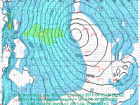
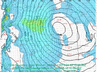
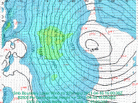
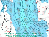
The strongest winds will begin impacting Dodge City after midnight tonight. The wind fields in all the models are extremely impressive with wind magnitudes about as high as I’ve seen for Southwest Kansas behind a mid latitude cyclone like this. The NAM has been persistent in showing 65 to 75 knots in the 800-700mb layer from 12z to 21z Friday. The ECMWF model has also shown a very similar signal in the strength of winds. NAM Boundary Layer (BL, 0-15mb AGL mixed depth) winds are expected to be around 45 knots sustained during the day on Friday. This is as high as I’ve ever seen BL winds for Southwest Kansas behind a low with deep vertical mixing. These are all strong signals of a prolonged, significant wind event last a good 12 to perhaps 18 hours! Below is the time sequence of this morning’s NAM model showing the development of high winds in the 0-15mb AGL mixed layer:
Lastly, here is a text output from the NAM12 model for Dodge City. Highlighted in red is the mixed layer. Typically, the mean wind in the lower third of the mixed layer in the NAM model translates well to surface sustained winds on the high plains. Peak wind gusts at the surface are typically the wind speed at the top of the mixed layer that have mixed all the way down to the surface due to both the mechanical mixing (by the wind) and the more traditional mixing due to insolation. The NAM model would suggest a prolong period of gusts in excess of 60 mph during the day tomorrow, withe a potential peak gust of 68 mph during the early to mid afternoon hours when the mixing height increased to about 775 mb:


