10.4" officially as measured at the NWS Dodge City. Well, this makes it two straight seasons now with at least one 10-inch snow event (the last being April 13 this past Spring). The wind did pick up with gusts to 25 mph, and given the light, powdery nature to the snow, drifting was very common. There is two-foot drift on the backside (facing south) of my duplex building. There’s another long 14 to 17 inch drift in between my Jeep and my neighbors cars out front. Below are a few photos from the event (click on the thumbnail for the full size version):


8.3" as of 10pm CST. The last band of moderate-heavy snow is moving through at this time — about on schedule per the model forecasts. The measurement in the backyard at the top of the hour yeilded a little over 8 inches! A northeast wind will be picking up more after midnight, so there will be increased blowing and light drifting of snow through the overnight hours. A very nice storm!!!
 Measured 6.7" in my backyard as of 8:00pm. We remain in a mid level deformation zone which has kept a southwest to northeast orientation of moderate to occasionally heavy snow bands in the vicinity. Snow rates continue in the 1/2 to 3/4 inch per hour as of the time of this post. As I type, there’s a good band overhead once again… so we are probably just over 7" now
  This is very nice!!
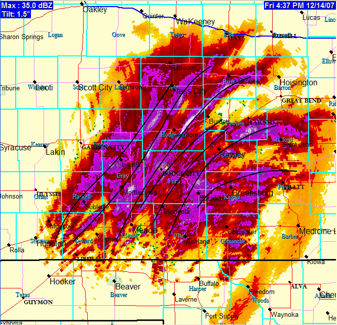
 Around 5" now! Man, I’m loving this! Radar loop still looking good around Dodge City with narrow intense bands of heavy snow. The snow has changed a little bit… much smaller flakes, but very numerous. This is a type of snow that can really accumulate fast. We may be at 7 or 8 inches by mid-evening… which was the upper end of the forecast. Here is a radar image below. I drew some black lines where the intense frontogenetic bands are centered:
3.3" here at my place in Dodge City. It’s been snowing moderate to heavy at times since 11:30am…averaging about an inch per hour! The upper low is still over New Mexico, so we should remain in pretty good lift through most of this evening…until the upper low comes out across the TX Panhandle. Here is another photo outside my front door:
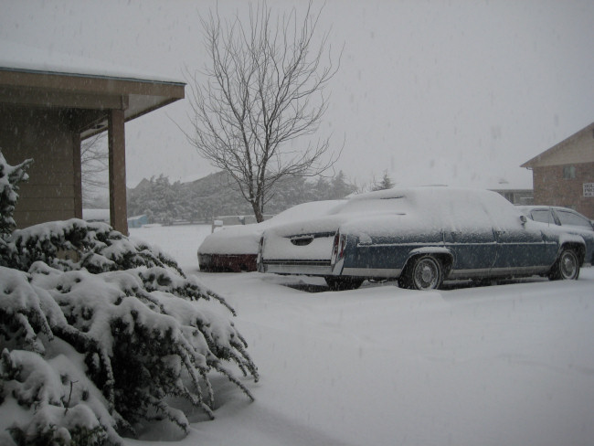
A look out the window… It’s nice and white!
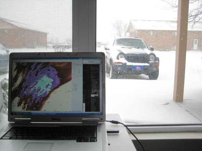
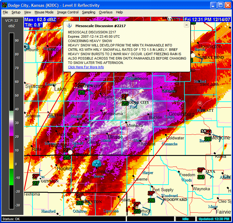
 Heavy Snow! It started snowing here in Dodge about 11:30am, and we already have near an inch in the first hour just looking out the window. SPC issued a mesoscale discussion concerning this heavy snow axis centered just about on top of Dodge, especially the southeast edge of town. Radar shows some lower 30s dBZ echoes, which translates easily to 1.5 to 2" per hour rates. Looks like mod to heavy snow for much of the afternoon! We could see 6+ inches here based on the latest QPF guidance from NAM, RUC13, and Canadian 15km morning model runs.
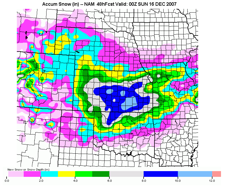
 No rest for the weary following the ice storm. Bring on the snow! Nice little surprise setup (in that, I mean we weren’t exactly seeing this nice of a system > 4 or 5 days out) could bring much of southern Kansas a swath of 4 to 9" of snow, including here in Dodge City. Right now, if the latest 00z runs of the Canadian, NAM, and RUC models verify, we should see 4-6" of snow here in Dodge City. It looks like impressive lift will be over Dodge from roughly 1pm to 9pm tomorrow… probably maxed out around late afternoon. A surface low will eventually strengthen to the southeast, so we may see some 20-30mph wind gusts from the north-northeast by midnight tomorrow night as the pressure gradient increases… to help blow the snow around a little bit.
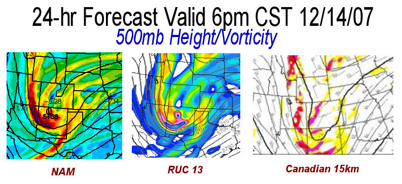
  In Img 1, I show the 500mb (mid level of the troposphere) Height and Vorticity pattern (basically showing the storm in the mid levels) from 3 model forecasts at 24 hours. A vorticity max (where the colors max out at the base of the height trough), taking a path to the south of Dodge City is favorable for snow here. These three forecasts look quite favorable. Img 2 shows the run total snow accumulation forecast from the NAM model. I hope that verifies!
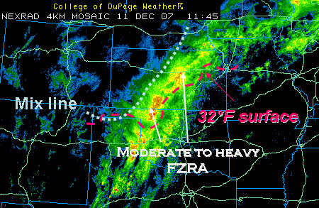
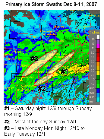
The ice storm of December 8-11, 2007 was one of the more far-reaching ice events I’ve seen. There were three distinct corridors of significant icing events during this time span of nearly 3 days. These areas are depicted in the image below, which is a 7-day precipitation map covering the days of the ice storm across the midsection of the country:

Below are a few links of interest related to the December 8-11, 2007 Plains ice storm:
Stormtrack Forum forecast, nowcast, reports:
WINTER STORM FCST 12/07/07-12/12/07: KS, MO, IA, IL, MN, WI, NE, MI
WINTER STORM NOW 12/08-11/2007: KS, OK, NE, MO, IA, CO, among others
12/9-12/11/07 REPORTS: Plains to Great Lakes
National Weather Service summary pages:
NWS Dodge City, KS
NWS Norman, OK
NWS Tulsa, OK
NWS Wichita, KS
NWS Topeka, KS
NWS Pleasant Hill, MO
NWS Springfield, MO
NWS Hastings, NE
Just changed over to sleet on the backside. Well it’s now 6am, after a night filled with freezing rain and occasional claps of thunder at 31-32°F. The surface cold front has just pushed through as our winds are now out of the north, so our temperature will now slowly fall throughout the day. As a result of the deeper cold air now, the warm layer aloft is being pinched off, thus we are changing over to sleet now in Dodge City. Garden City observation had light snow on the last observation. A very nebulous "comma head" of precipitation will produce mainly snow through midday across Southwest Kansas, although since this wave ejecting out is not a closed low per-say, there shouldn’t be a whole lot of significant "wrap-around" precipitation back in the cold air. Exactly 1.00" of precipitation has been recorded by the Dodge City ASOS by 6:10am this morning…. all of it in the form of freezing rain. I haven’t had the chance to see what has accumulated and been damaged from around town, but just by the looks of the healthy trees in my front yard and my neighbor’s, there’s at least 1/2 to 3/4" ice accumulation.
