Today is Wednesday, June 13th -- still a solid 10 days away from Day One
of my annual storm chase trip -- and the time has come to begin
speculating on how the beginning of the trip will look as far as storm
chasing/photography prospects go. I will be chasing with Evan
Bookbinder and Jay Antle... leaving Kansas City either late night Friday
Night the 22nd or first thing in the morning on the 23rd. Attached to
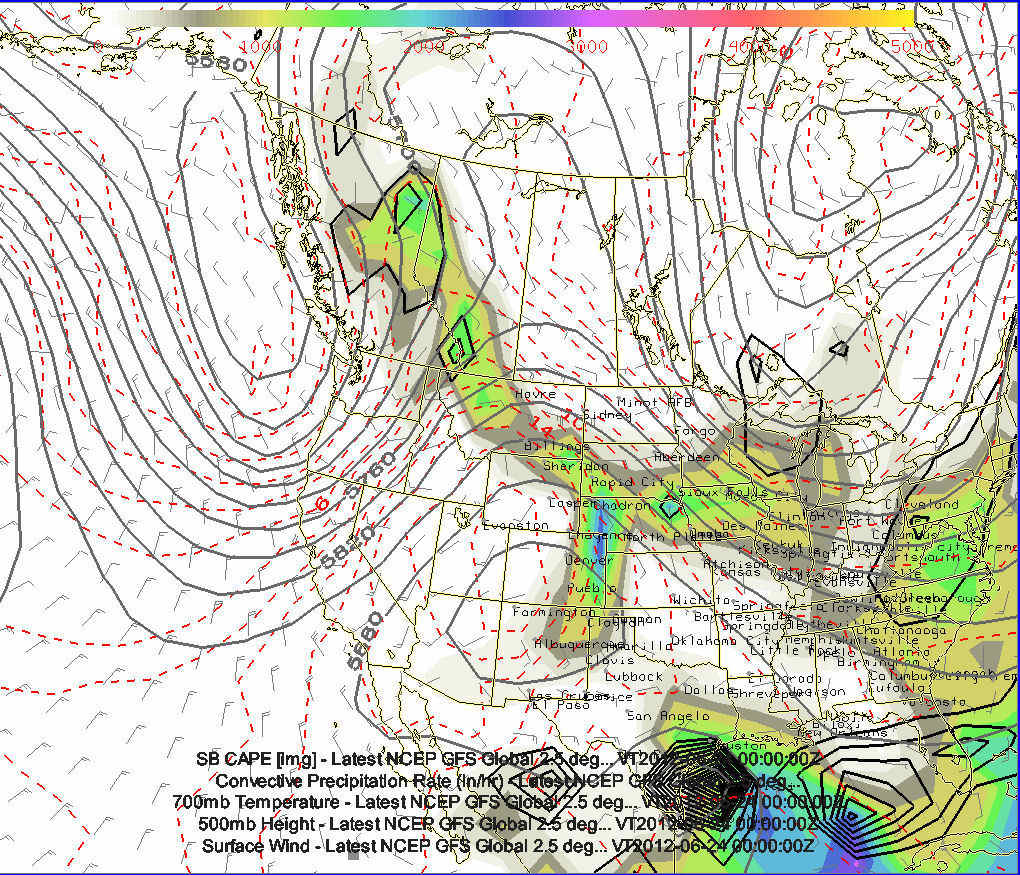
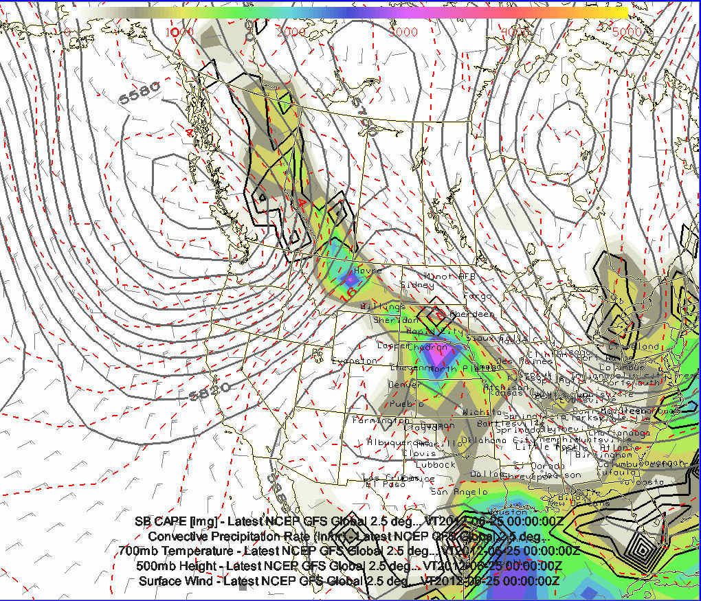
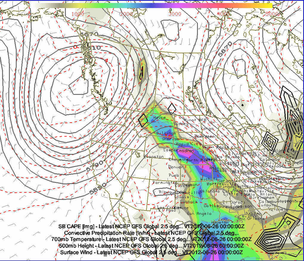
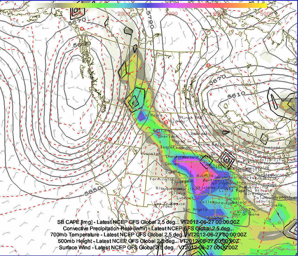
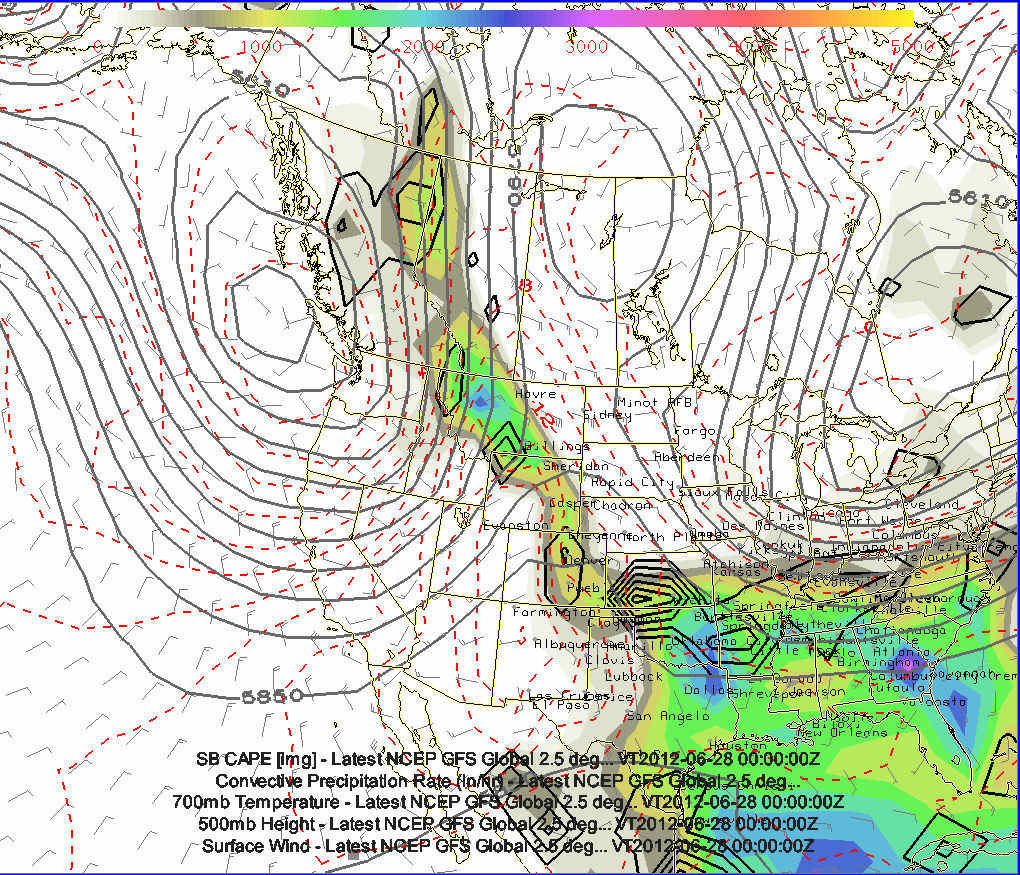
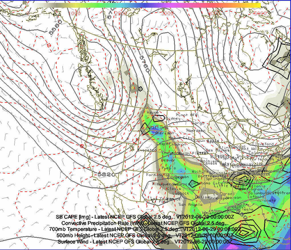
this post are 6 images showing this morning's 12z run of the GFS valid
June 23rd through June 28th. The GFS is hinting at a very well-defined
trough off the coast of Washington-British Columbia... bring multiple
days of southwest flow across Montana and into Alberta and southern
Saskatchewan.
The images are of the GFS 500mb Heights, CAPE, Surface Wind, and QPF
valid 00z June 24th (Image 1) through 00z June 29th (Image 6)
This would be a dream setup if it were to pan out this way... but this
is the 240-368 hours out and models have next to no skill at synoptic
features. However, the good global models to have just a little bit of
skill in the longwave pattern... and the continued notion of low heights
in the Pacific Northwest/northeast Pacific Ocean with an extended
Pacific Jet is probably a noteworthy signal in the models June 23-June
26th time frame.
|