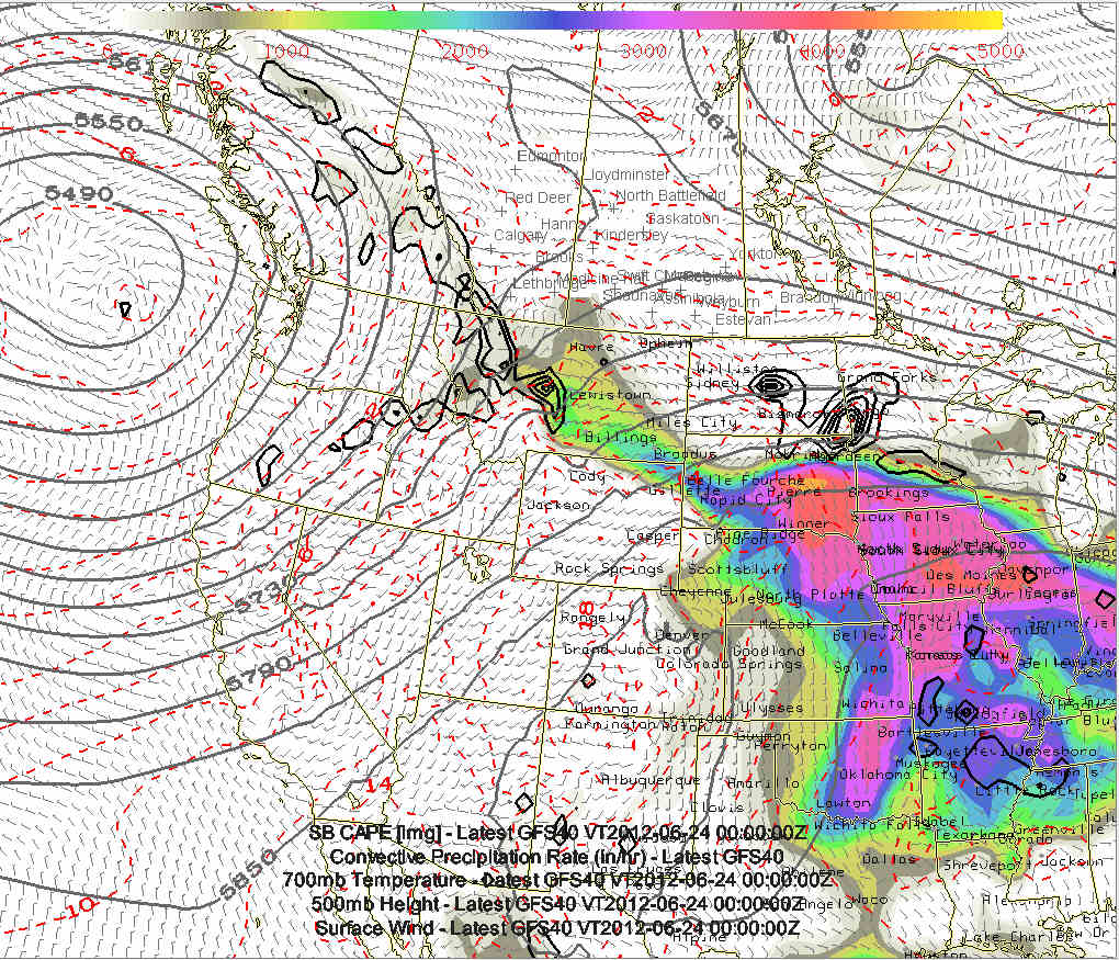
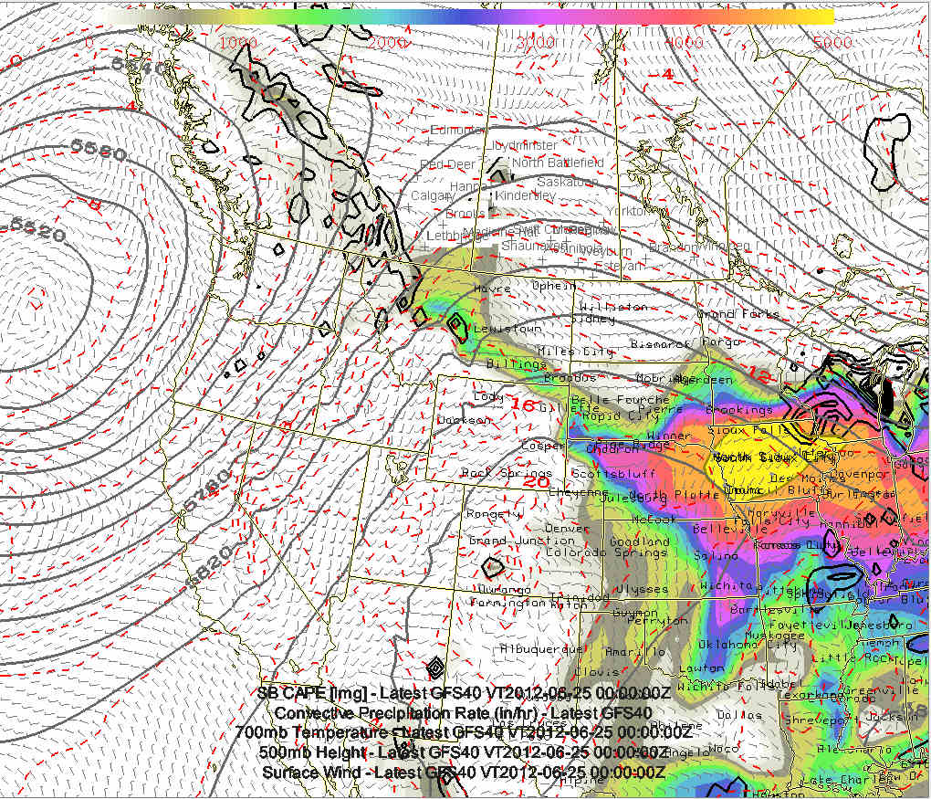
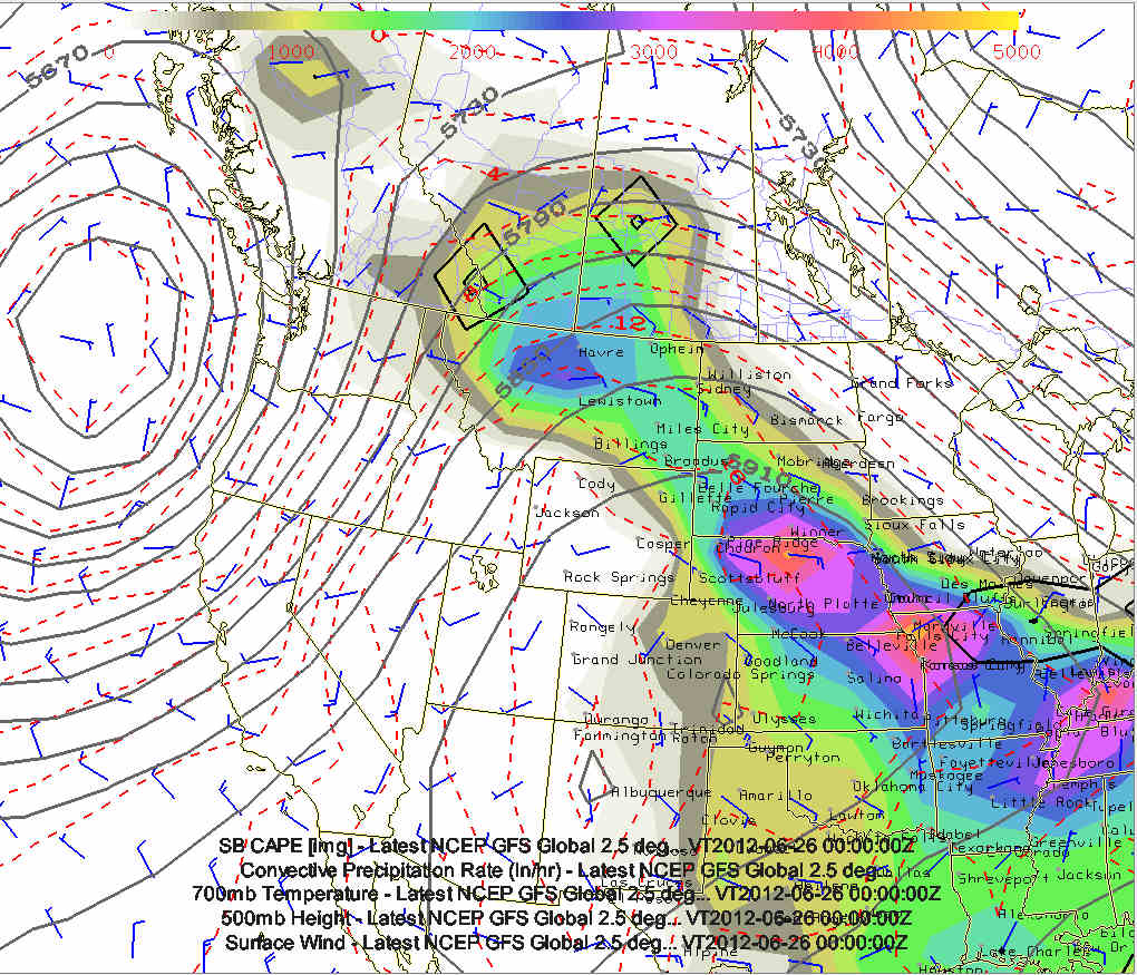
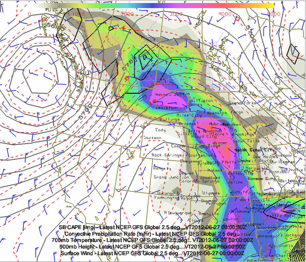
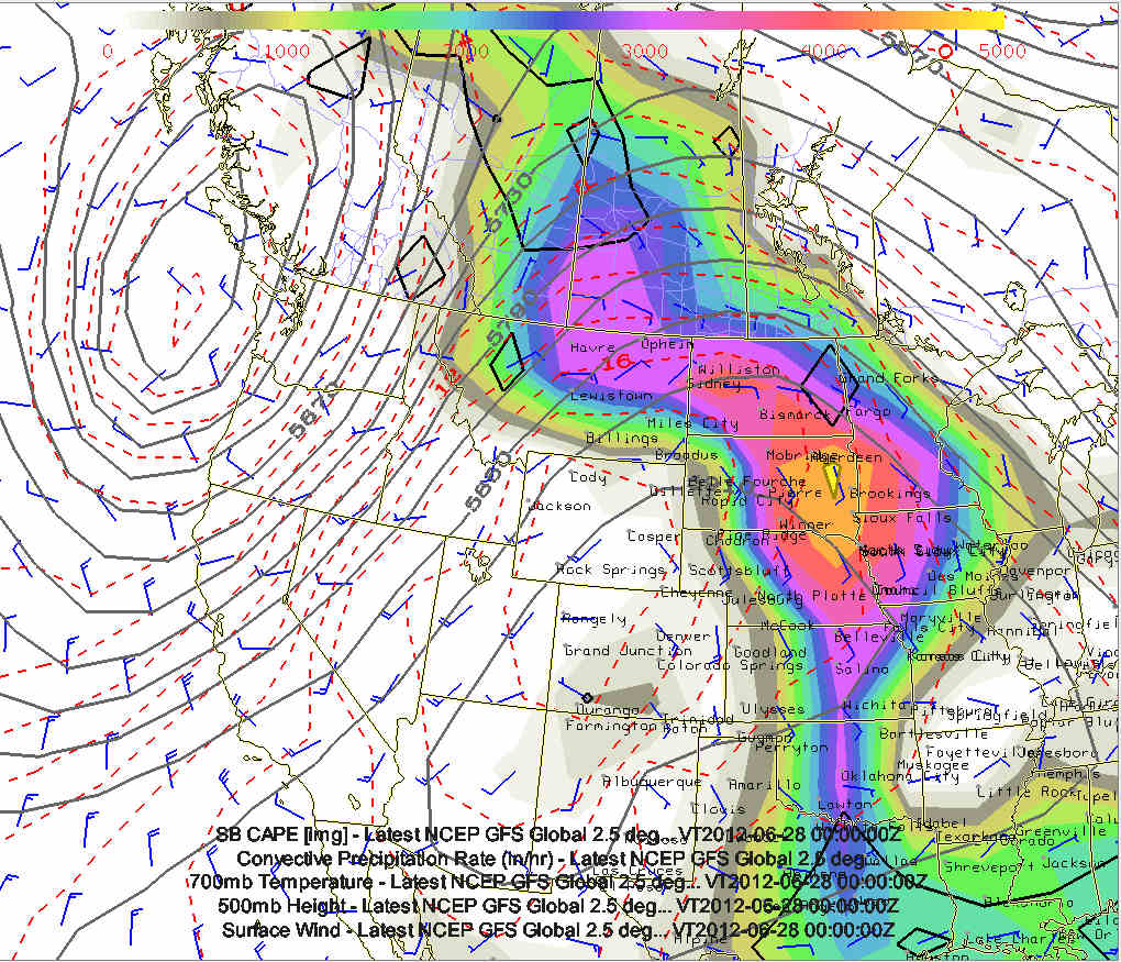
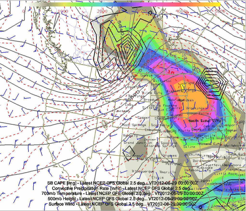
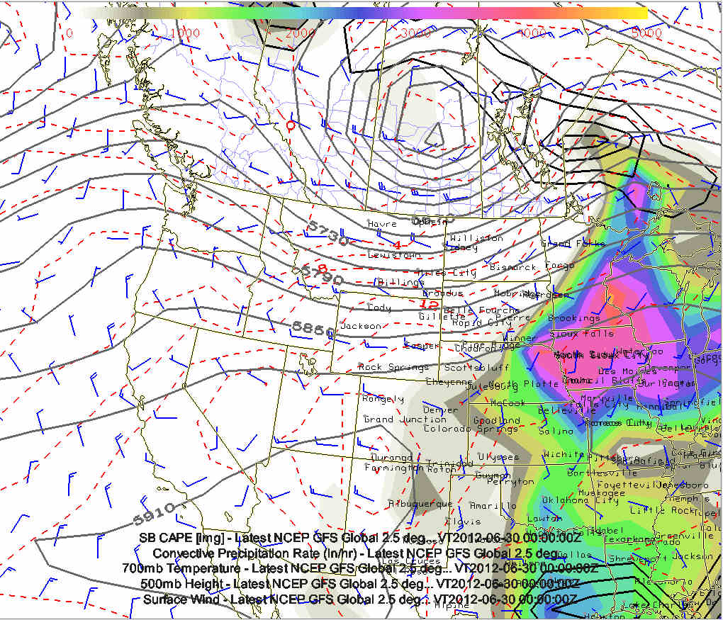
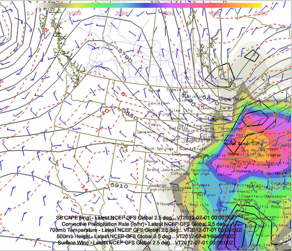
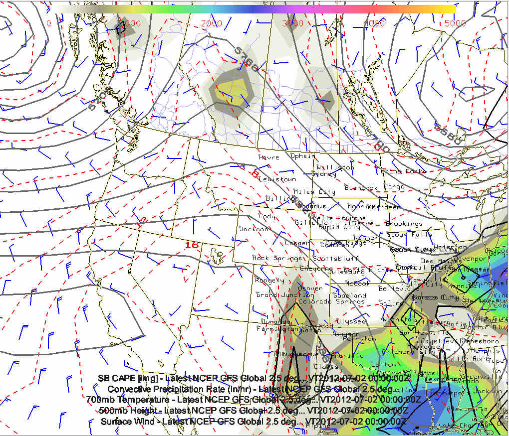
Composite chart of 500mb heights, CAPE, 700mb temperature, and QPF:
#1 valid 7pm CDT, Saturday 6/23
#2 valid 7pm CDT, Sunday 6/24
#3 valid 7pm CDT, Monday 6/25
#4 valid 7pm CDT, Tuesday 6/26
#5 valid 7pm CDT, Wednesday 6/27
#6 valid 7pm CDT, Thursday 6/28
#7 valid 7pm CDT, Friday 6/29
#8 valid 7pm CDT, Saturday 6/30
#9 valid 7pm CDT, Sunday 7/1
Impressive, large scale upper low off the coast of Washington/British
Columbia may yield plentiful chase opportunities in Montana...and
eventually North Dakota... perhaps a day or two in southern
Alberta/Saskatchewan! A lot can still change in the models, and
probably will, so it's still quite a bit of speculation at this point.
|