Day One (Sat, June 23): (GFS Composite Chart, See Fig. #1)
The BIG drive day. After a hopefully incredible night in the dugout
suites at the Royals vs. Cardinals baseball game in KC, Evan
Bookbinder and I will begin the big drive with an estimated time of
departure around midnight. I am fresh of my midnight shifts, so I
will be pulling the majority of the overnight driving. We plan to
make the 20-hour, nearly non-stop drive to Great Falls, MT with an
estimated time of arrival around 7:30 or 8pm MDT (0130-0200 UTC).
If we do indeed make it there by that time, we will still have
around two hours of photographic daylight to work with for any
storms that may be ongoing in the Great Falls-Conrad, MT vicinity.
If we do indeed manage to photograph a storm on Day One, it will be
quite the incredible feat after starting in Kansas City the night
before. Day One is largely a positioning day to get ready for what
looks to be a fairly impressive stretch of storms from far northern
Montana into southern Canada
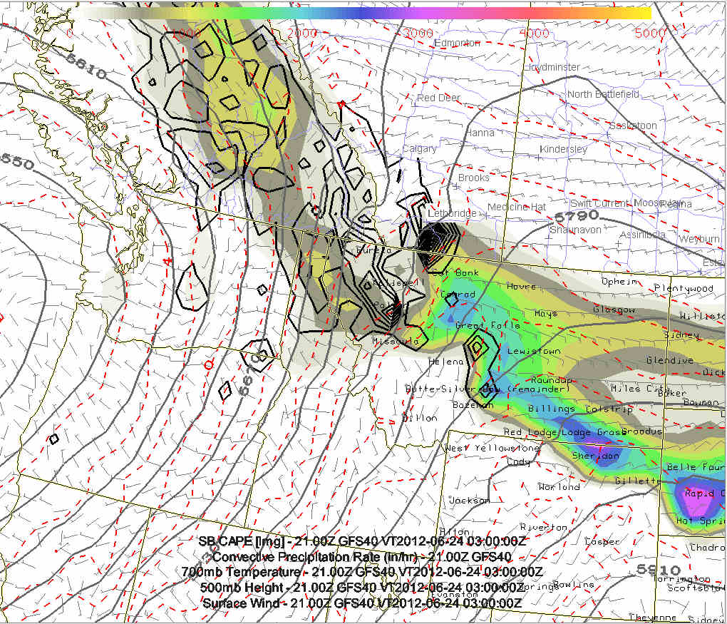
Day Two (Sun, June 24): (GFS Composite Chart, See Fig. #2)
We will likely begin this day in Great Falls, MT or something like
that. Day Two looks like the same area as Day One, so the driving
may be kept to a minimum... which would be good! The main upper low
will still be sitting off the coast of Oregon-Washington with
south-southwest mid level flow over the Montana and Alberta
Rockies. Good dewpoint air in the upper 50s to lower 60s will yield
1800-2200 J/kg CAPE with both the GFS and ECMWF suggesting supercell
storms from west of Great Falls off the mountains northward to west
of Lethbridge, AB.
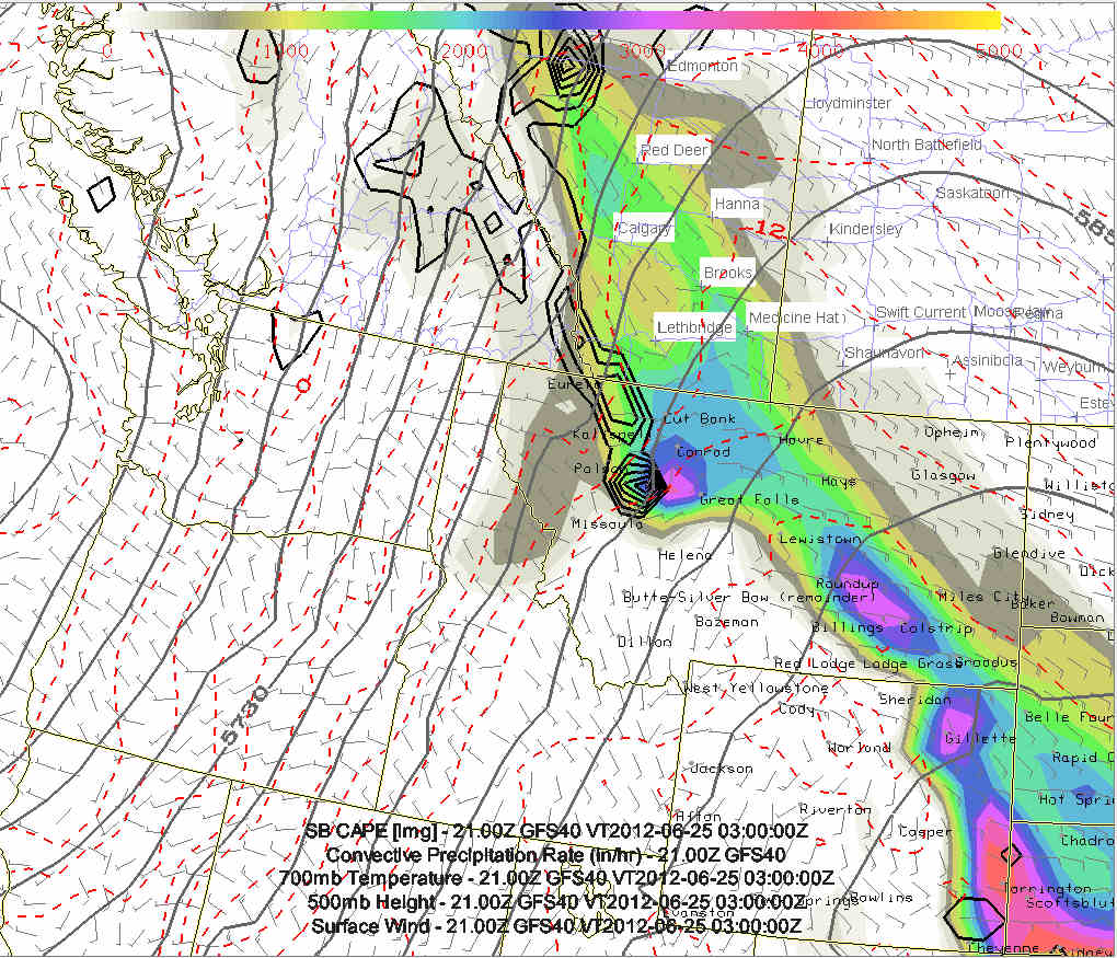
Day Three (Mon, June 25): (GFS Composite Chart, See Fig. #3)
More storms are expected in the same general vicinity as the
mentioned upper low inches very slowly toward the Oregon-Washington
coast. The GFS model suggests even higher moisture and CAPE
spreading northward into Alberta. This may be the first day to
chase in Canada from Lethbridge to Medicine Hat.
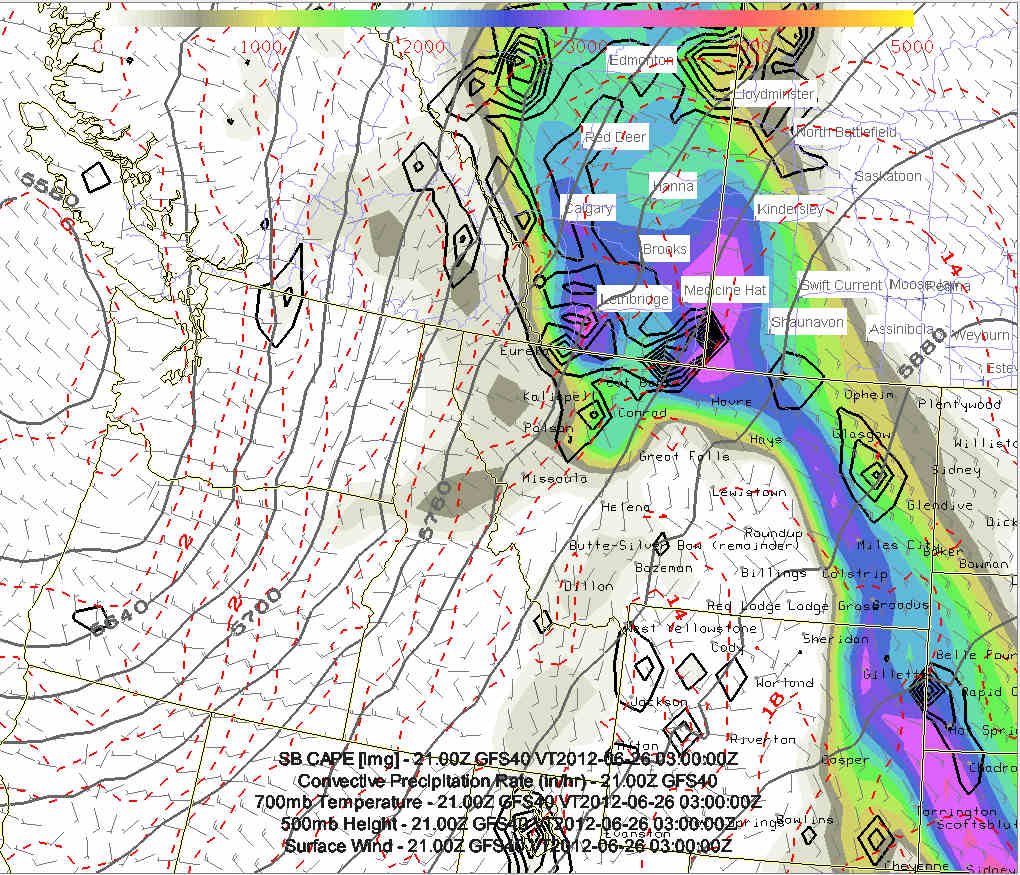
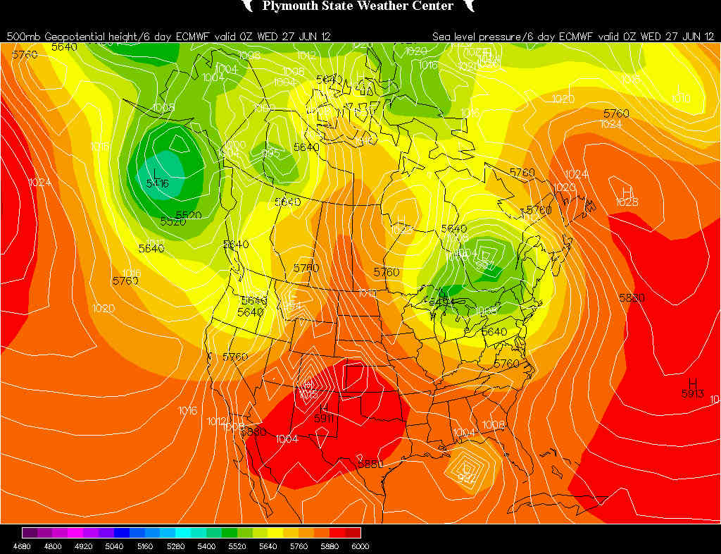
Day Four (Tue, June 26): (GFS Composite Chart, See Fig. #4,
ECMWF 500mb/MSLP Chart, see Fig #5)
This is where the GFS and ECMWF models really begin to diverge in
how fast it ejects the upper low northeastward. The GFS is much
faster than the ECMWF model... and in fact the ECMWF model has
slowed down even more than the previous runs. Where the GFS
suggests the best play will be well into southeastern Saskatchewan
(east of Swift Current to Assiniboia, SK), the ECMWF suggests yet
another day (perhaps the best day of the bunch) back in southeastern
Alberta from Lethbridge to Medicine Hat. This is still quite a ways
away, but the trend of slower is certainly promising for additional
chasing without a substantial amount of driving.
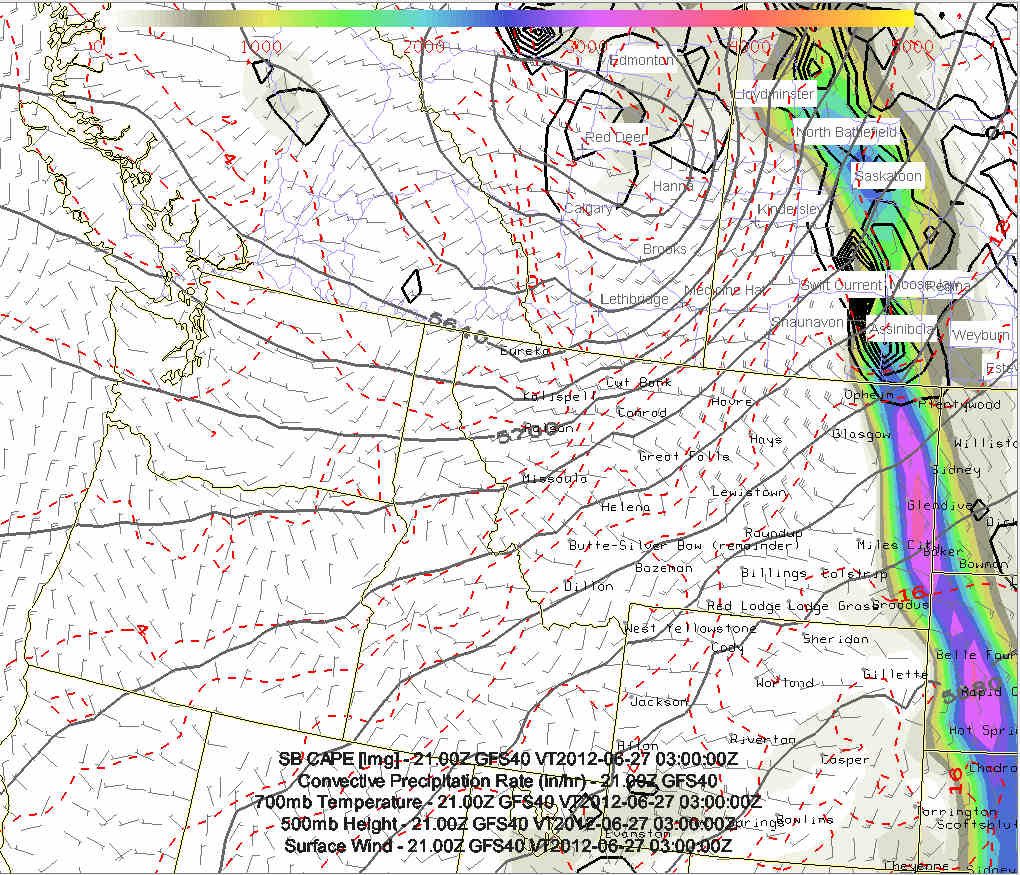
Day Five (Wed, June 27):
The GFS model, given its faster speed, is suggesting a down day
Wednesday, but the slower ECMWF would suggest yet another chase day
farther east in Canada from southeastern Saskatchewan to
southwestern Manitoba.
|