Sat, 29 Jun 2013 09:13:09 -0500
Menacing HP storm structure south of Atwood!
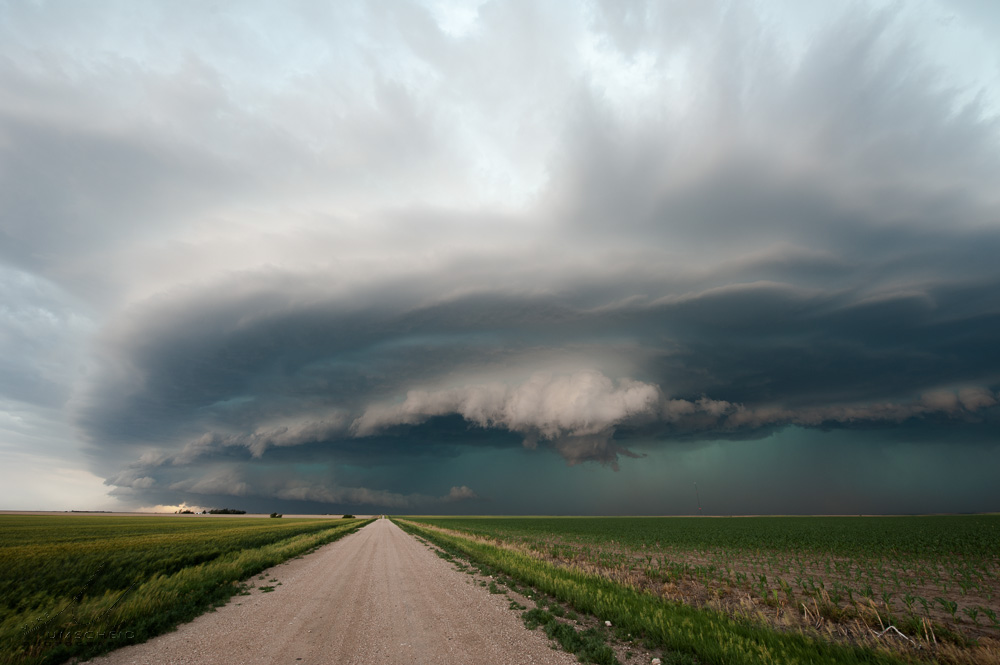
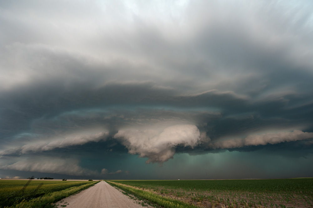
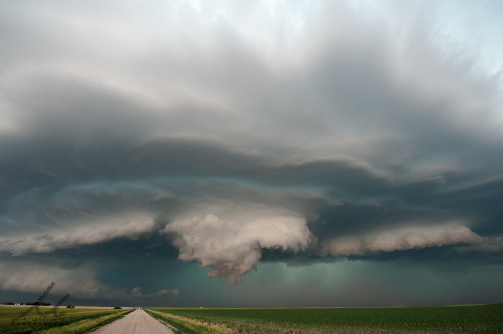
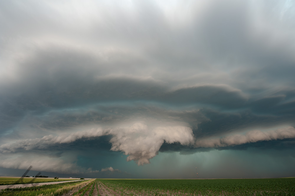
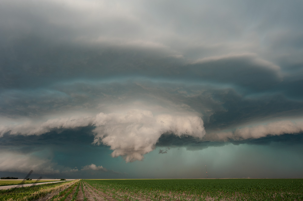
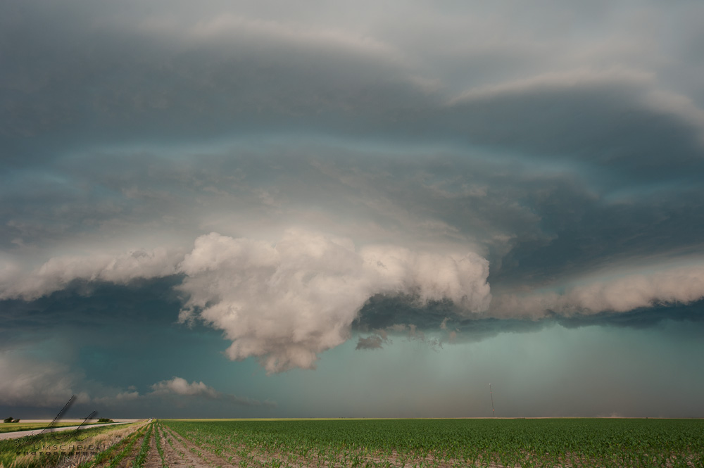
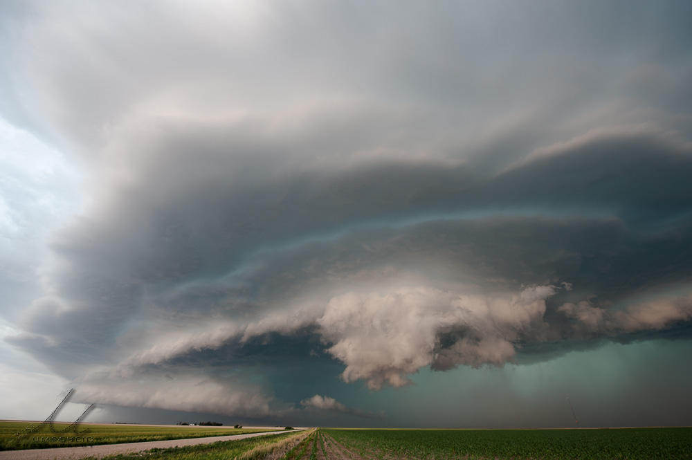
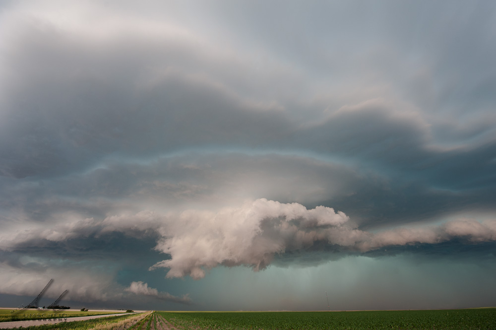
Summary & Images (part 8) | Now south of Atwood, I decided to venture east on an unpaved county road grid across southeastern Rawlins County since the storm was moving southeast. This would afford some better storm structure shots, I thought, instead of just continuing south on Highway 25. This ended up being a good decision. This set of images was taken about a mile east of Highway 25 (39.7271690,-101.0402985) looking west as an impressive, blocky lowering developed at the edge of the advancing gust front.
| (click on thumbnails for pop-up of larger images) |
|