Tue, 31 May 2011 20:32:50 -0500
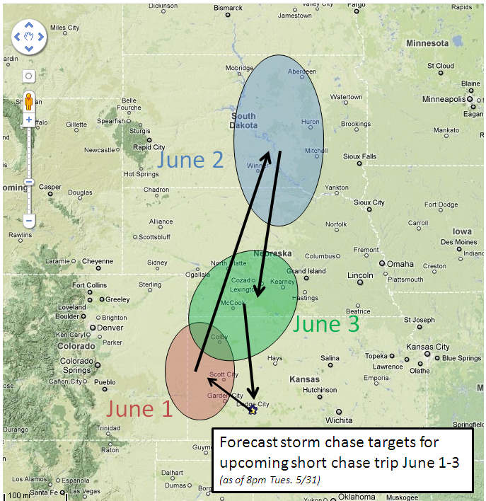
Updated storm chasing plans for June 1-3 | | My short storm chase trip for June 1-3 is still a go. This will be a
solo trip, and given the possibility for a long drive during this
trip, I've prepared for "car camping" during this trip to save a
little bit of money given the gas prices. This will also give me the
flexibility to sleep whenever I wish (except for the evening hours of
course!) since my body clock will still be in "midnight shift" mode
for the most part since my last shift is overnight tonight.
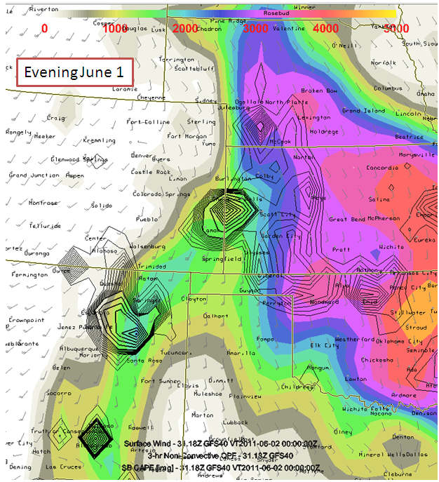
June 1: Target is actually fairly close to home, which sill give me
an opportunity to sleep at least a little bit when I get off work at
6am. Good moisture is coming back into western Kansas tomorrow which
will yield about 2000 to 2500 J/kg of SBCAPE. A minor shortwave
disturbance will move across the Rockies nosing into western Kansas
which will likely aid in storm development near the Colorado-Kansas
Border. Target around Tribune, KS.
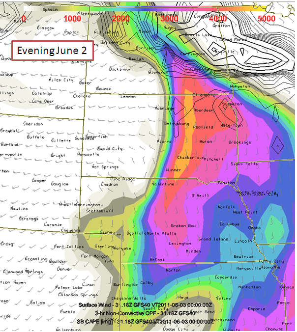
June 2: After the chase is done June 1, I will likely begin my drive
north to South Dakota, which appears to look quite good if a storm can
develop (which I think one will). It will be a long drive, so if it
cap busts... it will be a frustrating and EXPENSIVE one. I am taking
a risk that it WILL break, and I have confidence that it will. If
later model runs of the GFS show more of a potential for a cap bust
versus not... then I will scrub June 2nd chase up that far north. The
Instability and shear will be excellent with classic 50 knots
southwest flow coming into South Dakota at 500mb. Tentative target
Kennebec to Selby, South dakota
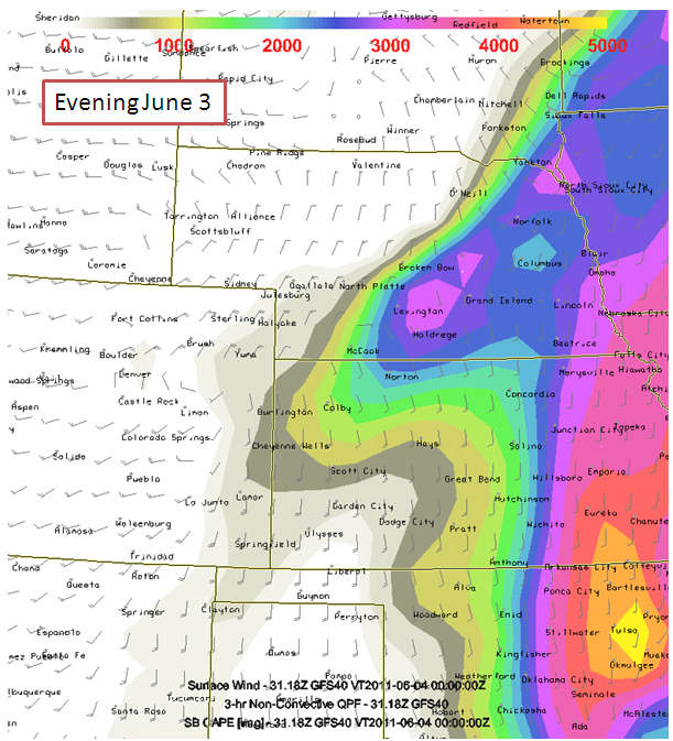
June 3: The front associated with the initial jet streak late June
2nd will move south into Nebraska. The front will slow down and
perhaps stall out in southern Nebraska with 60s dewpoints as far west
as southwestern Nebraska. Tentative target McCook to Lexington, NE.
I will drive back to Dodge City following this chase arriving home
late night, more than likely. I am due back to work Saturday morning
the 4th.
| (click on thumbnails for pop-up of larger images) |
|