| About This Shoot | Date: 3 June 2011 | Location: Northwest Kansas from Russell Springs to Colby, KS | Shoot Type: Storm Chase | Rating: | Synopsis:
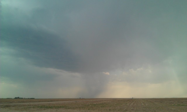
Intercepted initial high-based storms in the Wallace and Sharon Springs area with a marginal high-based supercell emerging southwest of Colby with fairly dramatic, scalloped updraft structure. I then decided to go west of the storm and photograph dramatic sky scenes in the wake of the storm nera Brewster with great results using a windmill as foreground subject |
|
Other Shoots Around This Date 
24 May | 25 May | 26 May | 27 May | 28 May | 
29 May | 30 May | 31 May | 
1 Jun | 
2 Jun |
3 Jun | 4 Jun | 5 Jun | 6 Jun | 
7 Jun | 
8 Jun | 
9 Jun | 
10 Jun | 
11 Jun | 
12 Jun | 13 Jun | |
|
Navigate Other Shoots (by year) Navigate Other Shoots (by month)
|
Preliminary Storm Reports from 3 June 2011
 |
1630 UTC SPC Products from 3 June 2011

Categorical Convective Outlook
|

Probabilistic Tornado Outlook
|

Probabilistic Hail Outlook
|

Probabilistic Wind Outlook
|
|
Evening Meteorological Charts from 3 June 2011

250mb Chart
|

500mb Chart
|

700mb Chart
|

850mb Chart
|

Surface Chart
|
|
|
|