| About This Shoot | Date: 8 April 2013 | Location: near St. Francis, Kansas | Shoot Type: Storm Chase | Rating: | Synopsis:
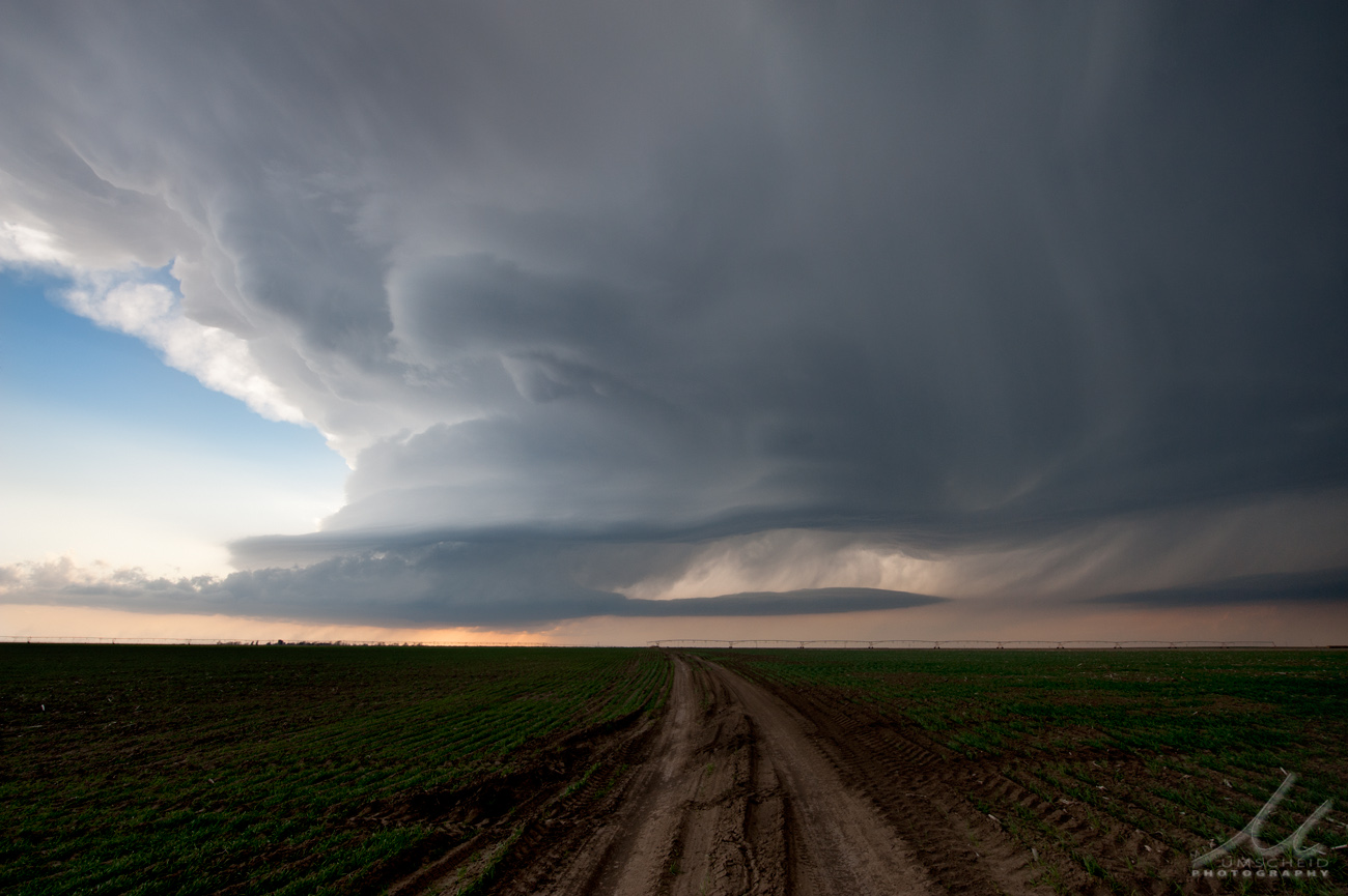
After debating two target areas, I made a late decision to head northwest toward my northern target around Goodland, KS. I arrived on-scene of a supercell northwest of Goodland in the early evening, but the supercell structure did not last all that long and evolved into a non-supercell severe storm with some other storms forming around it toward sunset. |
|
Other Shoots Around This Date 
29 Mar | 30 Mar | 31 Mar | 1 Apr | 2 Apr | 3 Apr | 4 Apr | 5 Apr | 6 Apr | 
7 Apr |
8 Apr | 9 Apr | 10 Apr | 11 Apr | 12 Apr | 13 Apr | 14 Apr | 15 Apr | 16 Apr | 17 Apr | 18 Apr | |
|
Navigate Other Shoots (by year) Navigate Other Shoots (by month)
|
Preliminary Storm Reports from 8 April 2013
 |
1630 UTC SPC Products from 8 April 2013

Categorical Convective Outlook
|

Probabilistic Tornado Outlook
|

Probabilistic Hail Outlook
|

Probabilistic Wind Outlook
|
|
Evening Meteorological Charts from 8 April 2013

250mb Chart
|

500mb Chart
|

700mb Chart
|

850mb Chart
|

Surface Chart
|
|
|
Mon, 08 Apr 2013 10:24:30 -0500
Chase Day April 8, 2013 -- Southwest Kansas Region | Two targets in mind today...
#1: This the primary chase target with lowest risk, on paper. Most
models generate convective QPF (storms, for the lay person) in this area
where convergence will be fairly strong as the synoptic dry intrusion
and highly mixed "hot" lifts northward into cooler, moist air with
southeast winds. This area will be closer to the upper level support
for large scale atmospheric lift.
#2: Despite the dearth of convective QPF on most of the traditional
models... there are ensemble members of the SREF and even the NCEP GFS
model are generating some convection on the dryline. This area
highlight is the traditional "hot spot" on the dryline from Lipscomb, TX
to Buffalo, OK. Many great long-lived supercell storms in similar
environments have initiated in this corridor. It is a favored meso-beta
scale convergence max on the dryline, especially by late in the
afternoon and early evening as the dryline ceases its eastward push and
begins to retreat. It will be hot, by early April standards, along the
dryline in this area with temperatures rising into the mid to upper 80s.
This warmth will be enough to erode convective inhibition, especially
right at the dryline (where the dewpoint gradient is). The key is how
much of a convective inhibition gradient there will be east of the
dryline. The RAP and NAM models suggest good warm east of the dryline a
good 60 to 100 miles, so any convective plumes that do go in the
convergence hot spot will have a chance to survive and grow into a
supercell thunderstorm.
Right now, as of 1030am, I am 50/50 on #1 or #2. I will likely make my
final call right before I depart later this afternoon.
| 
(click on thumbnail for pop-up of larger image) |
|