#1: This the primary chase target with lowest risk, on paper. Most
models generate convective QPF (storms, for the lay person) in this area
where convergence will be fairly strong as the synoptic dry intrusion
and highly mixed "hot" lifts northward into cooler, moist air with
southeast winds. This area will be closer to the upper level support
for large scale atmospheric lift.
#2: Despite the dearth of convective QPF on most of the traditional
models... there are ensemble members of the SREF and even the NCEP GFS
model are generating some convection on the dryline. This area
highlight is the traditional "hot spot" on the dryline from Lipscomb, TX
to Buffalo, OK. Many great long-lived supercell storms in similar
environments have initiated in this corridor. It is a favored meso-beta
scale convergence max on the dryline, especially by late in the
afternoon and early evening as the dryline ceases its eastward push and
begins to retreat. It will be hot, by early April standards, along the
dryline in this area with temperatures rising into the mid to upper 80s.
This warmth will be enough to erode convective inhibition, especially
right at the dryline (where the dewpoint gradient is). The key is how
much of a convective inhibition gradient there will be east of the
dryline. The RAP and NAM models suggest good warm east of the dryline a
good 60 to 100 miles, so any convective plumes that do go in the
convergence hot spot will have a chance to survive and grow into a
supercell thunderstorm.
Right now, as of 1030am, I am 50/50 on #1 or #2. I will likely make my
final call right before I depart later this afternoon.
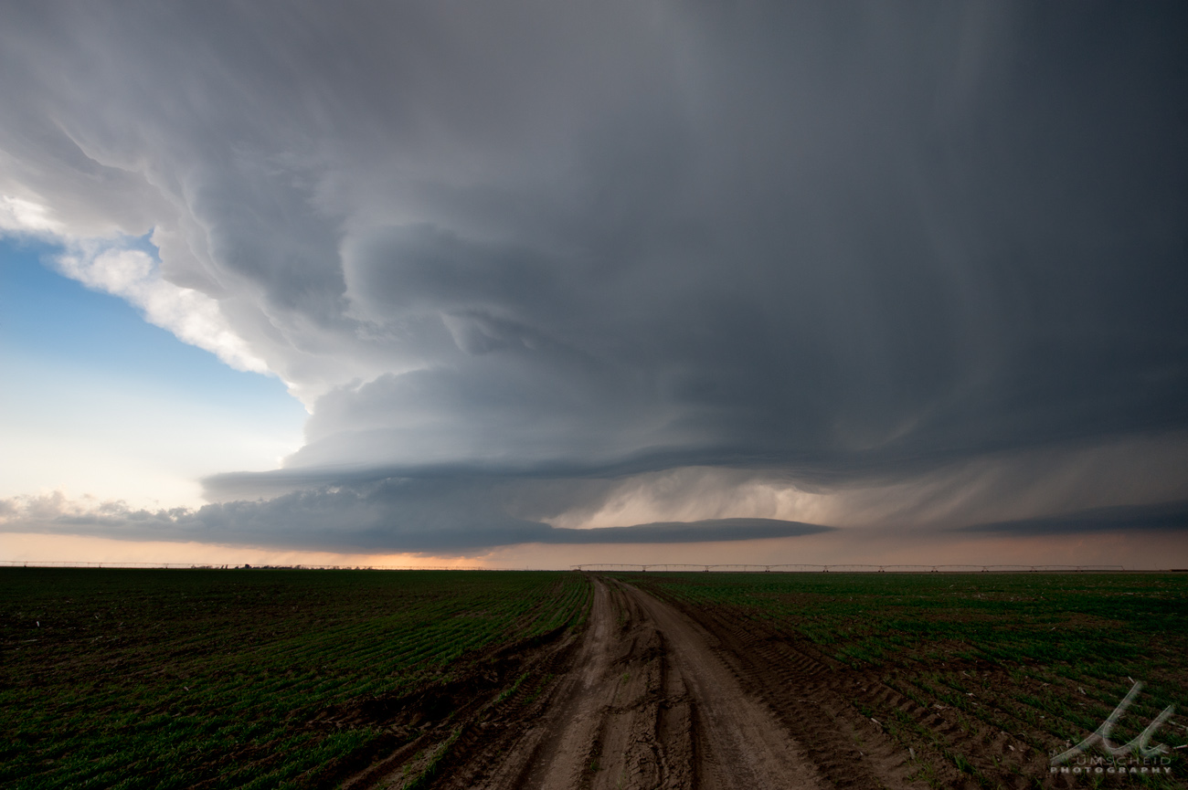
The first real good looking storm chasing setup of 2013 will be unfolding Sunday through Tuesday across the central plains. I just so happened to have this time period off work thanks to some well-timed Annual Leave. Unfortunately, I had to cancel out of some plans with friends in Kansas City for the Royals home opener -- the original reason for taking Monday and Tuesday off. Once it became increasingly likely that a multi-day chase setup was going to unfold, I had to make the decision on plan changes to take advantage of what the atmosphere was potentially going to provide from a fine art storm photography perspective.
A major spring low will be moving into the four-corners region and the Rockies during this time frame. Gulf of Mexico moisture will be transported northward into the central plains beginning today (Sunday), setting up the first of three good-looking storm chase days. Sunday/s target will be close to Dodge City, so I will have the luxury of getting some stuff done around the house before setting out to chase. I like the area from Dodge City south toward Woodward, OK as a target area for later this afternoon/early this evening.
On Monday, a warm front will be lifting north across western Kansas. A triple point will likely set up somewhere in western Kansas marking the convergence of warm moist, hot dry, and cool moist airmasses. Right now, I like the area from Burlington, CO down toward Scott City, KS as an initial target area. I will probably drive back to Dodge after this chase. Tuesday is still somewhat complicated depending on the strength of what looks like an incredible cold front (with temperatures in the teens and lower 20s behind it in western Nebraska!) If this front charges southeast quicker, it will wipe out a potential tornado outbreak with storms evolving into a squall line or quasi-linear structures early in the game. A large target from northern Kansas into central/southern Oklahoma is fair game at this point for a Tuesday chase. I am due back to work Wednesday morning, so herever I go Tuesday, I will have to drive back after the chase that night.