 | About This Shoot | Date: 9 May 2011 | Location: South-central South Dakota near Murdo, SD | Shoot Type: | Rating: | Synopsis:
|
|
Other Shoots Around This Date 29 Apr | 30 Apr | 1 May | 2 May | 3 May | 4 May | 5 May | 6 May | 7 May |
8 May |
9 May |
10 May | 
11 May | 
12 May | 13 May | 14 May | 15 May | 16 May | 17 May | 18 May | 19 May | |
|
Navigate Other Shoots (by year) Navigate Other Shoots (by month)
|
|
Mon, 9 May 2011 22:52:44 -0500
Another busted chase on Monday 5/9. Tuesday 5/10 may see some storms along dryline in Kansas? | It was an extremely frustrating chase day in southern South Dakota. I
picked the wrong target... it was a 50/50 coin flip Lusk/Harrison or
Dupree/Phillip. Well as it turned out, there were severe storms in
both areas.... however, in the Phillip, SD area, the tornadic
supercell formed way too late, after sunset, and was shrouded in
stratus clouds. I tried to pursue that storm, but came upon stratus
at Kadoka and decided to turn back to Murdo and call it a day. I
guess you could call this a storm chasing slump. Haven't even gotten
camera out of the bag to shoot storm images since the beginning of my
vacation on May 3rd. Quite sad. Some decent mid/upper level flow
will overspread the dryline in KS tomorrow, and there is some hope for
some storms along the dryline as some of this leading wind energy
ahead of the next shortwave trough may help enhance convergence and
lead to storm initiation. NAM model this evening shows storms
developing along the dryline northeast of Salina. That's 8 to 9
driving hours or so from Murdo, so I will be getting up early tomorrow
morning and heading south. -Mike U
|
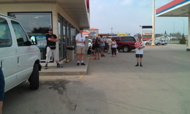
Mon, 9 May 2011 14:40:09 -0500
240pm in Murdo, SD along with a ton of other storm chasers. http://chase.underthemeso.com | At 2:30pm, am sitting in Murdo waiting things out. An outflow
boundary from overnight convection farther north had pushed south into
south central south dakota. This is enhancing convergence along an
east-northeast to west-southwest orientation very near my location.
The plan is to hang out here until hard towers start forming near or
west of this location. It is 73 degrees in Murdo with temperatures in
the 80s just to the southeast of here.
|
Mon, 9 May 2011 11:30:57 -0500
11:30am update from Valentine, NE | I'm pretty much committing myself to the northern target. I like the
look of the visible satellite with a lot of clearing in the
central/northern South Dakota area. 60s dewpoints will spread north
through the day. There is north-south baroclinic zone that will
develop, thanks to prolonged stratus farther west toward western South
Dakota. This will enhance local lifting due to frontogenesis... with
2500 to 3000 J/kg CAPE developing to the east over a large area.
Vertical shear is not spectacular this far north, but directional
shear will be adequate for nice storm organization and supercells.
| 
#1 | 
#2 |
(click on thumbnails for pop-up of larger images) |
Mon, 9 May 2011 07:42:58 -0500
Difficult chase forecast for today, May 9th: Two targets, which one to go to? | A significant jet streak will be nosing up into Wyoming today allowing
fairly robust cyclogenesis around the Laramie Range. Southeast winds
will develop over eastern Wyoming in response, bringing in some lower
to perhaps mid 50s dewpoints as far west as harrison, NE and even
Lusk, WY. This is Target #1 (Lusk WY to Harrison, NE). Second target
is a north-south convergence zone whihch will develop north of a
secondary sfc low farther east. Much more abundant moisture will
exist in this area with dewpoints in the mid 60s as far northwest as
central SD by late in the afternoon. Upper winds will be a bit weaker
in this area, but direction shear will still support supercells.
Target #2 is west to northwest of Pierre. Below is the 11z RUC model
and the 06z NAM model valid around 00z time later on today: I will
either head west-northwest to Harrison, NE or north to Murdo, SD (then
northwest from there) leaving around 9am.
I'll update the chasemode status with which target I select.
| 
#1 | 
#2 |
(click on thumbnails for pop-up of larger images) |
|