I am leaning more toward the Cheyenne Ridge play. The RUC wants to
keep development right up against the mountains west of the good
CAPE...then slowly moves stuff into the CAPE by like 03z... This is a
bias of the RUC. I think convection may form off of Laramie Range
and/or Cheyenne Ridge by 4-5pm, then roll east along I-80 corridor and
have fun with the high CAPE air 00-02z time frame. Will still head to
Imperial, be there by 10:30am or so.
A very nice pattern for supercell storm photography has been underway
for several days now, and it will continue Thursday Aug 11 and Friday
Aug 12. A jet streak in the west-northwest flow aloft will nose into
Wyoming, northern Colorado and western Nebraska on Thursday setting
the stage for supercell development anywhere from the Black Hills
southward into east-central Colorado. The best area looks to be
southeast of the Black Hills from, say, Martin SD then down into
Cherry County NE in the Sand Hills. This is very rough terrain for
chasing, but the photography opportunities would be very good. A more
favorable location from a chasing standpoint would be
Ogallala-Julesburg-Imperial area and points south from there. All the
models show storms forming in these areas with very good directional
shear and CAPE 2000-2500 J/kg. I am kind of leaning toward chasing
farther south for reasons of being closer to home and also better
terrain. The NAM has been showing an aggressive QPF signal in
east-central CO off the Palmer Divide area. This would be another
area to target. I will make a final decision probably late tonight...
for if I choose to drive all the way up north, I would need to leave
by 6 or 7am. A target in eastern Colorado would allow more time,
obviously, and I could leave around 10am for that target.
Friday. The jet will be nosing into southern Nebraska and into Kansas
with a more northwest to southeast orientation. Outflow boundaries
from the previous night convection would push the effective front well
down into Kansas. It is unclear how far south this will go, but the
convective signal from all models are very good with high CAPE
available. This could be an excellent northwest flow supercell day
somewhere in Kansas. Looking forward to it! Stay tuned for updates
on both days! -Mike U
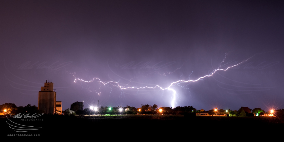
We were hoping for some lightning images after dark, and we finally
got some... although very infrequent... from a real small storm near
Plains, KS between 12:30 and 12:45am. There was maybe one flash every
4 or 5 minutes... but each one was fairly dramatic. There was one
brilliant cloud-to-ground flash that I just missed by seconds after
the shutter clicked off (I had the camera set up on 30 second
exposures instead of bulb.. d'oh!)