 | About This Shoot | Date: 17 July 2013 | Location: Phoenix, AZ afternoon. Quartzsite, AZ area evening. | Shoot Type: Storm Chase | | Synopsis:
|
|
Other Shoots Around This Date 7 Jul | 8 Jul | 9 Jul | 
10 Jul | 
11 Jul | 
12 Jul | 
13 Jul | 
14 Jul | 
15 Jul | 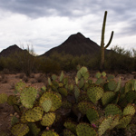
16 Jul |
17 Jul | 
18 Jul | 
19 Jul | 
20 Jul | 
21 Jul | 
22 Jul | 
23 Jul | 
24 Jul | 
25 Jul | 
26 Jul | 
27 Jul | |
|
Navigate Other Shoots (by year) Navigate Other Shoots (by month)
|
Preliminary Storm Reports from 17 July 2013
 |
1630 UTC SPC Products from 17 July 2013

Categorical Convective Outlook
|

Probabilistic Tornado Outlook
|

Probabilistic Hail Outlook
|

Probabilistic Wind Outlook
|
|
Evening Meteorological Charts from 17 July 2013

250mb Chart
|

500mb Chart
|

700mb Chart
|

850mb Chart
|

Surface Chart
|
|
|
Thu, 18 Jul 2013 10:28:43 -0700
Day 7, July 17. Dissipating storm with colorful sunset east of Quartzsite, AZ | First day out chasing with Evan Bookbinder. After picking him up at the
airport and a quick lunch in Tempe, we watched storms form well off to our
north/northwest from South Mountain on the south side of Phoenix. We were
hoping for a dust storm to roll into the northern part of Phoenix, but that
never panned out as the convective activity was shifting well west of the
city. We high tailed it west on I-10 and storms kept redeveloping west,
resulting in us playing catch up all the way to the early evening hours.
Our best photography of the day came from the I-10/US60 interchange east
of Quartzsite as a storm to our west developed a nice core and
lightning...but the lightning activity was on a downtrend as we finally
made our stop. We did manage to capture a couple of the last
cloud-to-ground flashes...then focused on the amazing sunset colors before
calling it a day and making the long drive back to Tucson.
| 
(click on thumbnail for pop-up of larger image) |
|


