Mike Umscheid Photography & Storm Chase Blog
* *  Mike Umscheid PHOTOGRAPHY & STORM CHASE BLOG   * *


Navigate Other Shoots (by year)
2020
2019
2018
2017
2016
2015
2014
2013
2012
2011
2010
Navigate Other Shoots (by month)
July 2020
June 2020
May 2020
April 2020
March 2020
February 2020
November 2019
September 2019
August 2019
July 2019
June 2019
May 2019
April 2019
February 2019
September 2018
August 2018
July 2018
June 2018
May 2018
April 2018
March 2018
February 2018
January 2018
December 2017
November 2017
October 2017
September 2017
August 2017
July 2017
June 2017
May 2017
April 2017
March 2017
February 2017
January 2017
December 2016
November 2016
October 2016
August 2016
July 2016
June 2016
May 2016
April 2016
March 2016
February 2016
January 2016
November 2015
October 2015
August 2015
July 2015
June 2015
May 2015
April 2015
February 2015
January 2015
December 2014
November 2014
October 2014
September 2014
August 2014
July 2014
June 2014
May 2014
April 2014
March 2014
February 2014
January 2014
December 2013
November 2013
October 2013
September 2013
August 2013
July 2013
June 2013
May 2013
April 2013
March 2013
February 2013
January 2013
December 2012
November 2012
October 2012
September 2012
August 2012
July 2012
June 2012
May 2012
April 2012
March 2012
February 2012
December 2011
October 2011
August 2011
July 2011
June 2011
May 2011
April 2011
June 2010
May 2010
April 2010
February 2010
January 2010

<<  Previous Page        Next Page  >>    Top Page

Fri, 14 Jun 2013 18:26:56 -0500
Supercell forming rapidly west point nebr
  
(click on thumbnail for pop-up of larger image)

Fri, 14 Jun 2013 07:25:37 -0600
A gustnado formed about 100 yards of me near Woodrow, CO on 13 June 2013
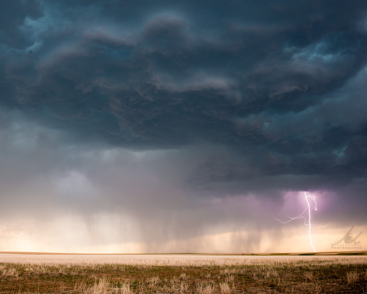
Looking off to the southeast a few miles southwest of Woodrow, CO when the
storm I was chasing and photographing become significantly
outflow-dominant, creating an environment for gustnado formation (not true
tornadoes), when the outflow winds from the storm interact with surface
inflow from the southeast.
  
(click on thumbnail for pop-up of larger image)

Thu, 13 Jun 2013 22:08:23 -0600
High-based severe storm developing west of Woodrow, Colorado on 13 June 2013
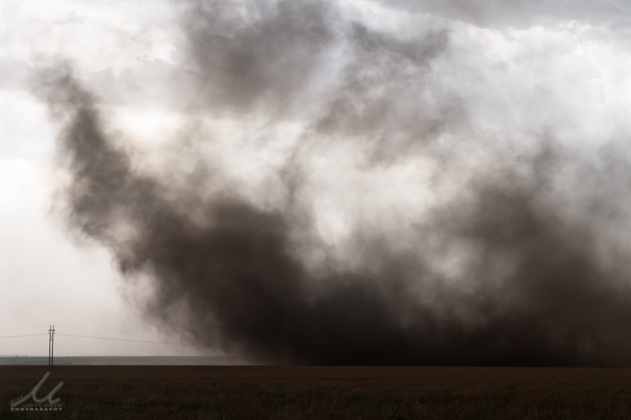
This image was looking west-northwest at the developing severe storm which
would ultimately become a substantial dust storm with a large number of
gustnadoes when the storm reached Hwy 71. The image posted here is of the
cleanest look I had of the storm before it became a mess with a bunch of
blowing dust everywhere.
  
(click on thumbnail for pop-up of larger image)

Thu, 13 Jun 2013 06:22:13 -0500
Chase Day June 13 - Northeast Colorado, Nebraska Panhandle
4-Day Chase Trip, June 13-16

June 13:
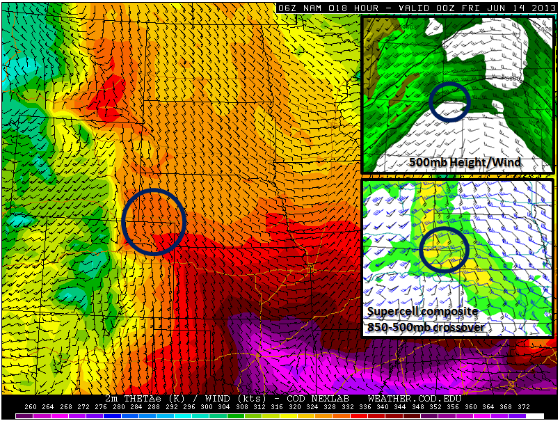
I will be departing Dodge City here in about an hour (around 7:00am) heading for a general target region encompassing Northeast Colorado and the Nebraska Panhandle.  There are two specific areas within this region I have my eye on.  The first is the corridor from Sterling to Julesburg to Wray, CO where the NAM and GFS have been most aggressive in convective development for several runs now. This area will be right at the area ahead of an advancing warm front north through eastern Colorado this afternoon. 1500-2200 J/kg SBCAPE will develop in this area.  Negatives in this region include: south of the 588 decameter height line at 500mb (Good supercells are less likely in environments with such high mid level heights) and also as a result weaker 500mb winds around 20 to 25 knots.  That being said, the directional shear will be good with 850-500mb forecast crossover supportive of supercell storms. The other area I have my eye on is the Chugwater-Scottsbluff hotspot for something initiating off the Laramie Range.  Several of the high-resolution WRF models support a supercell signal off the Laramies in this corridor in stronger 500mb winds/lower heights (below 588 decameters).  The one negative I see is a bit less moisture, but lower to mid 50s could still result in the Sidney-Scottsbluff, NE region which is certainly enough for a high-based, photogenic supercell.
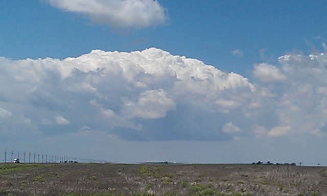
June 14:
This looks like a pretty good Central Nebraska day if the cap can be broken.  GFS and NAM have shown a consistent signal of enhanced surface convergence amidst 4000-5000 J/kg CAPE... at the southern edge of adequate 500mb flow.  I will probably stay somewhere along I-80 (Ogallala?) after this evenings chase.

June 15-16:
Upslope returns on the 15th favoring the northeastern Colorado/adjacent southern Nebraska Panhandle region again.  The same goes for the 16th, to a certain degree, as zonal flow at 500mb will be in place and 588 decameter line displaced south into southwest Kansas.  It looks like a broad region of interest on the 16th, but I need to be back to Dodge City by the morning of the 17th to resume day shifts.

Mike Umscheid
  
(click on thumbnail for pop-up of larger image)

Mon, 10 Jun 2013 20:36:12 -0500
-Eastern Bluebird Breakfast- at Kill Creek Park in Johnson County, Kansas on 10 May 2013
  
(click on thumbnail for pop-up of larger image)

Thu, 06 Jun 2013 23:51:07 -0500
-Majestic Mothership- The Julesburg, CO supercell of 28 May 2013 when it was in its classic mothership structure between Crook and Julesburg, CO
  
(click on thumbnail for pop-up of larger image)

Mon, 03 Jun 2013 21:14:34 -0500
Mammatus-filled southeasern sky over Dodge City.. viewed from my house north of town. 3 June 2013
  
(click on thumbnail for pop-up of larger image)

Thu, 30 May 2013 13:37:51 -0500
Viewed from Minneola, ks 110pm
  
(click on thumbnail for pop-up of larger image)

Wed, 29 May 2013 21:43:11 -0500
Weak, broad multiple vortex tornado about 12 miles northwest of Ulysses, KS. 29 May 2013
  
(click on thumbnail for pop-up of larger image)

Wed, 29 May 2013 14:08:27 -0500
Dryline tower going up fast near garden city 205pm
  
(click on thumbnail for pop-up of larger image)

<<  Previous Page        Next Page  >>    Top Page