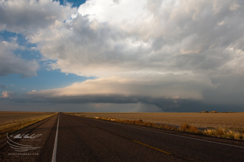
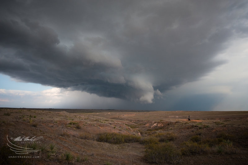
I continued east
and southeast on Ranch 2477 stopping intermittently along the way to
I-40 after sunset to photograph the structure of the supercell off
to the east. There was a left-split storm moving northeast to
eventually merge with the main supercell storm, although this ended
up being more of a destructive merger (in combination with the fact
that instability was rapidly declining with loss of insolation).
When I got to I-40, I continued east to Alanreed and went south on
Ranch 291, but by this point, the storm was not photogenic anymore
and the rising full moon was in a bad position providing harsh light
in the direction of the decaying and departing storm. All in all,
this was one incredible chase for October -- probably the most
impressive supercell, structure wise, I have photographed in the
month of October.
After photographing the sequence
at the first windmill, I continued south on Highway 70 a few more
miles and went east on Ranch 2477 (the road to Lake McClellan). I
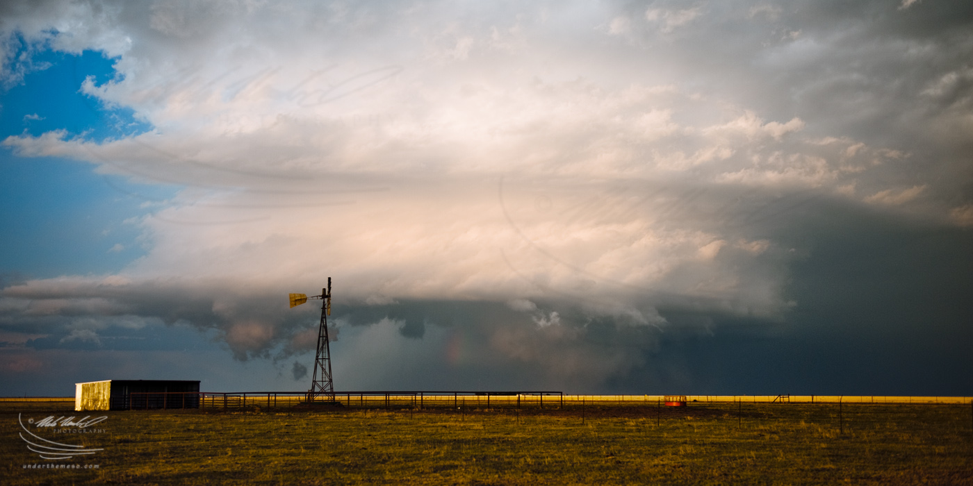
stopped again when I came across another windmill, only this one
without blades... and used this as a foreground subject to
photograph what was now becoming an incredible striated barrel
updraft to my east. It was right around sunset time at about 7:10
to 7:15 when I photographed the sequence of images below:
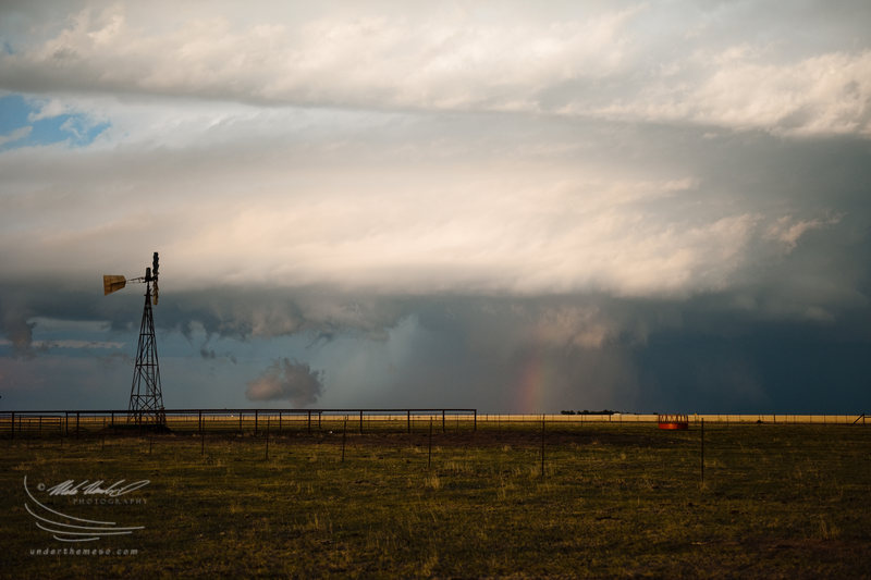
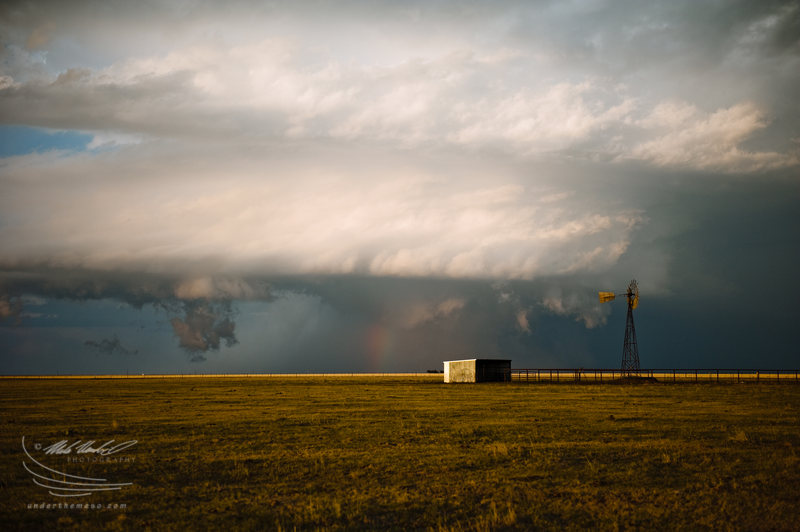
From the same location, I also
photographed a few wide angle images with the windmillat
around 7:00pm as the supercell storm continued to move southeast
near Lefors, TX:
I wanted to drive east a little bit off of
Highway 70 to try to get a little closer to the primary updraft
area, so I took one of the several unpaved roads that went east a
couple miles before dead-ending. Along the way on one of these
roads, I came across a windmill -- one of my favorite subjects to
shoot with storms -- and just went to town photographing the awesome
scene at around 6:50pm:
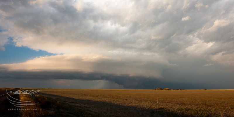
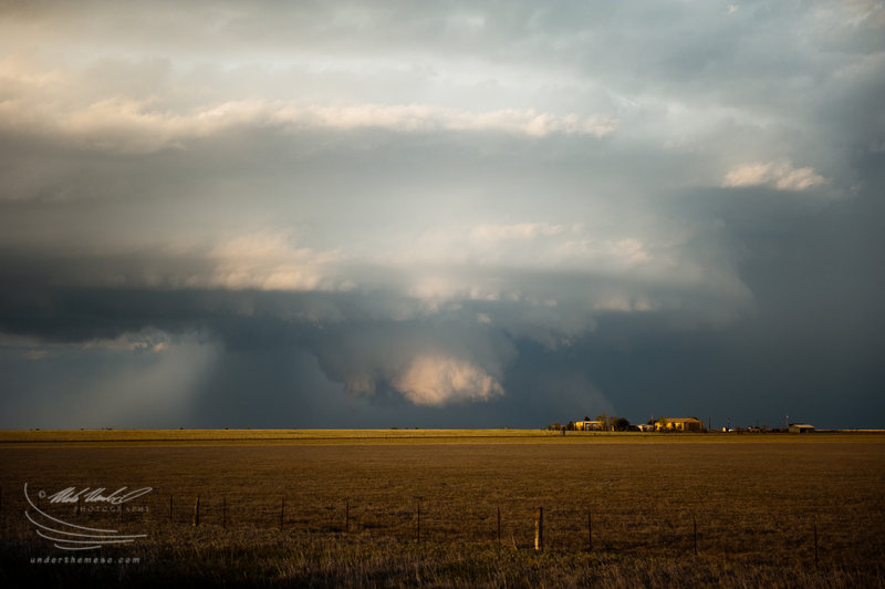
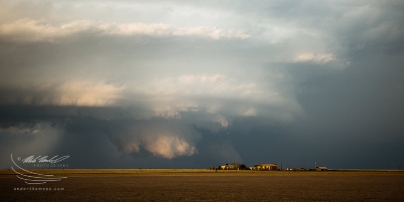
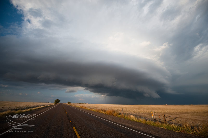
About 10 to 15 minutes later, farther south along Highway 70 (probably 12 miles or so south
of Pampa), I stopped again to photograph the storm structure to my
northeast. The sun was getting lower and the light was improving
(becoming softer). To my surprise, a big, blocky wall cloud emerged
beneath the base of the supercell. For a moment, the bottom portion
of the wall cloud was being illuminated by the sun. I used a
distant farm house to my advantage as a foreground subject to the
wall cloud farther back. The rear flank gust front had a rather
striated look to it as it extended a good distance
west-southwestward from the wall cloud area. Time of the following
images around 6:45pm:
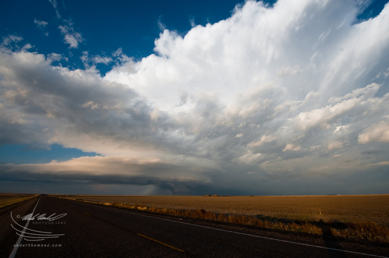
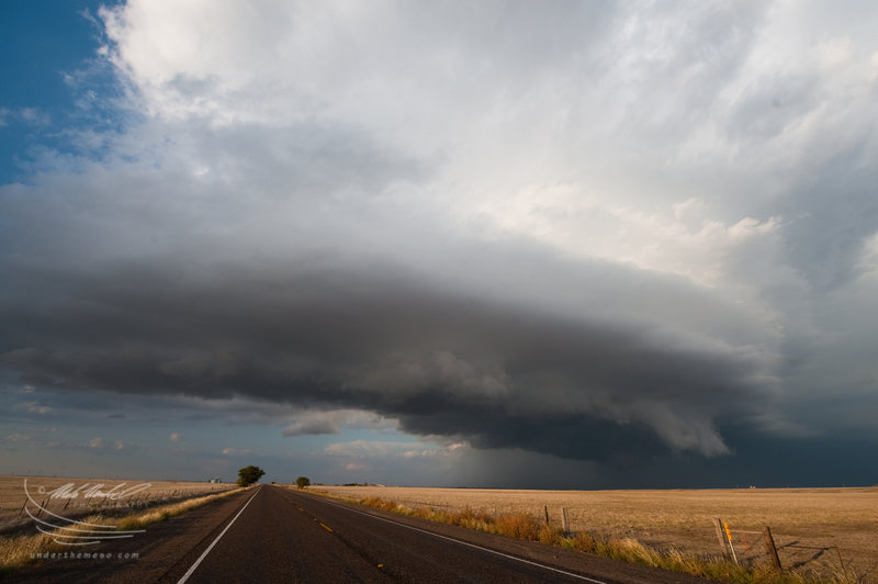
I continued my
drive south on Highway 70 south of Pampa to stay ahead of the main
updraft area, and in doing so, the structure of the supercell became
much improved. As viewed from the south-southwest, the storm
structure was quite impressive with a long rear-flank gust front
approaching me along Highway 70 and multi-tiered banded structure of
the main updraft area farther to the northeast. Here are a few
images during that stage shortly after 6:30pm:
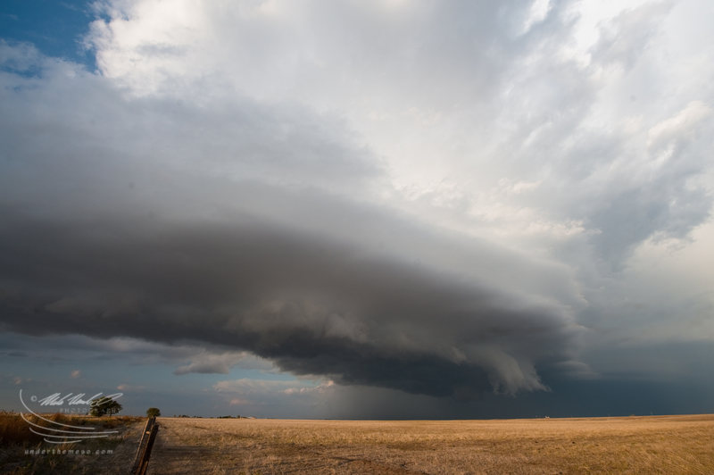
So, I departed Pampa after the hail ended, but
I wasn't entirely sure whether to go southeast or due south. I saw
the new big updraft base to my immediate south/southwest and had a
strong feeling that would be supercellular very soon... and move
straight southeast or even south-southeast. I also weighed in the
possibility that photography light might be better being due south
or even southwest of the primary updraft. I was on Highway 273 just
south of Pampa and decided to take Highway 70 south...instead of
Highway 273 southeast to Lefors. Here are a few images of the early
stages of the updraft base about to really ramp up and take on
supercellular characteristics... at around 6:20pm... about 5 miles
south of Pampa just east of Highway 70: