Mike Umscheid Photography & Storm Chase Blog
* *  Mike Umscheid PHOTOGRAPHY & STORM CHASE BLOG   * *


Navigate Other Shoots (by year)
2020
2019
2018
2017
2016
2015
2014
2013
2012
2011
2010
Navigate Other Shoots (by month)
July 2020
June 2020
May 2020
April 2020
March 2020
February 2020
November 2019
September 2019
August 2019
July 2019
June 2019
May 2019
April 2019
February 2019
September 2018
August 2018
July 2018
June 2018
May 2018
April 2018
March 2018
February 2018
January 2018
December 2017
November 2017
October 2017
September 2017
August 2017
July 2017
June 2017
May 2017
April 2017
March 2017
February 2017
January 2017
December 2016
November 2016
October 2016
August 2016
July 2016
June 2016
May 2016
April 2016
March 2016
February 2016
January 2016
November 2015
October 2015
August 2015
July 2015
June 2015
May 2015
April 2015
February 2015
January 2015
December 2014
November 2014
October 2014
September 2014
August 2014
July 2014
June 2014
May 2014
April 2014
March 2014
February 2014
January 2014
December 2013
November 2013
October 2013
September 2013
August 2013
July 2013
June 2013
May 2013
April 2013
March 2013
February 2013
January 2013
December 2012
November 2012
October 2012
September 2012
August 2012
July 2012
June 2012
May 2012
April 2012
March 2012
February 2012
December 2011
October 2011
August 2011
July 2011
June 2011
May 2011
April 2011
June 2010
May 2010
April 2010
February 2010
January 2010

<<  Previous Page        Next Page  >>    Top Page

Sat, 29 Jun 2013 09:34:16 -0500
Storm beginning to gust out as cold outflow air becomes dominant
Summary & Images (part 9)
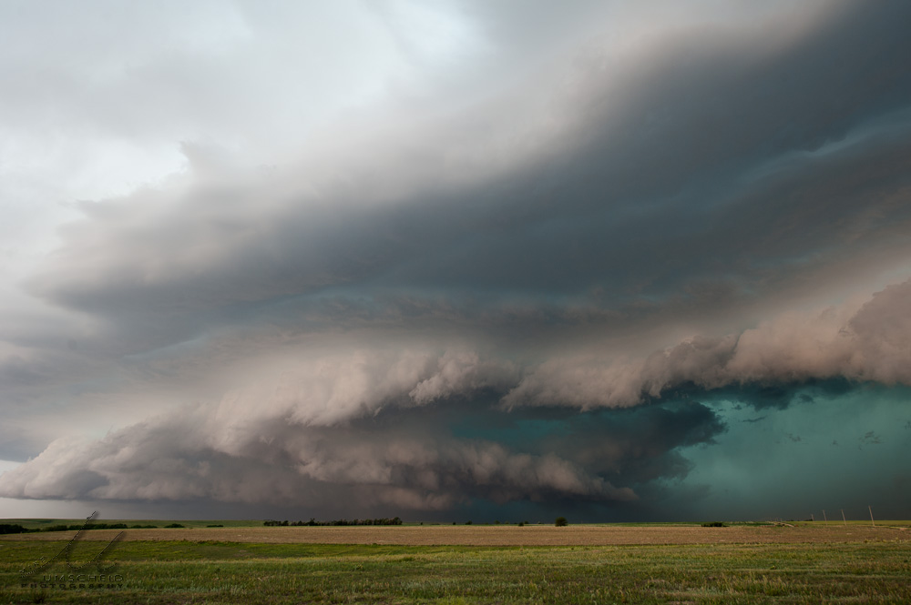
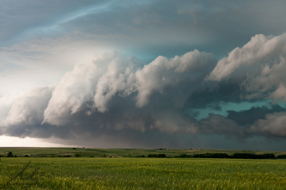
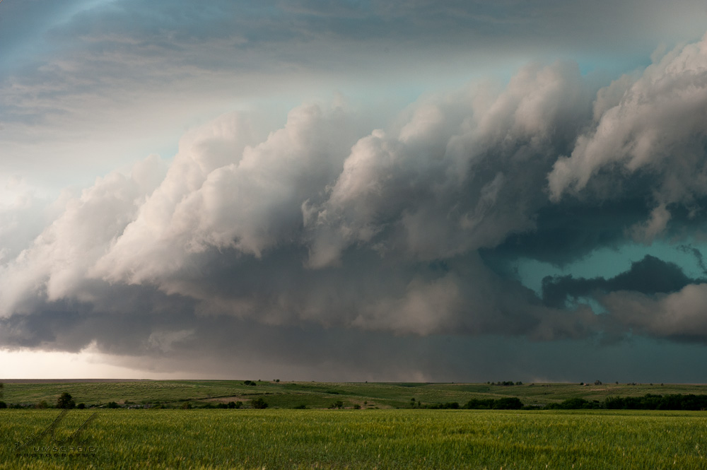
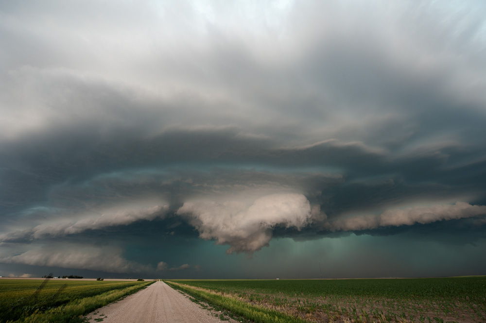
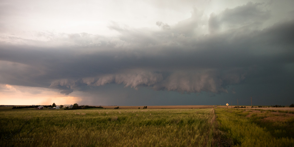
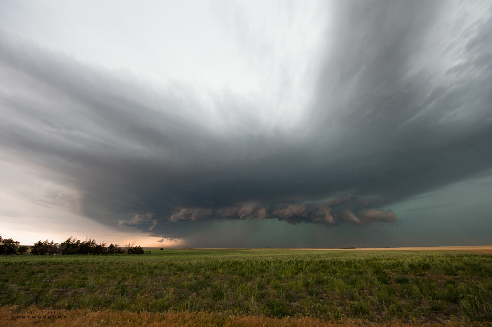
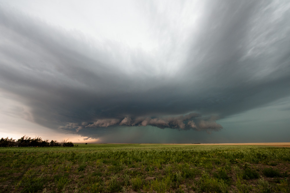
Between about 6:58 and 7:11pm, I photographed the storm from a location about 6 S, 7 E Atwood (39.7124901,-100.8991013) as the storm was becoming a bit messier as cold outflow was really overwhelming with more of a shelf cloud structure evolving. This was the last decent sequence of images of this storm. After this, I made my way south and east on the unpaved county roads to Seldon, KS where I hit paved highway again.

#1

#2

#3

#4

#5

#6

#7

#8

#9
(click on thumbnails for pop-up of larger images)

Sat, 29 Jun 2013 09:13:09 -0500
Menacing HP storm structure south of Atwood!
Summary & Images (part 8)
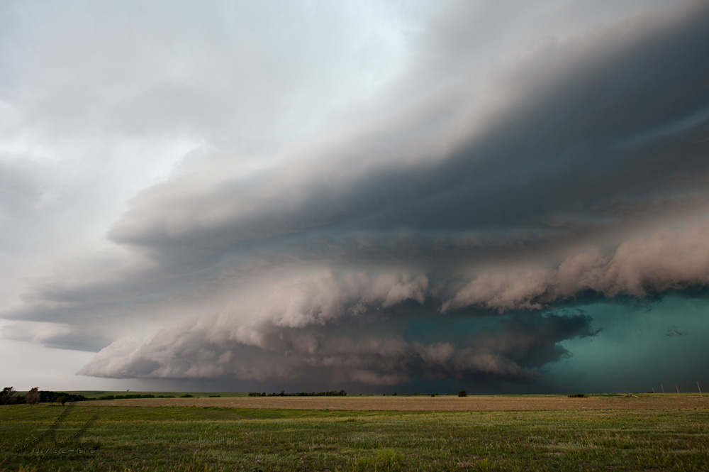
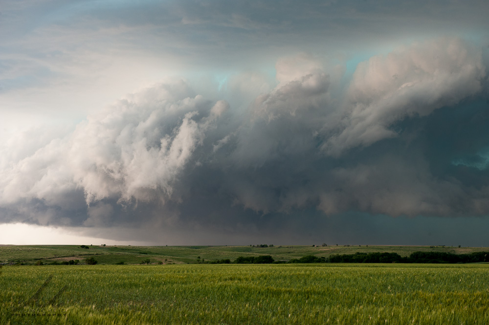
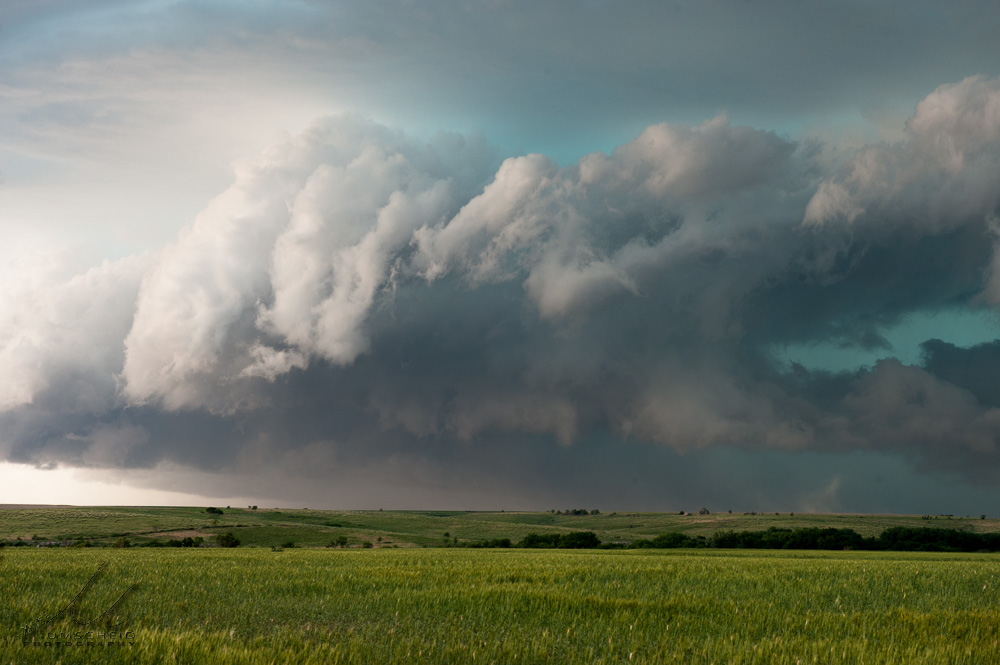
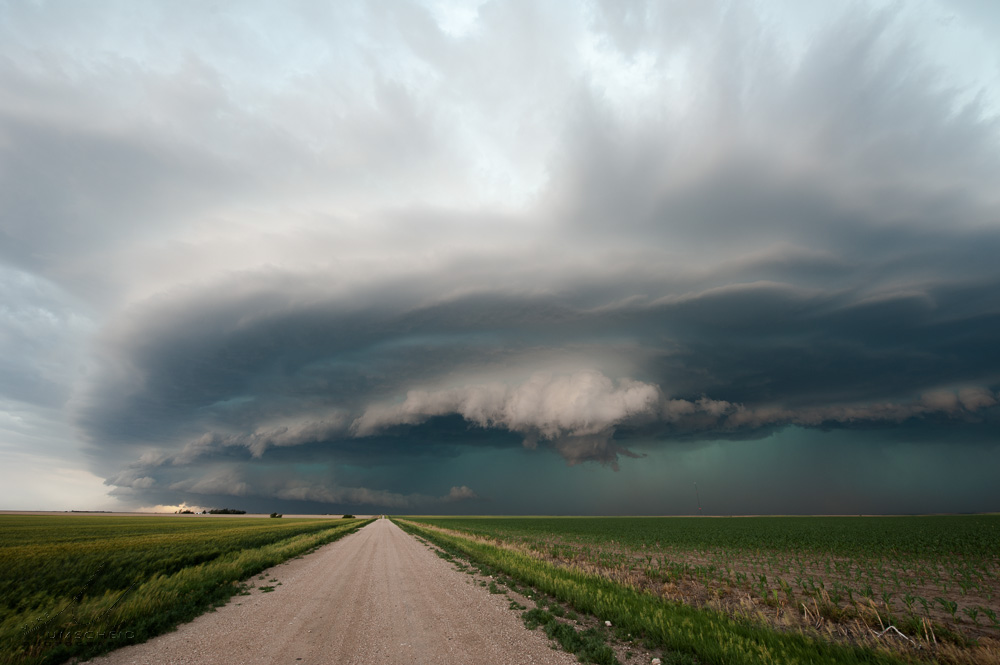
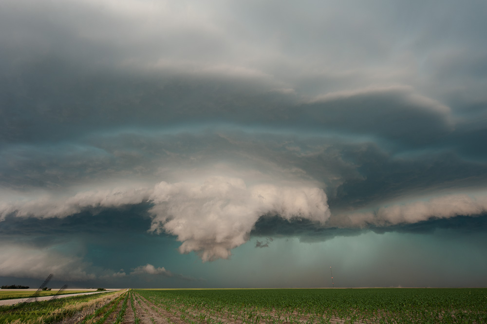
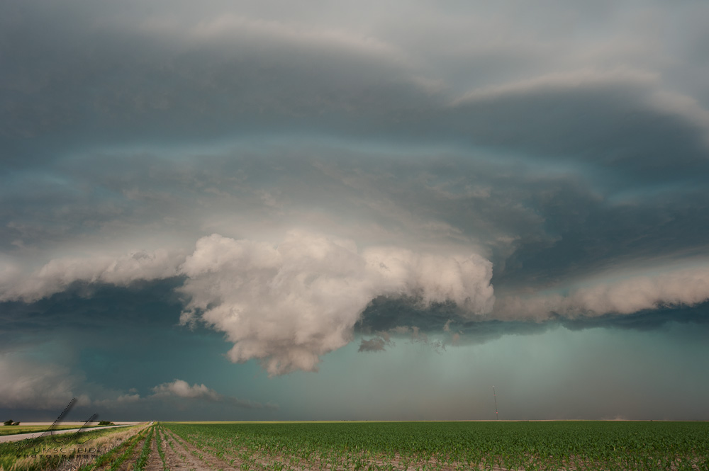
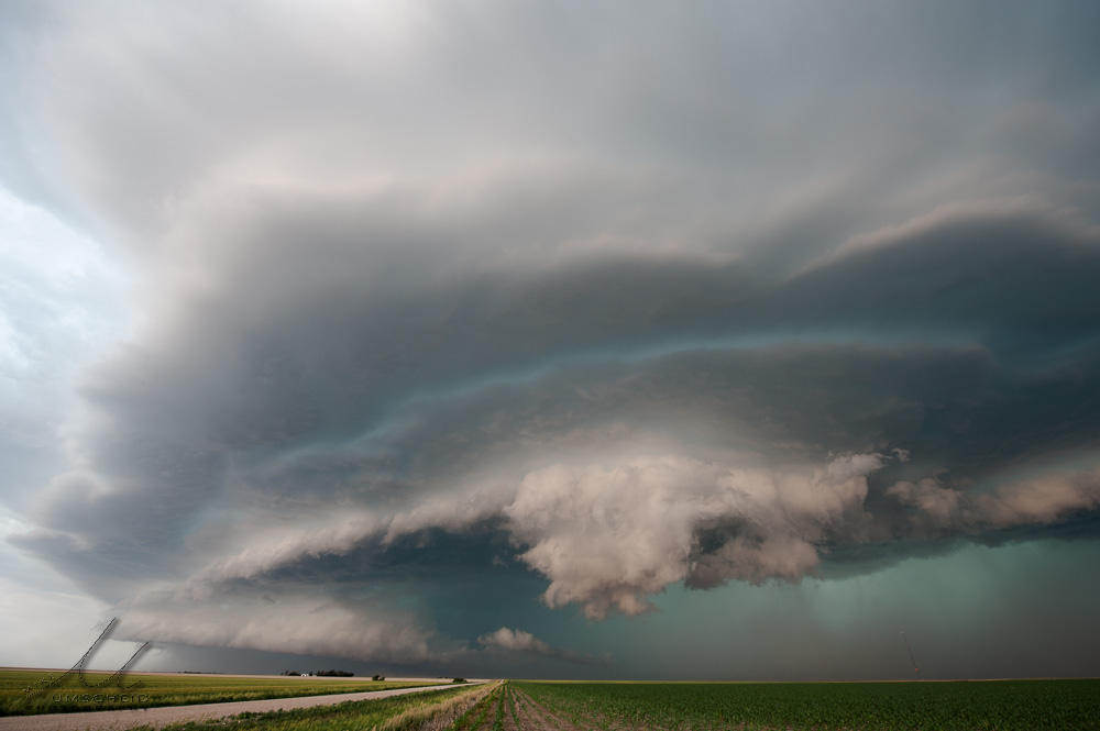
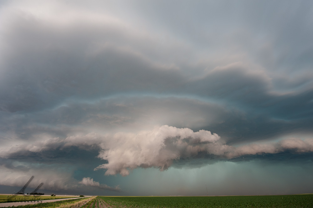
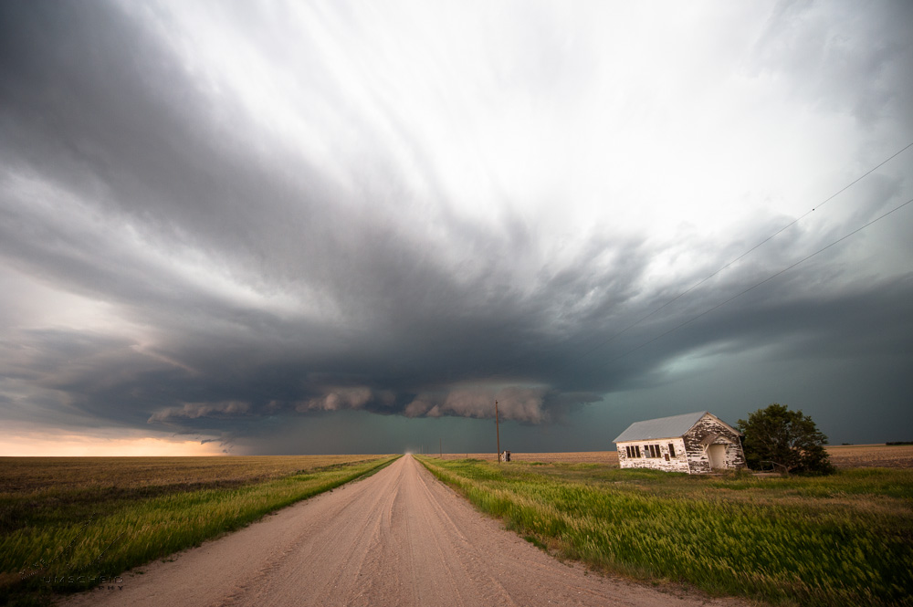
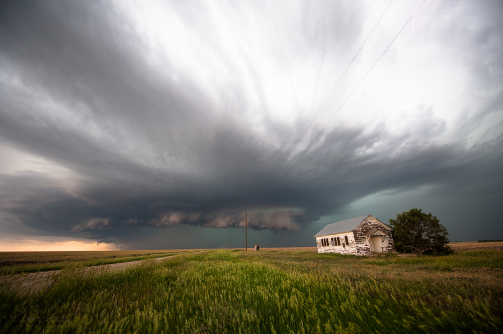
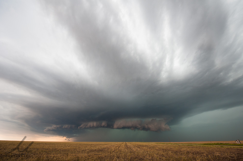
Now south of Atwood, I decided to venture east on an unpaved county road grid across southeastern Rawlins County since the storm was moving southeast. This would afford some better storm structure shots, I thought, instead of just continuing south on Highway 25. This ended up being a good decision. This set of images was taken about a mile east of Highway 25 (39.7271690,-101.0402985) looking west as an impressive, blocky lowering developed at the edge of the advancing gust front.

#1

#2

#3

#4

#5

#6

#7

#8
(click on thumbnails for pop-up of larger images)

Sat, 29 Jun 2013 08:54:36 -0500
New storm taking on impressive HP structure north of Atwood, KS
Summary & Images (part 7)
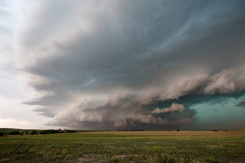
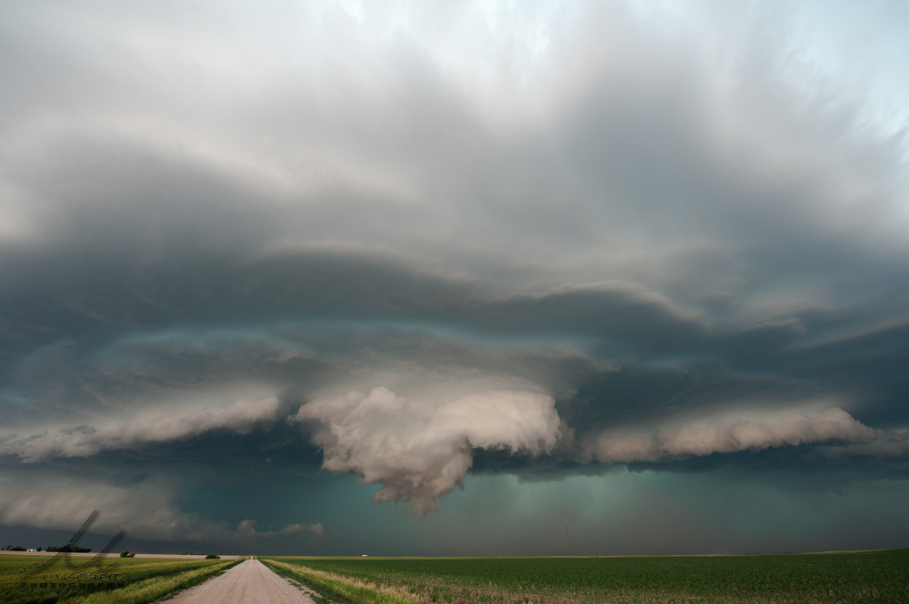
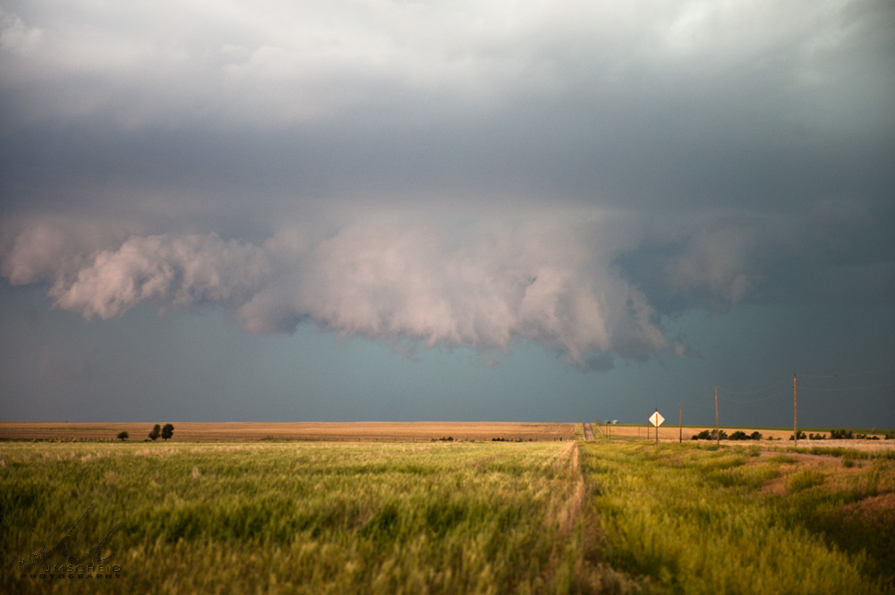
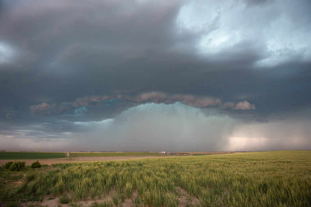
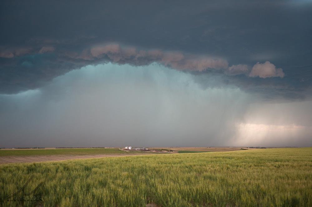
Between about 6:07pm and 6:20pm, I photographed some developing high-precipitation storm structure to my west from a location about a mile west of Highway 25 about 4 miles south of the Kansas-Nebraska state line (39.9435806,-101.0740967). I found an old school house at the county road intersection and used it as a foreground subject. The storm was clearly in an uptrend in strength during this time as the structure of the storm was really improving nicely during this time frame here at this location.

#1

#2

#3

#4

#5

#6

#7
(click on thumbnails for pop-up of larger images)

Mon, 24 Jun 2013 23:20:58 -0500
Cloud-to-ground lightning flash from a severe storm near Fowler, KS. 24 June 2013
Nikon D3 with 24-70mm f/2.8 lens
focal length 40mm
1/25s
f/10
ISO 100
Tripod + Lightning Trigger
  
(click on thumbnail for pop-up of larger image)

Mon, 24 Jun 2013 01:36:36 -0600
Otis, CO Bow-echo approach after sunset. 23 June 2013
This was a long drive of recovery to get back into position to at least
photograph a little bit of the Last Chance to Anton, CO storm. I caught the
northern end of the storm after being in southeast Wyoming earlier in the
afternoon/evening in hopes of catching an isolated storm off the Laramie
Range. I was racing north after this shot to stay ahead of the approching
bow-echo moving toward Otis, CO.
  
(click on thumbnail for pop-up of larger image)

Sat, 22 Jun 2013 22:06:40 -0600
Something out of nothing -- a storm struggle to death on 22 June 2013 north of Cozad, NE
  
(click on thumbnail for pop-up of larger image)

Thu, 20 Jun 2013 23:48:24 -0500
-Remnants- A small thunderstorm dissipates to the east across west-central Kansas around sunset on 20 June 2013
  
(click on thumbnail for pop-up of larger image)

Wed, 19 Jun 2013 21:03:33 -0500
West Point, NE supercell storm structure, complete with multiple layers of incredible striations. 14 June 2013
  
(click on thumbnail for pop-up of larger image)

Mon, 17 Jun 2013 23:38:46 -0500
-Schoolhouse Supercell- A high precipitation supercell thunderstorm approached this old schoolhouse in northern Rawlins Co., KS on 16 June 2013
  
(click on thumbnail for pop-up of larger image)

Mon, 17 Jun 2013 22:32:23 -0500
Last set of images of Round #1 of this chase with Jay
Atwood, KS HP Supercell Summary & Images (part 6)
Time 5:20pm north of Stratton, NE (40.2526207,-101.2489014) as we watch our storm continue to move southeast approaching the Stratton, NE area. By this time, the MCS was beginning to take shape with numerous storms developing southwest of this storm...effectively killing off our original storm. Jay broke off the chase not too long after this stop at Trenton, NE... to continue his vacation in Wyoming. I continued to follow the storms south into Kansas, which was conveniently on my way back home to Dodge. I noted to Jay that the new storm, which appeared to be developing southwest of our original storm, was showing a scuddy lowering (not knowing at the time that this would end up being a much more interesting storm intercept not too long afterwards!)

#1

#2
(click on thumbnails for pop-up of larger images)

<<  Previous Page        Next Page  >>    Top Page