Well, I’m not going to elaborate too long on this, but I went on my first long chase of the 2006 season on Wednesday the 8th. Long story short… 6 hour drive to near the Red River in southern Oklahoma to see a *&$!@-load of cirrus clouds. It appeared for all the world that things would erupt nicely after 4pm or so in the target area, and I KNEW ahead of time that there would probably be a significant problem with high cirrus clouds… but I went anyway. Storms did actually develop a bit farther south of my target in the Throckmorton to Decatur, TX areas just around sunset, but it was at least an hour before that when I threw in the towel and headed back to Dodge.
Now that I have another passionate hobby…photographing wildlife (mainly birds) at Quivira NWR… it’s going to take more to get me out the door for these early season marginal events. Especially with the way gas prices are.
A little about my Kyocera/Alltel setup. In looking at the coverage map on the Alltel site, I knew I would be in a world of hurt for data on the road. There is ZERO coverage in northwest Oklahoma north of I-40 and west of I-35. The route to my target area was through this area, and I can verify I could not connect…even though the Alltel software was seeing a signal, I would get a “could not connect to remote computer” errors….all the way from when I entered Oklahoma north of Laverne until I approached El Reno. The map indicates high speed service in the OKC metro area, and I could verify I got a great connection with impressive high speed performance in El Reno. About 10 miles south of El Reno, I lost this “OKC Metro” signal, and went back into a data void… which the coverage map indicated. I regained service near Duncan, which was my target town…and I downloaded data in a strip mall parking lot for about a half hour. It was a bit slower than OKC Metro signal, but it was still much faster than 56k….almost approaching DSL speed. The coverage map is a great tool, as it was amazingly accurate in depicting the locations that I did and did not have service. In looking at the coverage map, I am very pleased that most of West TX has quite adequate coverage. As well as, of course, all of Kansas, most of Eastern CO and a lot of the northern Plains. The only huge “hole” near where I live is in Northwest OK. I can live with that.
Well, I did actually chase, although it was a fruitless endeavour other than the fact that I did get out and play with some of the new equipment, mainly my new wireless internet setup with the kyocera air card and Alltel Axcess Mobilelink. I am pleased with the signal and service so far in western KS. Since Alltel digital service is operated on the CDMA network, signals extend farther out than GSM which is what Cingular and a few other providers use. There’s an Alltel CDMA tower in just about every KS county seat, and I could pretty much verify that on this short chase. The only areas where signal faded to “no signal” where right near the county borders. All in all, it was fun to check out the latest high res visible satellite imagery, short-fuse composite graphics, and a myriad of other data and websites out in the middle of nowhere Hamilton County, KS at a download speed just under that of DSL.
As far as the chase went… well, nothing formed on the dryline along the KS-CO border; there just wasn’t enough convergence as the short-wave trough was still too far to the southwest by late afternoon. Plus, increasing cirrostratus negated any outside chance of initiation by 430 or 5pm. I left and headed back to Dodge after sitting around the Syracuse, KS area for awhile. Got back around 630pm in time to take a long nap before my first mid shift. Am watching potential dryline opportunity Tuesday 7th… we’ll see. I’d have to forego bowling if it looks like anything worth pursuing within a 2 hour radius of Dodge.
It seems like every other year or so, there’s a marginal opportunity to get out and chase…
to more or less test out the new equipment for the new chase season…and just get out and observe a convective sky after a long boring winter. Especially this winter…a winter that has been so bone dry, but really not all that cold. Low level moisture will be advecting northward overnight tonight through west TX, getting into W KS tomorrow.
It’s not much moisture, granted…
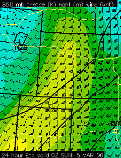
as it’s early March, but with cold temps aloft this time of year, it doesn’t take much to get some potential instability… the NAM shows CAPE’s of 700 to near 1000 J/kg by late afternoon Saturday 4th with some modest dryline convergence from Liberal to Scott City. So, I’ll watch this closely tomorrow morning and get the camera gear in “standby” mode just in case. I work midnight shift tomorrow evening, so I do have about a 3 hour leash.
… 9 to 11″ with major tree damage in Castle Rock …
The event is winding down early this evening, but not before dumping nearly a foot of snow in the Castle Rock area. The big winner with this event appears to be the Bennet-Strasburg area where a solid foot and a half had fallen. I took many photos of the event, which I will begin posting to my Oct 10 Snowstorm Gallery Page. I’m going to catch up on some sleep this evening. I plan to head back to Dodge tomorrow morning. This was certainly worth the trip!
… 7.1″ measured as of 920am MDT in Castle Rock…
Since around 7am, averaging about 3/4″ per hour rate. This kind of snowfall rate is expected at least through mid-afternoon. It looks like the big winner so far east of the mountains is along I-70 just east of Denver. Persistent 25-35dbz echoes all morning in the area around Bennett to Strasburg. Reports of 9 to 12″ already out there.
… 5.6 inches at 720am MDT …
Snow is starting to pile up pretty good now on surfaces other than pavement. The parking lot here is a giant slush pool. I’ll get out and take some photos a little bit later this morning. The surface winds are strongly northwest, which is really preventing the good 25dbz+ snows from getting to I-25. Some of these echoes are, however, edging slightly westward as deeper tropospheric upslope maximizes this morning through early this afternoon.
… 3.3 inches as of 230am MDT …
I have uploaded a few photos at http://www.underthemeso.com/gallery2/stormchase/chase05/2005oct10/
I found a decent measuring spot on a trailer bed that is elevated off the ground. Some melting and settling will make measuring difficult, but still think a solid foot to foot and a half is a good possibility by midnight tonight. The strongest lift will be continuing through mid afternoon. I’m gonna catch some Z’s for about 5 or 6 hours…and by the time I wake up, there should be about 3 or 4 more inches accumulation.
9pm MDT. I have been in Castle Rock for an hour now and when I arrived the temperature was 38 degrees with light rain. As of the time of this writing, I look out the window and see quite a few small flakes… so we have changed over. There is a huge area of moderate to heavy precip to the southeast that is moving northwest towards my area. This should be the beginning of “the show” for the urban corridor. I sit here at 6200 feet. The latest NAM brings the total QPF down just a little bit, but still an impressive amount of snow no matter how you slice it. A good foot and a half still looks good here in Castle Rock! -Mu
…Columbus Day Snow Chase — Castle Rock, CO…
Greetings everyone! Well this is a first for me. I have never done a snow chase before, but the timing couldn’t have been more perfect for me. I have both Columbus Day and Tuesday off, which coincides perfect with the timing of what looks to be a major snowstorm for the Colorado “urban corridor”. Both the GFS and the NAM models suggest upwards of two feet of snow south and southwest of Denver by late Monday Night or early Tuesday. Given the unusual early timing of such a powerful snow storm for this area, it may present some problems with numerous trees coming down as many of them have not lost their leaves yet.
I plan to leave Dodge City this afternoon around 2:30pm (Central time) and expect to arrive at my destination of Castle Rock, CO around 7:00pm (Mountain time). It should be raining by the time I get there, but rapidly change to snow sometime between 8pm and 10pm Mountain time. It may even changeover before I arrive. Castle Rock sits at about 6200 feet in elevation which will be plenty high enough for this storm system. Heavy snow will fall overnight tonight and continue heavy through the first half of Monday. By dawn, there may be 8 to 10″ already on the ground, with an additional 8 to 10″ on top of that. Thankfully, the warm ground will prevent a huge accumulation on roads, but if it snows that hard, it really won’t matter much. I hope to document this event extensively through photography and videography as it could be a national news story if there really is widespread 20″ or more of snow in the highly populated areas of the I-25 corridor. -Mike
Jay Antle and I ended our 2005 chase vacation on a good note. We intercepted 3 supercell thunderstorms near the Southwest KS-Eastern OK Panhandle border on Thursday 16th. We left GLD and decided to head down to DDC for a mid-afternoon data stop. Midday short-fuse composite (weather.gov/ddc/short.html) was pointing at far NW OK area south of DDC right along the state border for several hours… and it was based of this information that we pretty much committed to heading south of Dodge. Hard towers went up to our SSW through WSW by the time we got to Dodge. We stopped by my place for data real quick, only to find my damn cable was out. So much for that idea… we had to get back on the road.
We targetted the storm with a developing overshoot southwest of Englewood. We had to punch through some marginally severe hail, but after emerging on the south side we had a great view of the supercell updraft base along with a western supercell updraft over Meade County. We watched these two storms from a high spot on US283 right along the state line (maybe a mile south into OK) for a good while. Our eastern storm was becoming increasingly stretched out/linear and outflow dominant, yet producing Softballs near Ashland to our northeast.

We had northeast outflow winds at our location, but what was interesting was the fact that the winds were actually fairly warm. These winds became more easterly and ESE as the southeastern Meade Co. storm to our northwest began to really crank. A very organized wall cloud developed… classic blocky one at that… with relatively modest rotation… nothing violent, however. We let this action approach our location from the northwest…and the wall cloud itself began to take on a liberty bell appearance on the downshear side with great upward motion. Transparent rotating rain curtains were developing signifiying the presence of a "radar hook" and a classic clear slot developed.

Stacatto CGs then began bolting near us (deja vu of June 12th in Kent Co. TX) and we had to get back in the car. Rotation increased further and we did get a persistent pencil-shaped funnel looking almost due west… probably a couple miles south of the state border north of Knowles. This funnel was in the right spot in the occluded wall cloud with wrapping rain curtains. In my book, based on recent events in Trego County 6/9 captured by Jim Leonard on I-70 (rotating rain curtain invisible multi-vortex tornado) this was probably a weak tornado… I’ll leave it to Jay to review the video.

It didn’t take long for the storm to gust out with small dust foots and the like. We also heard of the tornado reports near Knowles that Rob Satkus mentioned after the storm had "gusted out" and believe these were only gustnadoes/dust foots and nothing
more.

Based on the evolution to outflow dominance, we decided to head west on 64 to catch the Sublette-Tice tornadic supercell. It also gusted out somewhat, however, it developed excellent supercell updraft structure once again as it approached our location near Forgan, OK.


This would be the last supercell intercept of the chase, and a close to one awesome chase vacation that included tornado intercepts from Montana south to Texas.
-Mike
