I photographed several severe storms/supercells from northeast of Dickinson to Mandan to Wishek, North Dakota. Below are a few images from this chase:


I photographed several severe storms/supercells from northeast of Dickinson to Mandan to Wishek, North Dakota. Below are a few images from this chase:
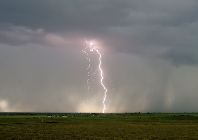
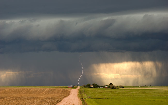
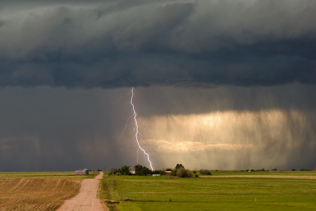
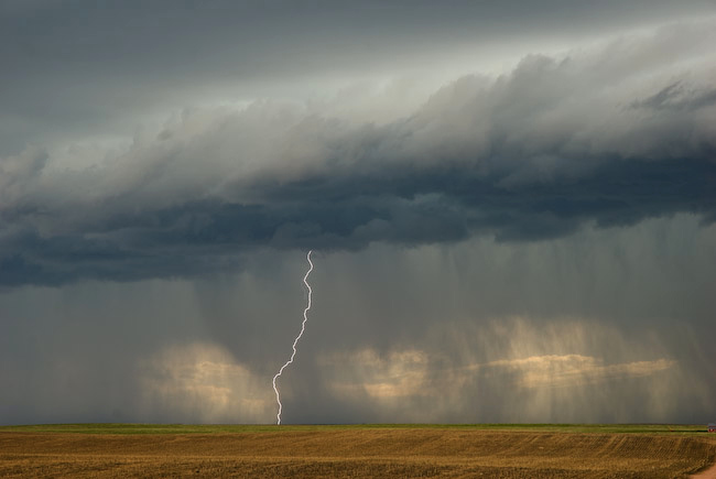
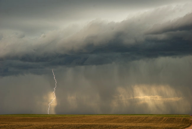
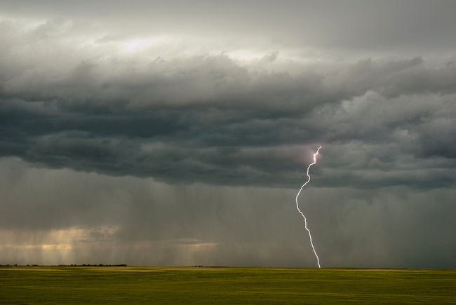
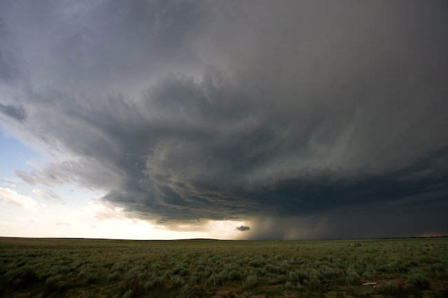
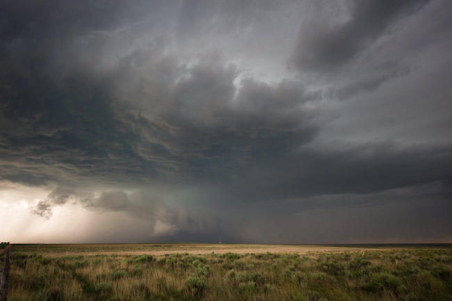
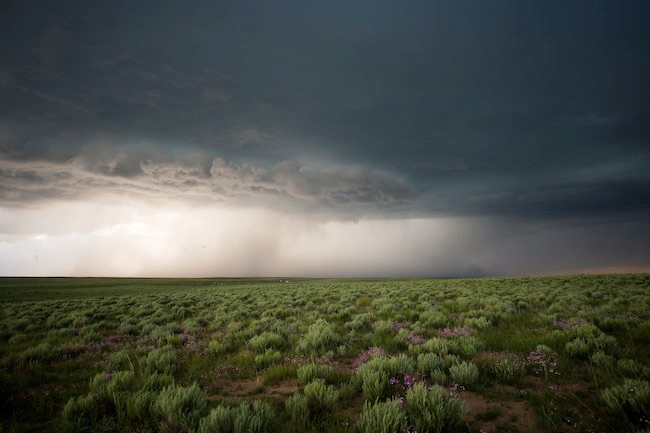
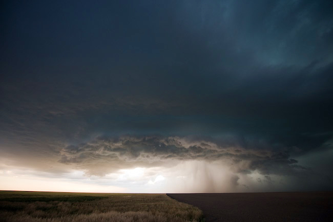
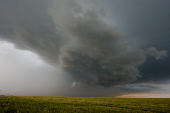
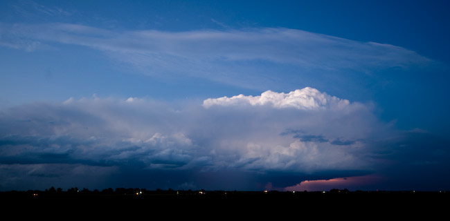
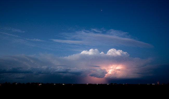
Lightning and Non-Severe Storm Structure from Iliff to Sedgwick, Colorado
Here are a couple images from June 21st chase. The color contrast was beautiful, and I managed to get a few decent daytime CG’s with the lightning trigger. No time for a report since I have to hit the road for today (June 22nd) chase.
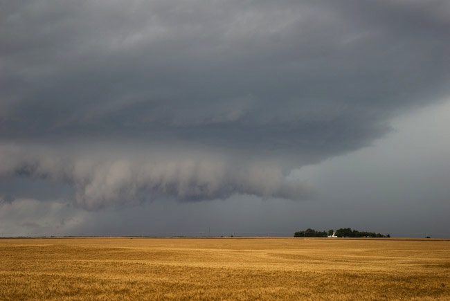
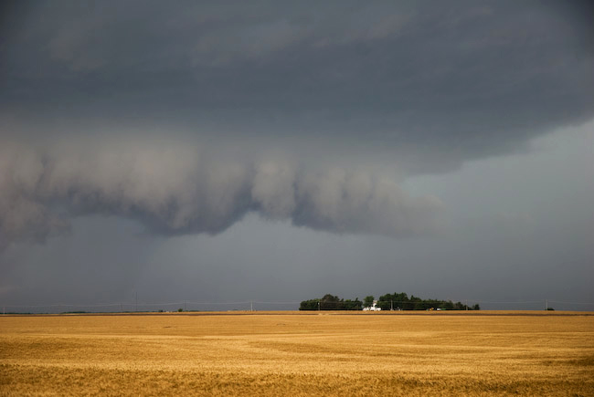
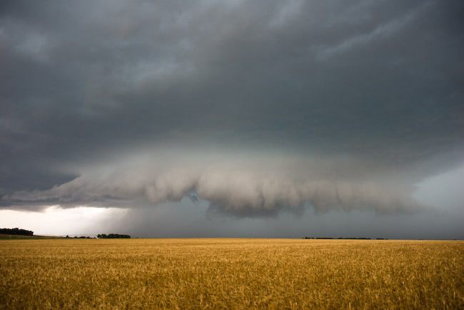
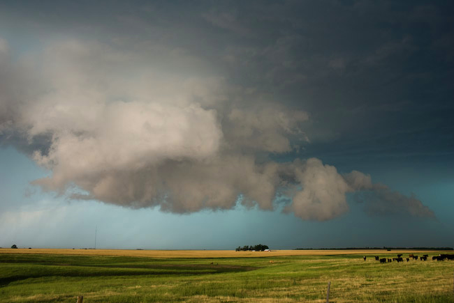
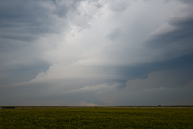
I left Dodge City mid-afternoon and headed to Greensburg as a staging point for severe thunderstorm development. A corridor of 2000-3000 J/kg CAPE developed in the wake of earlier day showers and thunderstorms with a decent east to west surface boundary. An interesting storm emerged out of a cluster of disorganized activity to the southwest of Pratt. The storm had some decent structure initially, with a formidable lowered region from the updraft base. All the unpaved farm roads were still fairly wet from the earlier day rainfall, so I had to stay on paved routes. This meant core punching the storm north of Pratt. I finally got ahead of it again to the west of Hutchinson. A new cell developed out ahead of the former storm by about 10 miles or so…which eventually merged with the former storm to the northwest of Hutch. Rotation in the storm increased, but it quickly became an HP mess with any tornadic circulation being wrapped in rain. My last shoot was northwest of Hutch shooting the shelf cloud extending down the rear flank from the strong wrapped up circulation. I didn’t like the way things were evolving with this storm and it wasn’t entirely photogenic, so I dropped down to South Hutch and called the chase off in favor of positioning for the next day.

…Missing the entire Ravenna to Aurora, Nebraska high-visibility tornadofest because of numerous consecutive poor decisions…
It all started with a poor target choice. I felt very confident we would see significant supercells this day… and more than one across the I-80 corridor. So for this reason, we decided on a western target: McCook to North Platte (instead of farther east toward Kearney). We were anticipating convective initiation around Julesburg or Ogallala. By late afternoon, there was a heavy congested cumulus field from north of McCook to Ogallala to North Platte…east toward Kearney. McCook had a late afternoon dewpoint of 72 degrees with 5500 J/kg of Surface-based CAPE nosing into southwest Nebraska. After staging in McCook for awhile, we drifted north to follow the agitated cu field in vicinity. We were most interested northwest of us where towers were starting to form in the distance. As we drew closer to North Platte, the cu field was holding status-quo, but we noticed a small plume of cirrus clouds oversrpeading our target. This wasn’t a good sign, we thought. The other problem with our area was lack of surface convergence. Winds were generally out of the southeast anywhere…with the best convergence east of us toward Kearney.
We realized, ultimately, that we needed to get closer to the stronger convergence, so we drove southeast toward Lexington. On the drive, towers were shooting up to our immediate south, which we eventually drove under and got on the other side as we approached Lexington. As we are driving, the fateful “storm of the day” was quickly organizing to our northeast. We could see the backside of the convection quite nicely, actually. In the meantime, as we drew closer to the Elm Creek exit, there was exploding, razor sharp convection going straight up in a wall up to 45,000 feet to our northwest. We were in best position for this newer convection than we were the already developed Ravenna (northeast of Kearney) storm. That being said, when we got to the Elm Creek interchange on I-80, my gut told me to go north. A lot of this gut is based on the fact that I hate chasing a storm that 10-thousand other chasers are already on if I really felt that other quality supercells would develop as well. I somehow convinced my chase partners Jay Antle and Evan Bookbinder to turn north. Much of the tactical decision making came to me, ultimately, since we were chasing in my vehicle and both Evan and I were glued to the data and the sky while Jay was driving. I was thinking “tail end Charlie” the most western storm would be the best, but little did I realize at the time that the orientation in which the western storm developed with respect to the lead storm (the Kearney-Ravenna storm) was NOT favorable for the western storm to thrive given its close proximity. This storm actually developed a bit NORTH of due west of the Kearney storm… and given the storm motion, it would eventually choke on the lead storm’s rain-cooled airmass. These were the things I was not thinking about at the time. I just assumed the storm would be ingesting quality air at all times.
We drove all the way northwest to Eddyville and watched a fairly nice base, actually, develop to our northwest with a small wall cloud with some slight rotation. Rotation was never vigorous, though, but the idea of photographing a beautiful supercell and possible tornado that no one else was chasing… was the only thing I could think about at the time. I am all about capturing images very few others do… it is one of my primary motivations in chasing and photographing storms, as many of you all know by now. We actually blew the storm off when we got back to highway 183/40 intersection, but after we drove a couple miles southeast on Hwy 40, the damn storm to the north developed a nice, really low ragged wall cloud in the distance with a distinct clear slot. We decided to follow it again, despite the fact that we new the temperatures were in the mid 70s. The visual observations to the north got the best of us, and this was fateful decision #2. Had we continued southeast and not turned off Hwy 40, we may have probably caught up with the lead storm in time to see the last “Aurora” tornado. But it wasn’t to be. We followed more farm roads north and east toward Ravenna. Of course, as fate would have it, as we drove north and east, the storm cycled down annd didn’t look as great with more of that “cool inflow air” look to it. At Ravenna, we went east-southeast on Hwy 2 to Grand Island, and along the way we realized what we had done and missed. I was really pissed off at myself. It was the worst feeling on a chase I think I have ever had — missing an entire cyclic tornadic supercell with high-quality photogenic tornadoes by a matter of 30 to 40 miles the ENTIRE TIME. We were suckered into the western storm and we (well mainly I) was too stubborn to leave a storm that we had to ourselves and hoping against hope that luck would be on our side. As it turned out, it was some of the dumbest in-situ decision making I’ve ever made chasing. It wouldn’t have been so bad if I was chasing solo, but I had two other chasers with me that were riding what was primarily my decision making during this chase… and they don’t chase nearly as much as I do… so there was a little more pressure to get on the best storm than I normally would have. It was a bad chase day, and the Elm Creek interchange on I-80 will forever haunt me the rest of my storm chasing days.
June 16th was a bust. We saw lightning and heard thunder, though! We did consider two targets: A) Eastern Colorado/Cheyenne Ridge where some residual moisture existed amidst fairly cool mid level temperatures. Slowly rising mid level heights, though and overall CAPE was a huge concern. B) South-central/southeastern KS. A remnant boundary from yesterday’s activity was expected to move slowly eastward. There was a huge cap concern here, but the CAPE was extreme: Around 5000 J/kg. Result: We chose (A) and we chose poorly. Nothing but showers and non severe thunder dotted our target from Sidney to Julesburg by early evening. We sat around Lodgepole, NE hoping one of the small storms would erupt into something a little more spectacular, but it wasn’t to be. We ended up calling off the chase in favor of grabbing a nice dinner in Sidney — which we did. At dinner, we saw target (B) erupt into a stationary non-tornadic supercell southeast of Wichita near Winfield. D’oh!!! That was rather painful. It’s part of chasing though. I took a couple images, but am too lazy to upload junk storm pictures to the blog right now, LOL. We are in Ogallala, NE this morning. Evan and I are debating our target for today, there are a couple of them across southern Nebraska. Stay tuned.
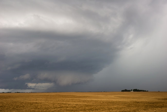
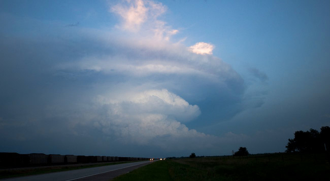
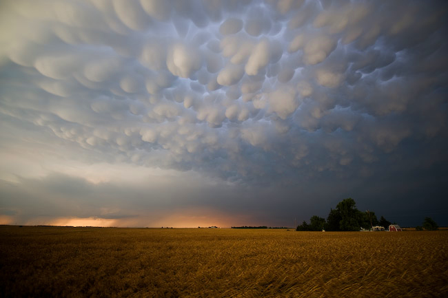
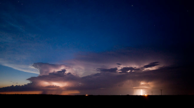
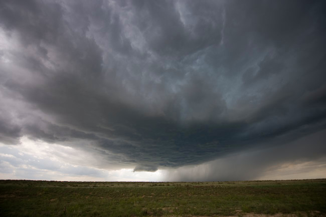
HP-Supercell Structure Spearville to Kinsley, KS — Beautiful Mammatus at sunset Pratt, KS — Astronomical twilight storms near Haviland, KS
Not much time for a detailed report given time constraints (we have to hit the road again). It was another fine day of storm photography on the 15th. We followed the HP-supercell that first initiated northwest of Dodge City. It became a beast of an HP supercell as it tracked from Spearville to Offerle to Kinsley as we followed it along Hwy 50. At Kinsley, we headed south and continued to photograph the structure from southeast of Kinsley to Trousdale to Hopewell to Pratt. We broke off the storm at Pratt then headed south toward Medicine Lodge taking a scenic way home. After a pit stop in Medicine Lodge, we noticed a new storm developed north of Greensburg. We retrated our steps back to Pratt on Hwy 281. When we reached Pratt, a beautiful sky full of vivid mammatus greeted us. We sat at a farm road just west of Hwy 281 a couple miles northwest of Pratt to photograph this atmospheric spectacle. Just phenomenal! After sunset, we drove back west toward Dodge City when another cluster of small storms formed with intracloud lightning. The lightning illuminated structure was quite nice. I took advantage of the low light capability of my Nikon setup (D3 + 14-24mm f/2.8 lens). Results were very good. Here are three images from this day:
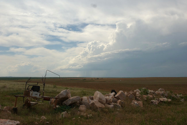
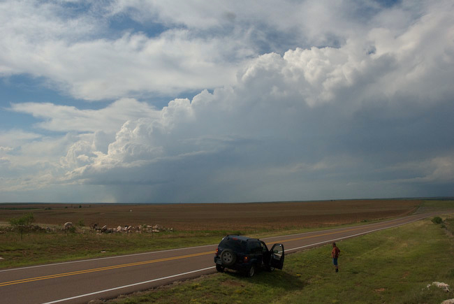
Evan, Jay, and I saw the end of the Karval, CO supercell(s) as we were sorely out of position earlier in the afternoon up along I-70 near Siebert. We busted south and west to get to tail-end charlie, but by the time we got there, the best of the show was likely over. We did catch some of the striated barrel updraft of the eastern supercell as we were driving east toward Karval. Ugh I wish we were closer. Best images of the day for me were daytime CG lightning from the high-based linear storms north of Limon overlooking a farmstead on a dirt road north and east of Limon. Obviously, am disappointed in Leaving DDC at damn near Noon missing the supercell and tornado in Haskell county. I over-analyzed this one. D’oh!
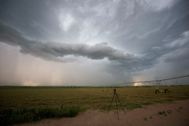
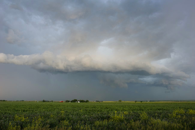
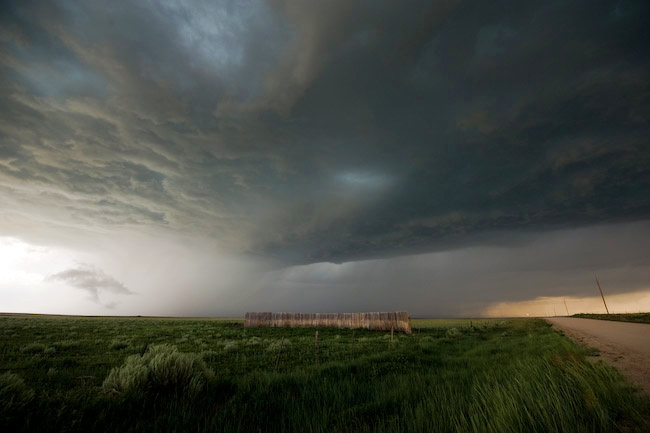
Kim to Pritchett, CO to Richfield to Hugoton, KS Long-lived supercell with brief tornado
Evan, Jay, and I had one long day. Intercepted the Kim to Pritchett, CO to Richfield, KS and beyond supercell. We observed numerous gustnadoes south of Pritchett, but as significant updrafting was beginning to occur above these dust whirlies. Soon, without much warning at all, a very nice and somewhat tall translucent dust tube extended from a compact dusty debris cloud upwad a good distance. This was no ordinary gustnado. We all three believe this was indeed a legit tornado, ~15 SSE Pritchett, CO at about 6pm MDT. Bookbinder and I got a few pretty good images, which will be posted by tomorrow morning at the latest. After this, the storm spewed out too much outflow, so we tried to blast east a good distance for structure. Some of the dust back in the storm was really opaque. Pretty hairy stuff. When we got to the KS border, we realized that getting gas was moving high on our priority list. We wanted to stay ahead of the storm though on our way to the next large enough town — Hugoton. So we went north on Hwy 27 from Hwy 51 to Richfield. We stopped a mile or so south of where Hwy 27 jogged east to Richfield to photograph incredible green vault color to our west. Beautiful. But we underestimated how close this was to us, and we figured we could get to the east jog in time. We miscalculated. We ate it. Golfball to 2″ diameter hail overtook us 6 miles west of Richfield. I have some spiders on the glass as a result. D’oh! We took Hwy 51 back south with some jaw-dropping structure to our west. Beautiful bell-shaped updraft with some of that vertical striations that most undoubtedly suggest 2.5″+ diameter hail. Then there was the dust. Wow. Inflow dust was just unbelievable. We drove through a couple inflow jets with less than 1/8 mile visbility. We eventually got out ahead of the storm enough on Hwy 56 to get more jaw dropping, menacing structure to the west-northwest with ground-scrapping lowerings/wall cloud. The kicker was the inflow dust jets — two of them streaming into the updraft from different locations and rising into the supercell. It was something I had really never seen before… two separate inflow dust jets going up into the supercell structure. Wow!!! At any rate, we continued to follow this beast watching a left-split race north as the main supercell was moving east. We thought these storms would merge between Hugoton and Liberal, but the left-split continued to race right on by. Our last photography location was west of Liberal with some shelf cloud structure in the waning nautical twilight. Met up with Scott Blair in Liberal for some fantastic McDonalds (sigh) since no other restaurant on Pancake avenue wanted to stay open past 10. Back to Dodge City tonight with more in store on this trip!


June 12th yielded far better results than the previous day. Evan, Jay, and I started the day off with a hearty breakfast at the Big Texan steak ranch in Amarillo. We were initially torn between two targets: 1) Western Oklahoma along a decent looking outflow boundary where CAPE would be much higher or 2) upslope across eastern Colorado. Each had their pros and cons, but in the end we chose the eastern Colorado target, which was a wise choice. Given the dearth of upper level forcing, it seemed the only reliable way to force convection would be due to elevated heating. Primary elevated heating sources for High Plains severe storms initiation are 1) Raton Mesa along the CO-NM border 2) Palmer Divide that extends east from Palmer Lake/Monument, CO north of Colorado springs, and 3) Cheyenne Ridge which extends east along the WY-CO border from Cheyenne. The anticipated late afternoon wind field and moisture situation at the surface suggested to us that the best of these 3 would be the Palmer Divide. It was encouraging to see the 12z NAM and GFS both force convection in this area. Our target from Amarillo, TX was Kit Carson, CO.
It didn’t take long for storms to initate along the Hwy 24 corridor southwest of Limon, which is the classic initation point for Palmer Divide storms. We drove to Hugo, CO where we refueled and on our way. Our target storm started getting better organized west of Hugo on our approach to Hwy 71. From there we followed the high-based supercell southeast following Hwy 94 to Wild Horse. At one of our stopping points along Hwy 94, we ran into a huge conglomeration of small gnats. We think a small mesoscale boundary/wind shift brought these bugs in, because they just hit us without warning. They were everywhere inside the Jeep, so it took the remainder of the chase to try and get rid of all these distracting gnats! Anyway, the storm was largely outflow dominant as we followed it south and east from Aroya to Eads. At one point, the structure of the supercell revealed a nice barrel shape to it. Once we reached Eads, we actually drove south about 7 miles or so to try and get well south of the storm to see if we could observe more interesting cumulonimbus structure from afar. Unfortunately, this didn’t work out so well so we drove back north to Eads then continued east on Hwy 96 toward Sheridan Lake. The supercell had a rather steady-state outflow dominant structure its whole life, but it was pretty. It was a challenge to shoot the storm against a very luminous backdrop. Contrasts were harsh quite often, so I tried to shoot more structure looking north or north-northwest where there wasn’t an 8-stop luminosity difference between the dark storm and the really bright backdrop behind the storm. We followed the storm on some farm roads southeast of Sheridan Lake until it got too dark and the storm was slowly weakening. One last photography shoot location was along Hwy 50 where we finally got a good glimpse of the cumulonimbus top from a distance. Occasional cloud-to-ground lightning illuminated some structure — even a lowering — as the storm moved away from us into Hamilton County, KS.
Evan Bookbinder, Jay Antle, and I decided on a chase target in the eastern TX Panhandle in favor of eastern Colorado mainly because I enjoy taking a chance every now and again, and I thought we could get an isolated beautiful supercell somewhere east of Plainview/Lubbock given the not-so-hot 700mb temps, great deep layer shear, and the nose of moderately high CAPE. The result of this decision was a bust. We were fairly excited about a storm that formed northwest of Silverton during the late afternoon hours around 4:30pm CDT or so. Unfortunately, the storm died a horrible death as it moved away from its source of convergence and into higher CIN airmass to its east. We were also watching an area near Floydada to our south where a mesolow developed. Some aggressive attempts at congested cumulus were noted, but in the end — nothing. It was sort of painful watching supercells thrive in southeast Colorado, the more obvious upslope play today. We took a gamble at something isolated and largely to ourselves (the majority of other chasers were up in Colorado) and we lost. Below are a few images if the little storm that couldn’t:
Powered by WordPress