Looking W from 30 N Cheyenne
(Sent by Mike’s Alltel Blackberry smartphone)
** Near-real time radar with Mike Umscheid's position along with mobile blog and photo updates! More detailed information on UTM's Live CHASE MODE here!**
status: >> August 2022 -- North American Monsoon Lightning -- Southeast Arizona Region
(this page auto-refreshes every 90 seconds)
|
....map loading, please wait...
....map loading, please wait...
|

|
-- No recent radar/chase position image. --
Mike has not been in active CHASE MODE in the past 48 hours!
== Most recent mobile blog & photo updates ==
June 23, 2009
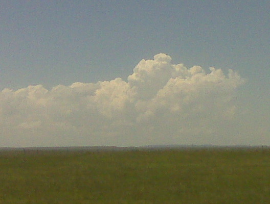
Updraft tower at 2pm mdt
Hanging out 30 miles north of Cheyenne
I found a nice high spot just off the interstate at interchange #39
about 30 miles north of Cheyenne. I think I’m in about as good an
area as one can be with east southeast winds , a moisture cu field to
my south through east-southeast…and developing updraft towers over
the mountains to my west through southwest. I have a great view to
the northwest at Laramie Peak, too, where there’s another cluster of
agitated cumulus over the 10,000 foot peak.
–
Mike Umscheid Photography
http://gallery.underthemeso.com
mesomike@gmail.com
58 dewpoint in Cheyenne at 1pm mdt. Nice!
With an east southeast wind. I’m goin there now.
(Sent by Mike’s Alltel Blackberry smartphone)
Heading to Chugwater, WY along I-25
Just finished lunch in Scottsbluff, NE. I will be heading to
Chugwater, WY to stage for the afternoon. Fairly warm 700mb temps
would suggest a late afternoon initiation off the mountains, and given
how close the good moisture is to the mountains, storms may rapidly
become severe along the I-25 corridor…hence the reason for heading
that far west to begin this chase. More later!
–
Mike Umscheid Photography
http://gallery.underthemeso.com
mesomike@gmail.com
June 22, 2009
Done chasing for the day
The last storm I intercepted died a rapid death but was photogenic complete with rainbow. Heading to Pierre SD for the nite.
(Sent by Mike’s Alltel Blackberry smartphone)