* *  C H A S E   M O D E  * *
** Near-real time radar with Mike Umscheid's position along with mobile blog and photo updates! More detailed information on UTM's Live CHASE MODE here!**
 status:      >> August 2022 -- North American Monsoon Lightning -- Southeast Arizona Region


(this page auto-refreshes every 90 seconds)
....map loading, please wait...


  --  No recent radar/chase position image.  -- 
Mike has not been in active CHASE MODE in the past 48 hours! 


== Most recent mobile blog & photo updates ==

June 21, 2009

staging in Kimball, NE

Filed under: chase mode updates — Mike U @ 4:46 pm

I drove all the way west to Greeley, CO where I had lunch at a mexican
restaurant, since Weld County, CO was my target. I am disappointed
that the lower/mid 50s dewpoints had mixed out into the lower to mid
40s in my target. This is frustrating and led me to believe I was too
far west as the showers coming off the mountains were extremely
un-appetizing. I then noticed a congested Cu field some 80-100 miles
to my east… across extreme northeast Colorado. Since this was
closer to the better moisture, I figured this was now the best target.
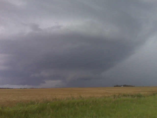
As I was driving east on I-80, I had been keeping a close eye on this
cu field both with my eye balls and on 1km visible satellite. Looking
in my rear view mirror, cumuls was getting taller in altitude and
glaciating at a higher altitude as well…suggesting perhaps better
future development. So I am hedging both plays by hanging in between
the Cheyenne developing convection and the Julesburg Cu field. The
Julesburg cu field is in negligible surface convergence/forcing while
the Cheyenne stuff had the advantage of much better elevated heating
and closer to the nose of the mid level jet. Hence why the storms had
already developed… the problem is the crappy moisture with
surface-based CAPE less than 1000 J/kg. I’m gonna sit here in
Kimball, NE and just let the atmosphere tell me where to go next based
on my visual observations in the cumulus development.


Mike Umscheid Photography

http://gallery.underthemeso.com

mesomike@gmail.com

June 20, 2009

Done chasing for the evening, heading to Goodland, KS

Filed under: chase mode updates — Mike U @ 8:12 pm

The storm is HP and outflow dominant northeast of Hutchinson.
Apparently there’s a rain-wrapped tornado reported, but I blew off the
storm in South Hutch because it just looked too messy for my
photography liking. I like the looks of the Cheyenne Ridge area
tomorrow at the nose of an incoming upper level jet, so I am going to
head to Goodland for the night, arriving there about 12am MDT or so.
More later!


Mike Umscheid Photography

http://gallery.underthemeso.com

mesomike@gmail.com

Supercell structure sw of pratt

Filed under: chase mode updates — Mike U @ 5:38 pm

(Sent by Mike’s Alltel Blackberry smartphone)

Storm with developing structure near pratt at 534pm

Filed under: chase mode updates — Mike U @ 5:35 pm

(Sent by Mike’s Alltel Blackberry smartphone)

Sitting in Greensburg

Filed under: chase mode updates — Mike U @ 3:47 pm

I am in Greensburg at 3:45pm awaiting storm development to my south
and southwest. CAPE is above 2200 J/kg just south of me for these
storms to work with. It is all unorganized development at this time,
however, it a supercell storm may emerge from this development in the
next hour or two as the activity moves northeastward into
southwest/south central KS. Depending where I end up today, will
probably stay at a motel in northern Kansas and begin my journey north
into the Dakotas to set up for what may be a couple days of supercells
to photograph Monday 22nd and Tuesday 23rd. Tuesday will be the last
chase of my vacation.


Mike Umscheid Photography

http://gallery.underthemeso.com

mesomike@gmail.com

« Newer PostsOlder Posts »

Powered by WordPress