
(Sent by Mike’s Alltel Blackberry smartphone)
|
....map loading, please wait...
....map loading, please wait...
|

|
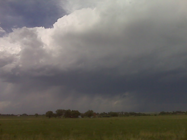
Amazing bell shaped supercell structure in Morton County Ks!! Unfortunately it cost me a windshield 6 W of 3
Richfield. Whew!!
(Sent by Mike’s Alltel Blackberry smartphone)
We are driving ahead of the supercell and repositioning to try to get south. Our best south option is the road south to black mesa state park. Kind of frustrating the road network and battling renewed development on the forward flank
(Sent by Mike’s Alltel Blackberry smartphone)
(Sent by Mike’s Alltel Blackberry smartphone)
We are traveling southwest toward Trinidad, CO toward storms
developing against the mountains north and northwest of Trinidad. The
road network will probably not be very kind to us today, so we are
hoping for a little bit of luck in that department. The instability
and shear is excellent today in this area for supercells (even
long-lived tornadic perhaps). Once we get to Trinidad we will
probably have a decent storm to chase. Internet connectivity may be
limited given the sparse population east of Trinidad, so be prepared
for long periods of no updates perhaps.
–
Mike Umscheid Photography
http://gallery.underthemeso.com
mesomike@gmail.com
Powered by WordPress