We are going to hang out in Silverton, TX and monitor the north-south
convergence axis extending from Canyon south to about 10 W Plainview.
This is the most interesting area to us at this time. We see the
exploding storms east of Abilene, but that is way out of our
reach/target area. More later.
–
Mike Umscheid Photography
http://gallery.underthemeso.com
mesomike@gmail.com
Watching some cu congestus developing to our south and southwest. This is a good sign for later on. We will be in silverton around or after 3pm.
(Sent by Mike’s Alltel Blackberry smartphone)
Our latest forecast thinking is that an area from AMA to LBB seems to
be the most likely region for quality surface-based storms after 4pm.
We are planning on a tentative target of Plainview, TX. It is clear
across much of W TX with only a few cirrus clouds evident. A weak
convergence line is setting up around the Plainview/Lubbock area which
is the area of most interest at this point. Very good deep layer
shear across this region with high CAPE as well as dewpoints in the
mid-upper 60s are poised just southeast of LBB. -Mike
–
Mike Umscheid Photography
http://gallery.underthemeso.com
mesomike@gmail.com
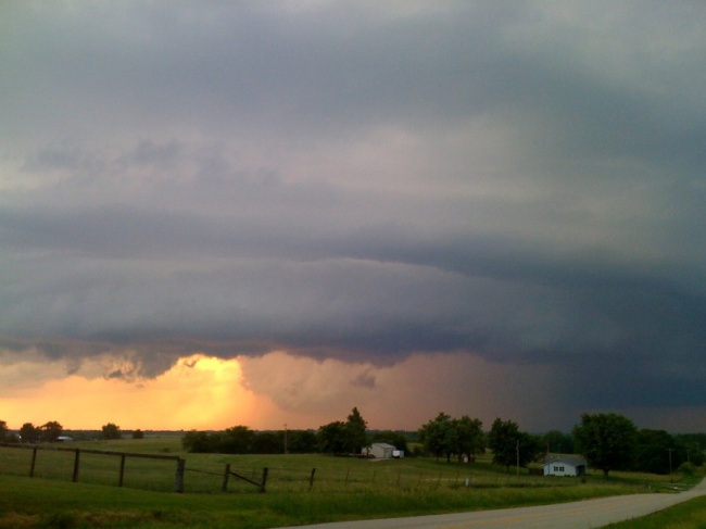
Wow, what a fun chase. By far the most photogenic supercell I’ve seen
in Missouri. As much as I dislike the state, I gotta say, it put on a
nice little show this evening! We concluded chasing around 9:00pm
east of Cameron, MO and are heading back to Salina to drop Robin
off… and I will continue my drive into the wee-hours of the morning
to Dodge since I start back up on day shifts tomorrow at 10:00am.
–
Mike Umscheid Photography
http://gallery.underthemeso.com
mesomike@gmail.com
Robin Lorenson
Robin Lorenson Photography
www.robinlorensonphoto.com
660.287.0950
