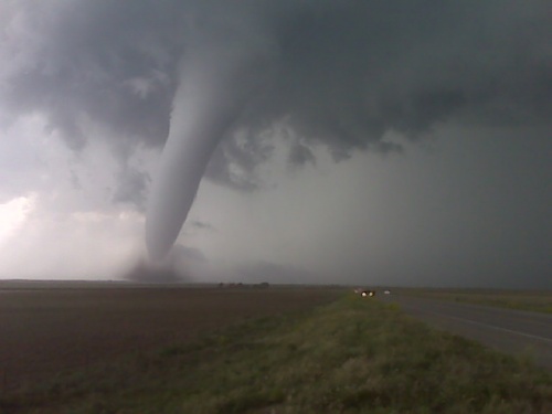
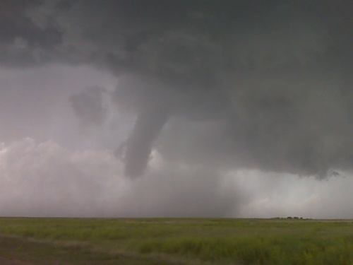
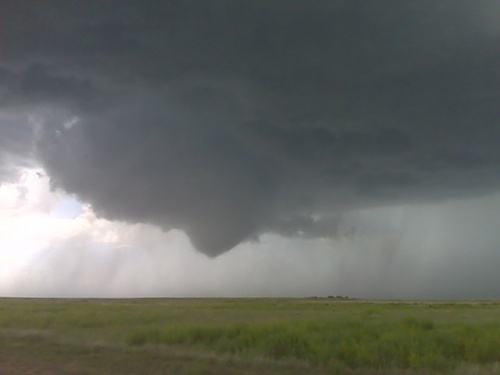
I don’t necessarily believe in a “perfect” storm chase, but after
doing this for 13 years now, I think this may be as close as I’ve come
to it. An absolutely beautiful, tall long-lived tornado developed
just west of Highway 287 and matured pretty much as it crossed the
highway maybe a mile to my north. I was operating both the ultra-wide
angle (D3) and my D200 for more zoomed-in images. It kicked up some
amazing dust, and actually engulfed some chase vehicles that decided
to get up close and personal with it. I got some pretty impressive
images of car headlights in a field of dust as the large, tall tornado
crossed Hwy 287 about 6-7 miles south of Campo. I know, because in a
number of my images, I got the mileage sign (Campo 7, Springfield 29)
with the tornado. More later.
** Near-real time radar with Mike Umscheid's position along with mobile blog and photo updates! More detailed information on UTM's Live CHASE MODE here!**
status: >> August 2022 -- North American Monsoon Lightning -- Southeast Arizona Region
(this page auto-refreshes every 90 seconds)
|
....map loading, please wait...
....map loading, please wait...
|

|
-- No recent radar/chase position image. --
Mike has not been in active CHASE MODE in the past 48 hours!
== Most recent mobile blog & photo updates ==