Regional radar image. Dotted red line represents the rain/snow line. This is a very impressive radar image. There is going to be a LOT of snow where I’m at!!:
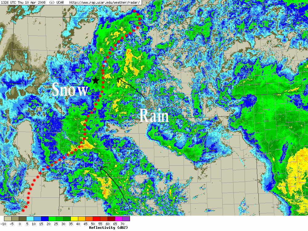
Regional radar image. Dotted red line represents the rain/snow line. This is a very impressive radar image. There is going to be a LOT of snow where I’m at!!:
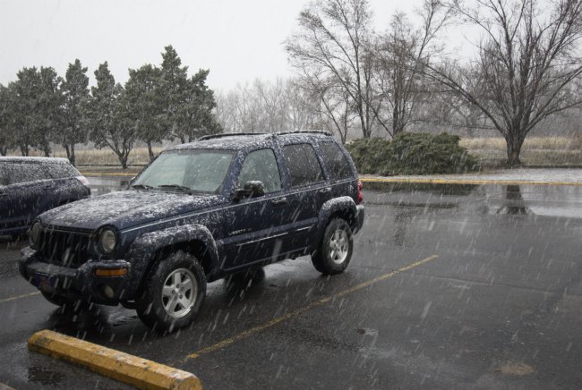
Rain has changed to snow in North Platte. I drove west about 20 miles on I-80 to see where the rain/snow line was at about 715am or so. It was 36F in North Platte when I left with light rain. By the time I reached mile marker 160, I was getting large snow flakes, but then it changed back to rain by about marker 158… this was likely due to precipitation intensity. As I was driving back, the temperature was holding steady about 34F and the rain was very chunky… about 75% melted snow as it was reaching the ground. As I got back to North Platte, it was almost entirely back to all snow as precipitation rate was fairly intense. So, as I type, I look out the motel window at heavy wet snow now finally. Now let’s commence the accumulation!
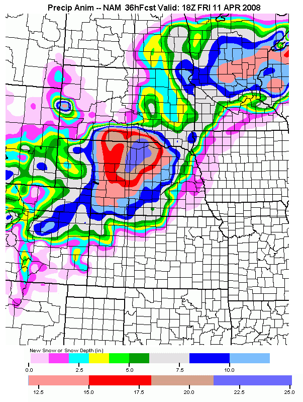
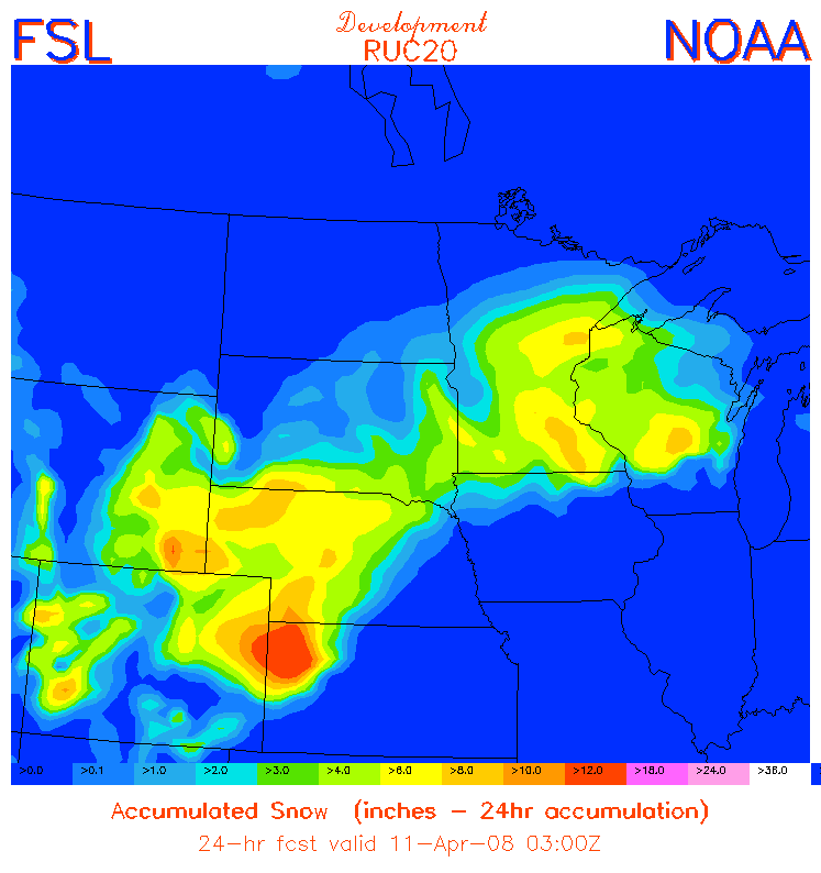
36 degrees in North Platte with "chunky" rain. The radar loop out of Goodland, KS is very impressive with significant precipitation echoes across all of northwest Kansas. The temperature continues to slowly drop here in North Platte. It is snowing and 32F in Ogallala about 50 miles west of here. I estimate the rain/snow line to be probably 20-30 miles west of North Platte as of 6am. Below are a couple more model forecast snowfall amounts for this storm, the first is the "Dev" RUC20 model and the second is from the NAM. Both are suggesting 10-12" here in North Platte. The NAM shows a significant 20" bullseye across north-central Nebraska:
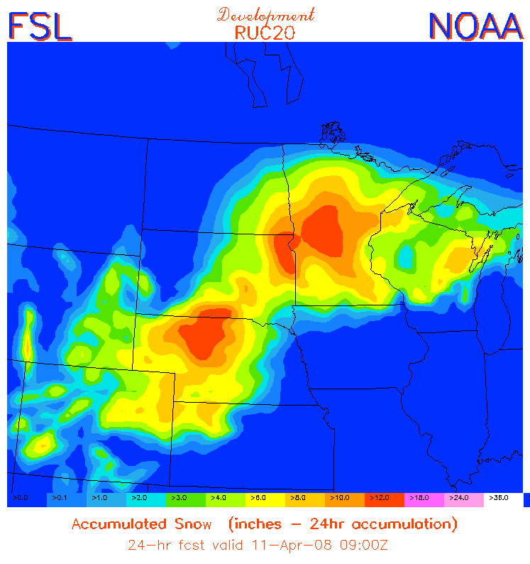
10-12" forecast ending 10pm Thursday night from the latest "Dev" RUC20 model! The RUC is also showing sustained winds in the 25-30kt range. Given the quantity of snow expected, am thinking that at least near-blizzard conditions will be likely tomorrow afternoon!
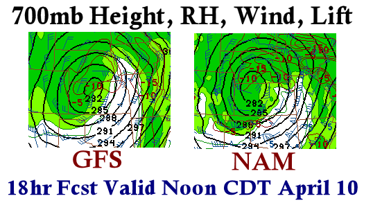
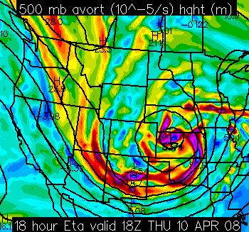
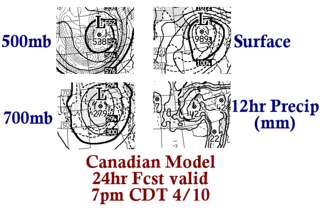
Below are a few images I put together of some of the model forecast meteorological fields:
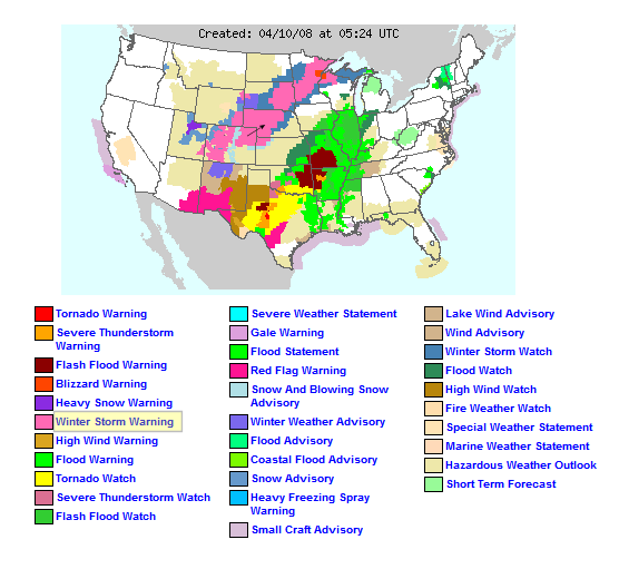
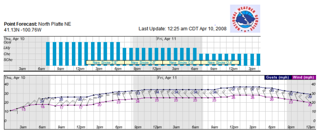
Below are a few images of official National Weather Service watches/warnings and a point forecast for North Platte (per the gridded forecast output for North Platte, the North Platte NWS office is calling for 6-7" in North Platte):
Arrival in North Platte. I’m staying at the Quality Inn along I-80, arriving about 9:30pm or so. It is currently 41°F here and is already snowing west of here in Sidney. The motivation for this trip was to experience one last good winter storm, and the timing fits perfectly with my days off work. I am not due back to work until Saturday morning. The peak of the storm is expected to be roughly Noon tomorrow (Thursday 10th) through Midnight or so. A classic upper low bombing out over western Kansas puts this portion of the High Plains in the cross-hairs for 10+ inches of heavy, wet snowfall. There’s some question about how much this snow will blow around (versus plastering against everything) given how wet it is expected to be, however, north winds will increase to 25-35mph tomorrow afternoon with frequent gusts above 40mph. This could be quite fun!
I chose to do this versus severe local storm chasing for the simple reason being I could not have made it down to the Abilene, TX area earlier today immediately following my last Midnight-8am shift. If I had a chase partner that could leave with me right when I got off work, I could have done it, so I could sleep on the way to the target, but it was not to be. Also, I had considered giving Thursday a shot for low-topped severe storms near the surface low, but am not overly excited about the prospects of seeing anything worthwhile — that being said, I think there could be an interesting low-topped supercell or two very near the deepening surface low tomorrow perhaps along the KS-NE border. I really liked the looks of the winter weather aspects of this system, so I thought "what the hell" and decided to head north to a location I thought might get plastered given the track of the 500mb and Surface lows. So I chose North Platte. I’ll post a couple weather maps in my next post.
I’ve made a very impromptu decision to drive to North Platte, NE to be a part of what looks like an amazing Spring snow storm across much of western Nebraska. I will arrive in North Platte about 9pm or so, and plan to be there through Friday. The storm will be at its height tomorrow (Thursday 10th). Given it’s spring time and temps not being too far below 32F, major highways should be cleared by late Friday, allowing me to get back to Dodge in time for "back to work" Saturday. This looks too good to pass up, and I love an opportunity to witness heavy snow and wind (and possibly thundersnow!). I’ll provide fairly frequent updates with snow amounts around North Platte, as I’ll be staying at one of the hotels along I-80.
Powered by WordPress