Robin Lorenson
Robin Lorenson Photography
www.robinlorensonphoto.com
660.287.0950
Robin Lorenson
Robin Lorenson Photography
www.robinlorensonphoto.com
660.287.0950
Robin Lorenson
Robin Lorenson Photography
www.robinlorensonphoto.com
660.287.0950
Robin Lorenson
Robin Lorenson Photography
www.robinlorensonphoto.com
660.287.0950
(Sent by Mike’s Alltel Blackberry smartphone)
We are sitting wnw of big springs, ne first following a left-mover storm. New updrafts are forming back to the sw again w pof julesburg. I like the upstream dewpoints at LBF and MCK. If these storms can survive the next hour or so we may be in business. More later.
(Sent by Mike’s Alltel Blackberry smartphone)
Robin Lorenson
Robin Lorenson Photography
www.robinlorensonphoto.com
660.287.0950

Robin Lorenson
Robin Lorenson Photography
www.robinlorensonphoto.com
660.287.0950
Heading west towards towers by Kimball, Nebraska.
Robin Lorenson
Robin Lorenson Photography
www.robinlorensonphoto.com
660.287.0950
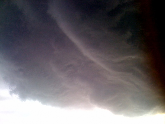
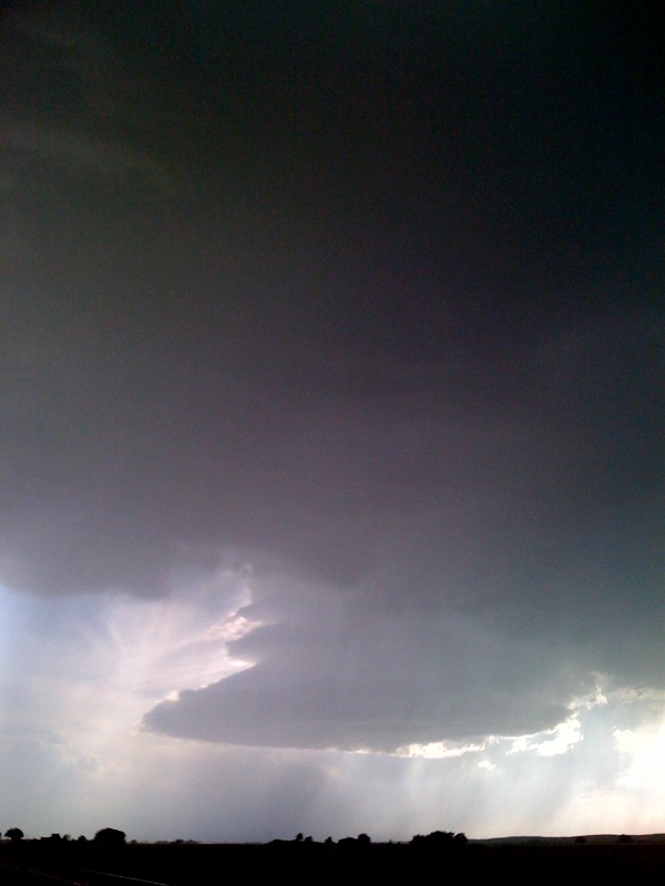
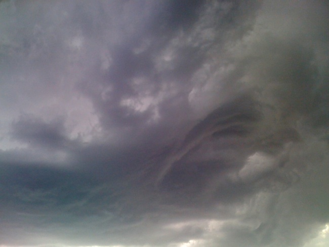
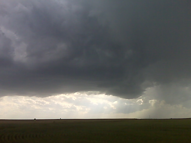
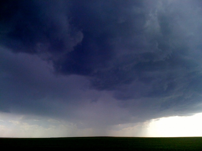
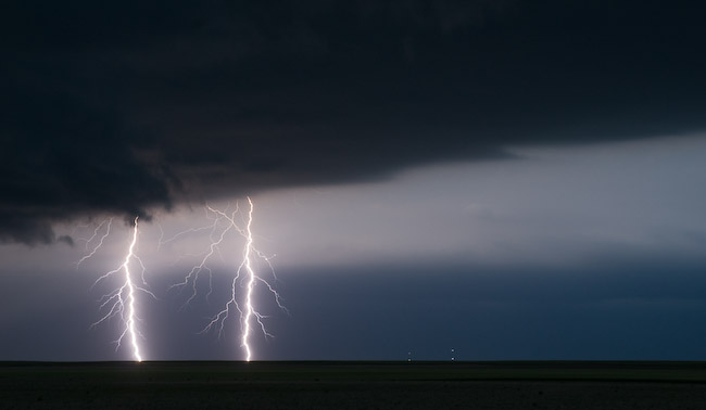
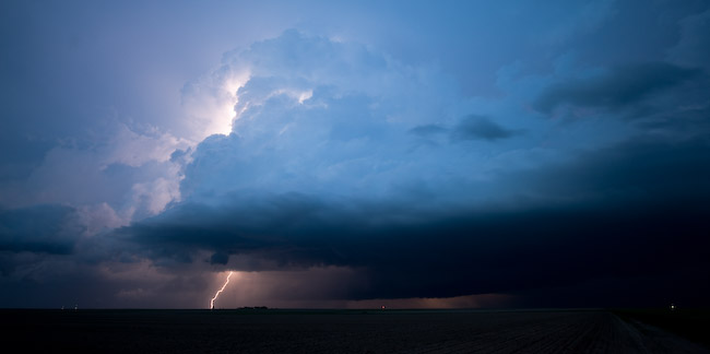
This is very brief with a more detailed account to be written later on next week. My chase partner Robin Lorenson and I left Salina, KS about 8:45am for a target somewhere around Sidney, NE to Sterling, CO. We missed the La Grange, Wyoming 25-minute tornado event by about 30 minutes. We were simply late. Other storm chasers had the same fate as I’m finding out (including Bill Hark, who we chewed the fat with for probably too long in retrospect in Sterling!! ![]() It was great to catch up with you again though, Bill!). However many others were not late, who were already up along I-80 in the early afternoon — including Vortex-2. Some fine High Plains storm photography, though, ensued as we followed the supercell as it evolved over the next several hours from south of Harrisburg to north of Dalton to southwest of Oshkosh by late-evening twilight. Below are a few images from this chase:
It was great to catch up with you again though, Bill!). However many others were not late, who were already up along I-80 in the early afternoon — including Vortex-2. Some fine High Plains storm photography, though, ensued as we followed the supercell as it evolved over the next several hours from south of Harrisburg to north of Dalton to southwest of Oshkosh by late-evening twilight. Below are a few images from this chase:
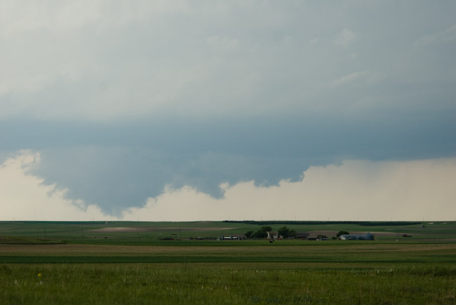
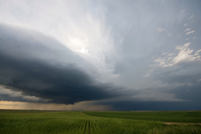
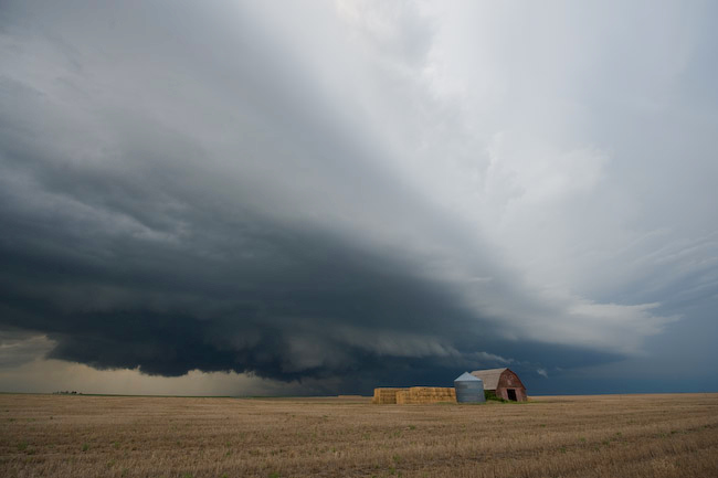
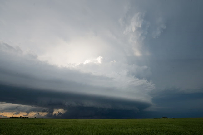
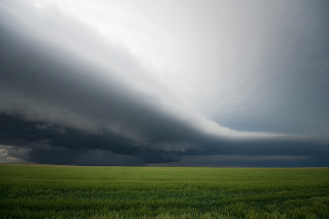
Robin and I managed to photograph a very beautiful supercell across
the southern Nebraska panhandle. Even though we missed the tornado
this storm produced earlier in the afternoon, this was a very fun and
rewarding chase. We managed to get fairly close to a very wild
rotating cloud mass northwest of Dalton shortly after there was a
storm merger. I thought for sure tornadogenesis was imminent on a
couple occasions, especially with the cloud bases so low. In fact,
there was a broad dusty circulation we noted which very well could
have been a brief, broad/weak tornado. We are going to be staying in
Ogallala, NE tonight. Tomorrow’s target is still uncertain with a
number of different options possible. -Mike U with Robin L.
–
Mike Umscheid Photography
http://gallery.underthemeso.com
mesomike@gmail.com
Powered by WordPress