…Missing the entire Ravenna to Aurora, Nebraska high-visibility tornadofest because of numerous consecutive poor decisions…
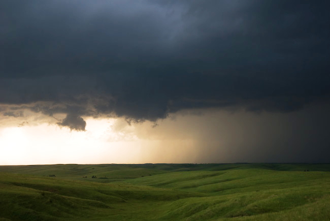
It all started with a poor target choice. I felt very confident we would see significant supercells this day… and more than one across the I-80 corridor. So for this reason, we decided on a western target: McCook to North Platte (instead of farther east toward Kearney). We were anticipating convective initiation around Julesburg or Ogallala. By late afternoon, there was a heavy congested cumulus field from north of McCook to Ogallala to North Platte…east toward Kearney. McCook had a late afternoon dewpoint of 72 degrees with 5500 J/kg of Surface-based CAPE nosing into southwest Nebraska. After staging in McCook for awhile, we drifted north to follow the agitated cu field in vicinity. We were most interested northwest of us where towers were starting to form in the distance. As we drew closer to North Platte, the cu field was holding status-quo, but we noticed a small plume of cirrus clouds oversrpeading our target. This wasn’t a good sign, we thought. The other problem with our area was lack of surface convergence. Winds were generally out of the southeast anywhere…with the best convergence east of us toward Kearney.
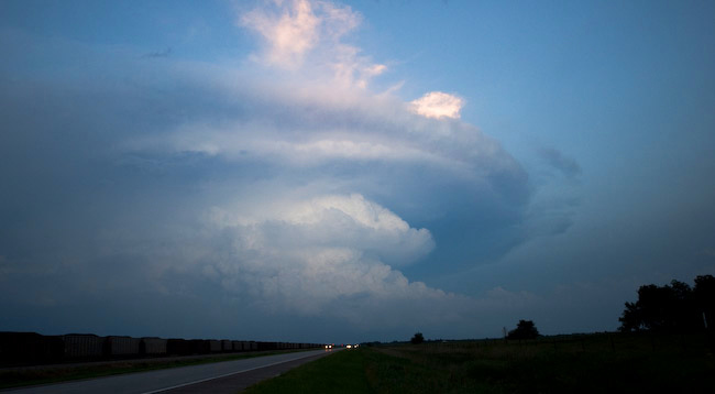
We realized, ultimately, that we needed to get closer to the stronger convergence, so we drove southeast toward Lexington. On the drive, towers were shooting up to our immediate south, which we eventually drove under and got on the other side as we approached Lexington. As we are driving, the fateful “storm of the day” was quickly organizing to our northeast. We could see the backside of the convection quite nicely, actually. In the meantime, as we drew closer to the Elm Creek exit, there was exploding, razor sharp convection going straight up in a wall up to 45,000 feet to our northwest. We were in best position for this newer convection than we were the already developed Ravenna (northeast of Kearney) storm. That being said, when we got to the Elm Creek interchange on I-80, my gut told me to go north. A lot of this gut is based on the fact that I hate chasing a storm that 10-thousand other chasers are already on if I really felt that other quality supercells would develop as well. I somehow convinced my chase partners Jay Antle and Evan Bookbinder to turn north. Much of the tactical decision making came to me, ultimately, since we were chasing in my vehicle and both Evan and I were glued to the data and the sky while Jay was driving. I was thinking “tail end Charlie” the most western storm would be the best, but little did I realize at the time that the orientation in which the western storm developed with respect to the lead storm (the Kearney-Ravenna storm) was NOT favorable for the western storm to thrive given its close proximity. This storm actually developed a bit NORTH of due west of the Kearney storm… and given the storm motion, it would eventually choke on the lead storm’s rain-cooled airmass. These were the things I was not thinking about at the time. I just assumed the storm would be ingesting quality air at all times.
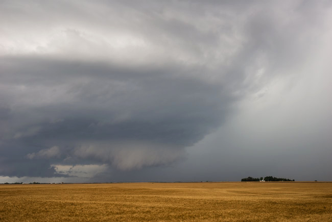
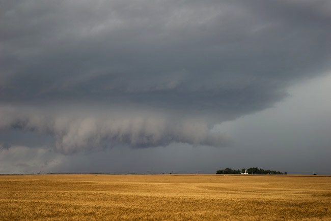
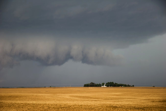
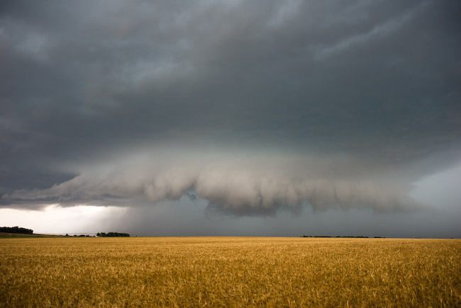
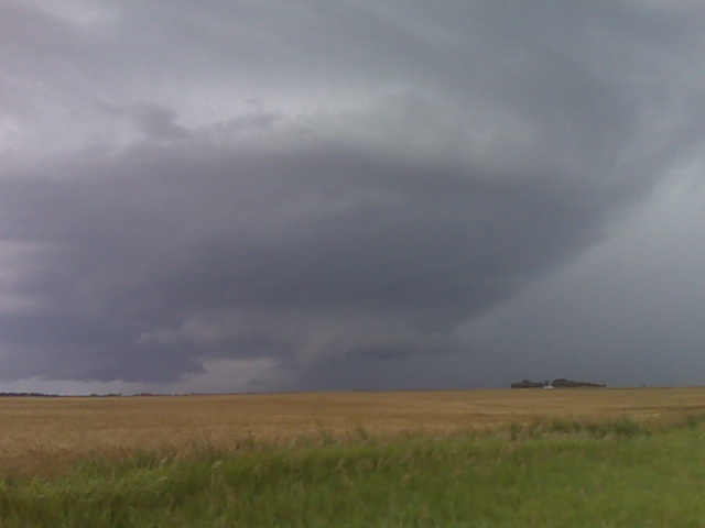
We drove all the way northwest to Eddyville and watched a fairly nice base, actually, develop to our northwest with a small wall cloud with some slight rotation. Rotation was never vigorous, though, but the idea of photographing a beautiful supercell and possible tornado that no one else was chasing… was the only thing I could think about at the time. I am all about capturing images very few others do… it is one of my primary motivations in chasing and photographing storms, as many of you all know by now. We actually blew the storm off when we got back to highway 183/40 intersection, but after we drove a couple miles southeast on Hwy 40, the damn storm to the north developed a nice, really low ragged wall cloud in the distance with a distinct clear slot. We decided to follow it again, despite the fact that we new the temperatures were in the mid 70s. The visual observations to the north got the best of us, and this was fateful decision #2. Had we continued southeast and not turned off Hwy 40, we may have probably caught up with the lead storm in time to see the last “Aurora” tornado. But it wasn’t to be. We followed more farm roads north and east toward Ravenna. Of course, as fate would have it, as we drove north and east, the storm cycled down annd didn’t look as great with more of that “cool inflow air” look to it. At Ravenna, we went east-southeast on Hwy 2 to Grand Island, and along the way we realized what we had done and missed. I was really pissed off at myself. It was the worst feeling on a chase I think I have ever had — missing an entire cyclic tornadic supercell with high-quality photogenic tornadoes by a matter of 30 to 40 miles the ENTIRE TIME. We were suckered into the western storm and we (well mainly I) was too stubborn to leave a storm that we had to ourselves and hoping against hope that luck would be on our side. As it turned out, it was some of the dumbest in-situ decision making I’ve ever made chasing. It wouldn’t have been so bad if I was chasing solo, but I had two other chasers with me that were riding what was primarily my decision making during this chase… and they don’t chase nearly as much as I do… so there was a little more pressure to get on the best storm than I normally would have. It was a bad chase day, and the Elm Creek interchange on I-80 will forever haunt me the rest of my storm chasing days.