Nothing new to report as we hung around Lodgepole for awhile to see if a storm would emerge from the showers. It didn’t happen so we are blowing off the chase. We will drive to Ogalalla after dinner for the night
(Sent by Mike’s Alltel Blackberry smartphone)
disclaimer: "The meteorological
views/forecast
thinking expressed are those solely of the author of this blog
and do not necessarily represent those of official National Weather Service forecast products,
therefore read and enjoy at your own risk and edification!"
and do not necessarily represent those of official National Weather Service forecast products,
therefore read and enjoy at your own risk and edification!"
June 16, 2009
Storms aren’t organizing. Heading to Sidney for dinner
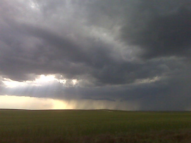
Storm trying to organize near Lodgepole NE
(Sent by Mike’s Alltel Blackberry smartphone)
Evening update 6/16
Monitoring some showers with little vertical development to our west. We are hoping they will gain more verticality, but so far not much to report from near Lodgepole NE
(Sent by Mike’s Alltel Blackberry smartphone)
heading toward the Cheyenne Ridge
Afternoon update. We just left Wray, CO as I type and we are noticing
a congested Cu field developing along the WY-CO border and adjacent
far southwest NE Panhandle along the Cheyenne Ridge. Unfortunately,
the moisture situation is rather paltry, with just 48to 50 degree
dewpoints from Sidney to Akron. Initial storms have already formed
just east of Cheyenne which are moving east. More devleopment may
occur farther east along the Cheyenne Ridge. We are heading north now
toward Julesburg. It will be a very nice treat if the atmosphere can
produce a high-based supercell today given the CAPE concerns.
–
Mike Umscheid Photography
http://gallery.underthemeso.com
mesomike@gmail.com
June 16th — Back to Colorado
After successfully using a Frisbee to enhance low =
level
helicity in SW KS yesterday, we figured we’d try our luck out in =
Colorado
– somewhere. In response to yesterday’s supercells and =
long-tracked
MCS, moisture has been shunted into SE Kansas and Oklahoma. Has anyone =
ever
seen a photogenic storm with 4000 J/kg of CAPE and low 70F dewpoints? =
No. So we’re
going to pray for a couple nice isolated supercells within the residual =
moisture
over NE Colorado, cooler temps aloft, and a nice jet streak coming out =
of the
southwest upper trough. At the very least, we’re in position for =
tomorrow’s
Nebraska show. As we say in the business, stay tuned for later updates =
and
possible warnings. — Evan
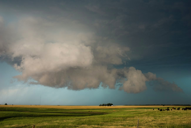
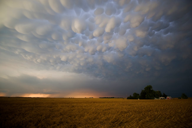
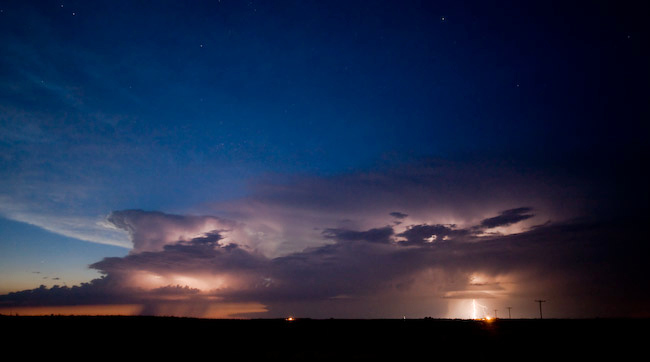
Day 5 (June 15): Southwest KS HP-Supercell, etc.
HP-Supercell Structure Spearville to Kinsley, KS — Beautiful Mammatus at sunset Pratt, KS — Astronomical twilight storms near Haviland, KS
Not much time for a detailed report given time constraints (we have to hit the road again). It was another fine day of storm photography on the 15th. We followed the HP-supercell that first initiated northwest of Dodge City. It became a beast of an HP supercell as it tracked from Spearville to Offerle to Kinsley as we followed it along Hwy 50. At Kinsley, we headed south and continued to photograph the structure from southeast of Kinsley to Trousdale to Hopewell to Pratt. We broke off the storm at Pratt then headed south toward Medicine Lodge taking a scenic way home. After a pit stop in Medicine Lodge, we noticed a new storm developed north of Greensburg. We retrated our steps back to Pratt on Hwy 281. When we reached Pratt, a beautiful sky full of vivid mammatus greeted us. We sat at a farm road just west of Hwy 281 a couple miles northwest of Pratt to photograph this atmospheric spectacle. Just phenomenal! After sunset, we drove back west toward Dodge City when another cluster of small storms formed with intracloud lightning. The lightning illuminated structure was quite nice. I took advantage of the low light capability of my Nikon setup (D3 + 14-24mm f/2.8 lens). Results were very good. Here are three images from this day:
June 15, 2009
Photographing lightning
Shooting lightning illuminated structure near haviland ks a little after 10 pm
(Sent by Mike’s Alltel Blackberry smartphone)
AMAZING mammatus at sunset in Pratt, KS!
Some of the best mammatus I’ve ever photographed with golden wheat in
the foreground. Awesome storm photography day despite missing a
tornado, which if we were daring to be on Hwy 50 east of Kinsley, we
would have had more damage to the windshield from 2″ diameter hail.
–
Mike Umscheid Photography
http://gallery.underthemeso.com
mesomike@gmail.com
new storms developing along Hwy 50 to our NW
well we went back north as new storms of interest developed NW of us
north of Greensburg. After drivinig to medicine lodge, we are back
north in Pratt continuing north for a sunset intercept across Stafford
County. Pretty mammatus above Pratt at this time.
–
Mike Umscheid Photography
http://gallery.underthemeso.com
mesomike@gmail.com
heading back to Dodge, storms messy and undercut
We will be driving to Medicine Lodge then west and north back to Dodge
City for the night. We photographed some fairly amazing storm
structure when the storm looked really good along Hwy 50 from west of
Spearville to Offerle to Kinsley, KS. Tomorrow (Day 6) doesn’t look
quite as good, however we will consider chasing storms off either the
Raton Mesa or the Palmer Divide.
–
Mike Umscheid Photography
http://gallery.underthemeso.com
mesomike@gmail.com