(Sent by Mike’s Alltel Blackberry smartphone)
(Sent by Mike’s Alltel Blackberry smartphone)
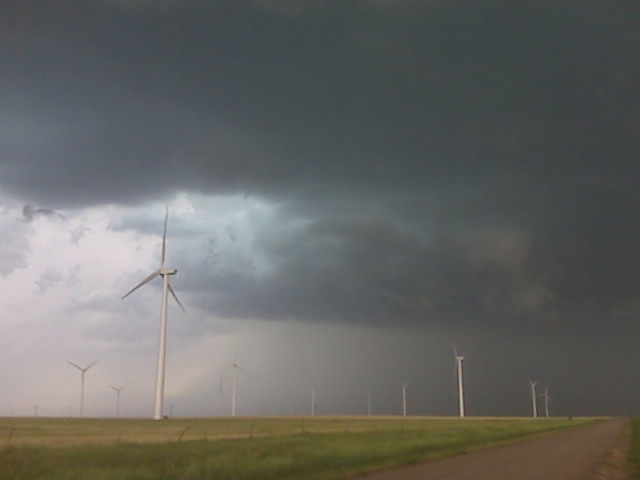
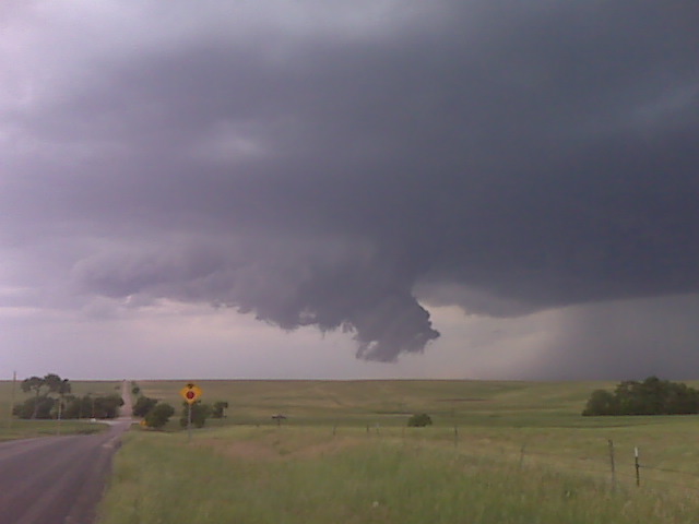
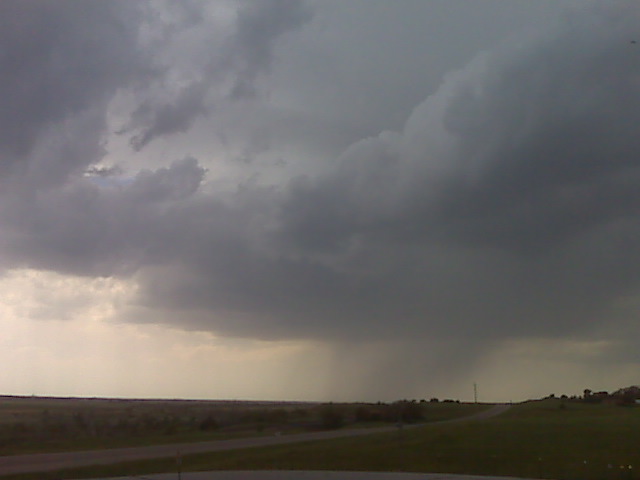
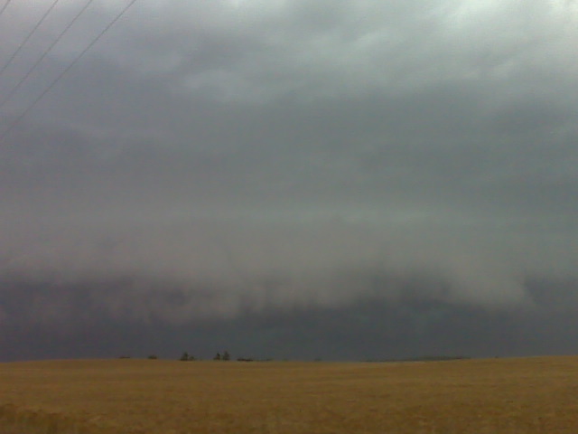
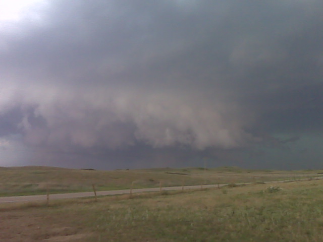
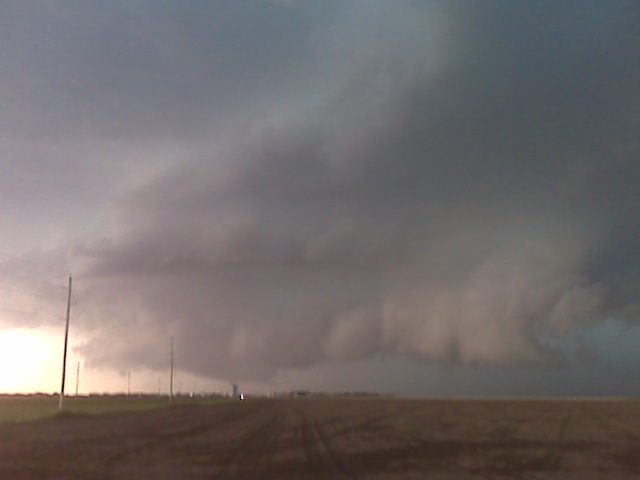
early evening update… some amazing colors and structure with the HP
supercell we are chasing. Unfortunately, we were in blast-east most
when the tornado was occurring to our northwest, and we were not due
east of it and closer to see it. We did see a laminar cone=-shaped
lowering/wall cloud back in the wet occlusion, but we were unable to
confirm anything. It will be interesting to see other chasers’
images/video of this since we were not positioned well to see the
tornado. We are repositioning south toward Pratt area to catch new
development on the south flank.
–
Mike Umscheid Photography
http://gallery.underthemeso.com
mesomike@gmail.com
(Sent by Mike’s Alltel Blackberry smartphone)
(Sent by Mike’s Alltel Blackberry smartphone)
Had another nice stay in Lamar last night. Mike, =
Jay, and I got
to eat at our favorite Thai place again — the Spicy Basil. Just cross =
back
into Central Time as we’re headed to Garden City for lunch and to
evaluate the volatile scenario shaping up for later this afternoon. =
Purchased a
Frisbee this morning as I think for once we’ll have some time to =
bake.
Definitely a large threat area, and we all have a feeling that the best =
target
may not be as obvious as it appears at this hour. Should hopefully be a =
long
chase evening! If all goes well, we should have live streaming up at =
www.stormchaselive.com
, although this will come secondary to our own safety and photographic
endeavors. Will be avoiding the hail as our windshield likely =
can’t
sustain much more. Have fun all!
- Evan
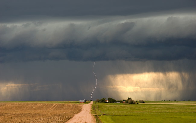
Evan, Jay, and I saw the end of the Karval, CO supercell(s) as we were sorely out of position earlier in the afternoon up along I-70 near Siebert. We busted south and west to get to tail-end charlie, but by the time we got there, the best of the show was likely over. We did catch some of the striated barrel updraft of the eastern supercell as we were driving east toward Karval. Ugh I wish we were closer. Best images of the day for me were daytime CG lightning from the high-based linear storms north of Limon overlooking a farmstead on a dirt road north and east of Limon. Obviously, am disappointed in Leaving DDC at damn near Noon missing the supercell and tornado in Haskell county. I over-analyzed this one. D’oh!
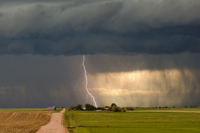
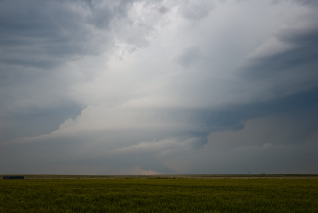
Well, the Karval, Colorado storms were rather picturesque with some
banded, barrel-shaped structure (the eastern storm), including a nice
wall cloud. However this did not last very long. The storms died a
rather painful death about 20 minutes after we finally had a good view
at a farm road intersection. Nevertheless, got some okay images. The
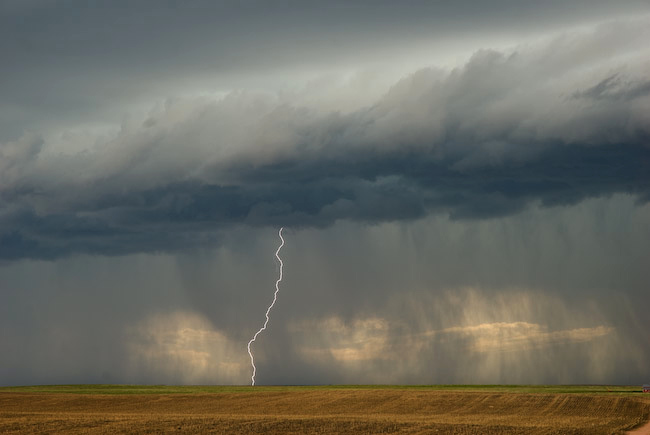
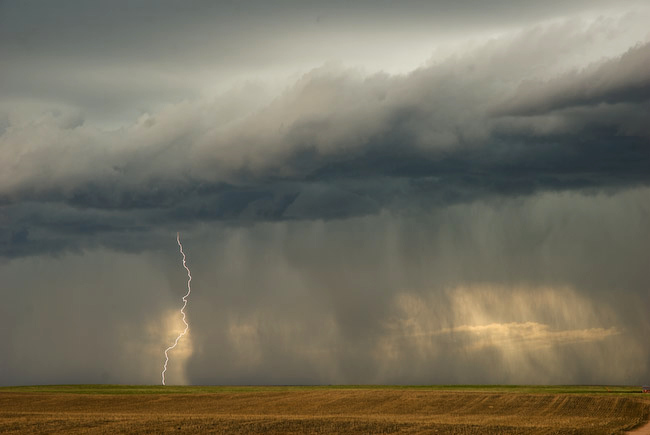
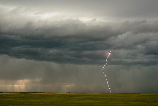
best images of the day, by far, were daytime lightning images from the
high-based storms north of Limon earlier in the afternoon. We are
headed to Lamar, CO for the night.
–
Mike Umscheid Photography
http://gallery.underthemeso.com
mesomike@gmail.com
Powered by WordPress