Nw of cheyenne wells co
(Sent by Mike’s Alltel Blackberry smartphone)
disclaimer: "The meteorological
views/forecast
thinking expressed are those solely of the author of this blog
and do not necessarily represent those of official National Weather Service forecast products,
therefore read and enjoy at your own risk and edification!"
and do not necessarily represent those of official National Weather Service forecast products,
therefore read and enjoy at your own risk and edification!"
July 12, 2009
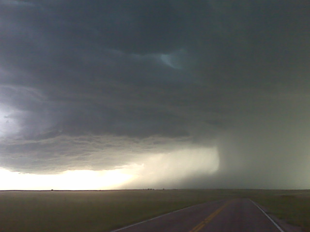
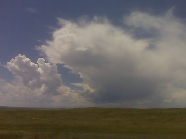
High based svr storm shelf cloud
An eastern colorado outflow-dominant beastie!
Wow… sorry for the lack of updates but that’s because a) poor
internet connection in the last couple hrs and b) being CHASED most of
the time by this beast of a severe storm. Just trying not to get
munched is a chore, and I’ve been on mostly dirt roads… back to
driving more later!
–
Mike Umscheid Photography
http://gallery.underthemeso.com
mesomike@gmail.com
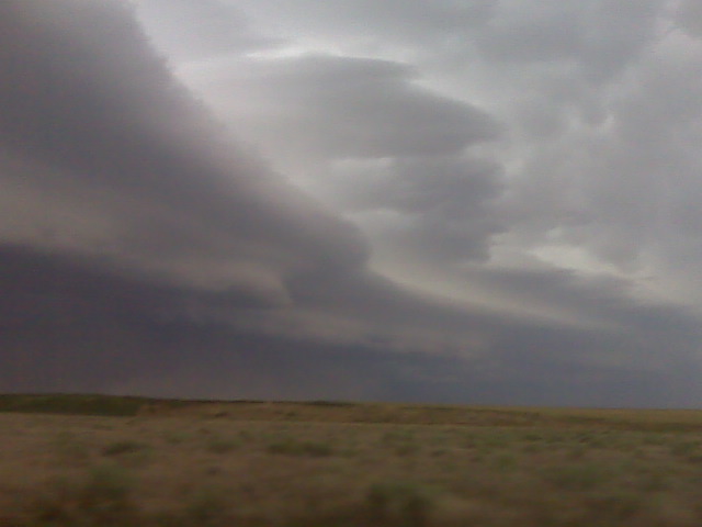
Svr storms w of kit carson
Whew!! This has been one active chase. Great structure outflow dominant beastie!
(Sent by Mike’s Alltel Blackberry smartphone)
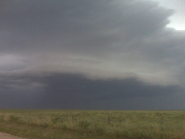
High based storm updraft
Looking west along the palmer divide near Calhan
(Sent by Mike’s Alltel Blackberry smartphone)
along the palmer divide watching towering cumulus grow into small
at 1:45pm mountain time, am sitting along a farm road just north of
Simla watching towering cu to my southeast to south to southwest….
and the one to the west-southwest is already a small storm on radar.
There are more organized storms on radar west of the palmer divide in
the front range… which are moving in my general direction.
–
Mike Umscheid Photography
http://gallery.underthemeso.com
mesomike@gmail.com
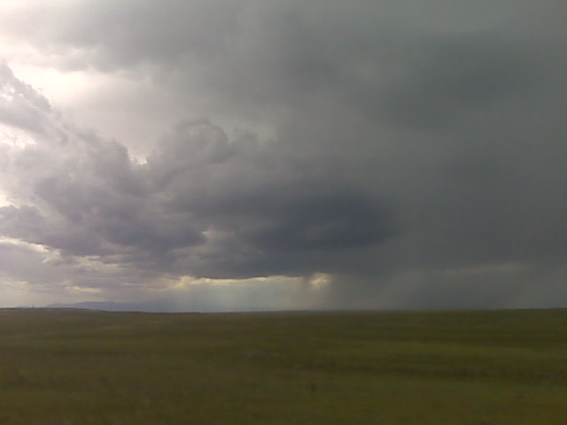
Incipient storm development
Looking west from near simla, colo along the palmer divide
(Sent by Mike’s Alltel Blackberry smartphone)
July 12th chase forecast
Since I have to drive back to Dodge City after the chase today, I am a
little more restricted to where I can chase — thus am choosing to
play storms in eastern Colorado (perhaps off the Palmer Divide). The
shear is weaker down here, but there should be enough, given the
moisture/CAPE, for some organized chaseable photogenic storms. I will
probably arrive in Dodge City rather late, perhaps 2 or 3 am CDT… or
earlier if storms don’t materialize as expected.
–
Mike Umscheid Photography
http://gallery.underthemeso.com
mesomike@gmail.com
Chase Acct: July 11, 2009 (Southeast WY)
After waiting patiently all afternoon along highway 26 in Goshen County, WY, I intercepted 3 severe storms that were briefly marginal supercellular in structure that first initiated off the mountains west of I-25 early in the evening. The first storm was west of I-25 to the northwest of Chugwater, WY. I managed to get a couple good cloud-to-ground images with the storm’s updraft using the lightning trigger. I sat at a parking area along the interstate for a good half hour or so watching this storm approach. This storm weakened and another more formidable severe storm/marginal supercell formed to the southeast of this one near Chugwater. I took the desolate highway 313 east, which ended up being a perfect road for this storm intercept as it was basically following me down the road. A classic, high-contrast rain-foot developed at the southern edge of the precipitation core near the updraft/downdraft interface. The sounds and smells to go along with the sights of this storm. This was the reason I took this trip!! This storm also waned, but yet a third storm with some supercell structure formed southeast of this one… to the west and northwest of LaGrange (this is the area where Vortex-2 intercepted the long-lived tornado back on June 5th). At sunset, the blues, oranges, and violets were vivid. Fantastic color. I continued to photograph this storm after dark as it rolled east into Nebraska to the northwest of Harrisburg. Below is a sample of images from this chase:
This SimpleViewer gallery requires Macromedia Flash. Please open this post in your browser or get Macromedia Flash here.
This is a WPSimpleViewerGallery
This is a WPSimpleViewerGallery
July 11, 2009
Headng to sidney for the nite
It was a very enjoyable evening of storm photograpy on tyhe high plains !
(Sent by Mike’s Alltel Blackberry smartphone)