I am driving west highway 160 in Ulysses Kansas. I’ll stop for a brief lunch, there are towering [chisels?] already developing in south Eastern Colorado, west up Spring Field, already at 12:30PM central daylight time. It could be a long chase day if the storm start developing early afternoon. I will follow storm ceased likely into far south west Kansas or Oklahoma Panhandle, __ later.
[ Transcribed by MyCaption ]
West to east flow aloft and southerly flow in the low levels… directional shear is very good for storm organization/supercells as far south as southeast Colorado… with mode more than likely on HP side of things. Mid level flow is better farther north into northeastern Colorado and adjacent southwest Nebraska/northwest Kansas. I think there is going to be adequate moisture across all of eastern Colorado into far southwest Nebraska for decent storms. Given the not-so-hot 700mb temps, 8-10C and adequate insolation farther north, I think storms will form… with perhaps the Palmer Divide initiating stuff. Other storms may also form in a weak convergent area farther northeast from Wray/Yuma to Imperial, NE. I think there will be a larger area of possible severe storms than what the SPC guidance suggests. That being said, I will target farther south closer to home where better low level convergence and moisture signal is in the model fields… initiation of storms far eastern Las Animas County or western Baca County. I think I’ll head to Lamar and re-evaluate from there… as I don’t want to totally rule out chasing a Palmer Divide initiated storm… which would probably roll east along I-70 corridor during the 23z to 02z time frame. I’m about 75%/25% in favor of farther south (Baca County) target vs. Palmer Divide (Limon, Genoa, Arriba, etc. along I-70) at this point
Today’s Chase is over. The Chase day was very uneven form the cold front overwhelmed all the could back should and storm structure was marginal at best up there in the Mullen area and the best store of the day was actually farther north near the South Dakota state border, I wish I was up there but, nevertheless stores down here just did not get their acts together and calling in a Chase or later.
[ Transcribed by MyCaption ]
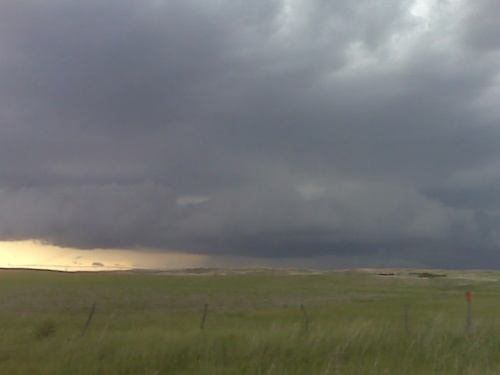
South of Mullen nebraska storms developing along cold front
I left Dodge City early this morning and am typing currently (12:15pm)
from North Platte. The target is fairly straight forward… play the
edge of the cap where lower 60s dewpoints exist just ahead of the
front. This is the Nebraska Sandhills northwest and north of North
Platte. It’s no-road network territory, but good visibility and great
terrain/landscape means that as a photographer, it’s not required to
be up close and personal to the storm(s). Storm motions should be
very manageable to the northeast around 20-25 mph. I will stay in
North Platte after this evening’s chase… then back to Dodge City
tomorrow. I will be driving Jon Smith and Rob Mitchell back with me
to Dodge so Jon can get his car that he dropped off at my house…
while Mitch and his wife Candice head back to Houston (they were
chasing in Mitch’s car this past week). More later as time permits.
a change in plans from preivous post, will have dinner here in Colby
with some of the vortex-2 contingent then back to Dodge probably by
1:00am or so. More tornadoes north of Goodland, but I’m tired of
driving and it’s not the best structure from the south, so I’m done
shooting.
a change in plans from preivous post, will have dinner here in Colby
with some of the vortex-2 contingent then back to Dodge probably by
1:00am or so. More tornadoes north of Goodland, but I’m tired of
driving and it’s not the best structure from the south, so I’m done
shooting.
Time, 8:38 central. I am just west of COLBY, Kansas. Photographed some lightning. It was some decent success but I will be heading home to Dodge City now. I did not observe the recorded tornadoes. Shortly after after 8:00, I was too far east. More later.
[ Transcribed by MyCaption ]
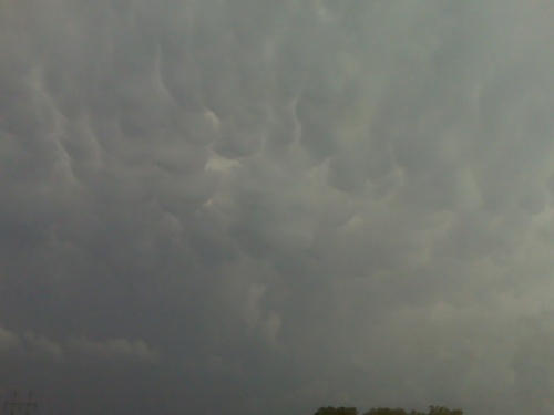
From the Gove county storm at 653pm cdt


