High Plains Drifter


disclaimer:  "The meteorological views/forecast thinking expressed are those solely of the author of this blog
and do not necessarily represent those of official National Weather Service forecast products,
therefore read and enjoy at your own risk and edification!"

June 13, 2009

Day 2 (June 12): Eastern Colorado “Palmer Divide” Supercell

Filed under: Chase Accounts,Chase Trip 2009,Latest Chases,Storm Chasing — Mike U @ 8:27 am

June 12th yielded far better results than the previous day.  Evan, Jay, and I started the day off with a hearty breakfast at the Big Texan steak ranch in Amarillo.  We were initially torn between two targets:  1) Western Oklahoma along a decent looking outflow boundary where CAPE would be much higher or 2) upslope across eastern Colorado.  Each had their pros and cons, but in the end we chose the eastern Colorado target, which was a wise choice.  Given the dearth of upper level forcing, it seemed the only reliable way to force convection would be due to elevated heating.  Primary elevated heating sources for High Plains severe storms initiation are 1) Raton Mesa along the CO-NM border 2) Palmer Divide that extends east from Palmer Lake/Monument, CO north of Colorado springs, and 3) Cheyenne Ridge which extends east along the WY-CO border from Cheyenne.  The anticipated late afternoon wind field and moisture situation at the surface suggested to us that the best of these 3 would be the Palmer Divide.  It was encouraging to see the 12z NAM and GFS both force convection in this area.  Our target from Amarillo, TX was Kit Carson, CO.

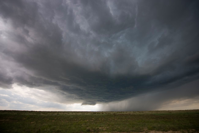
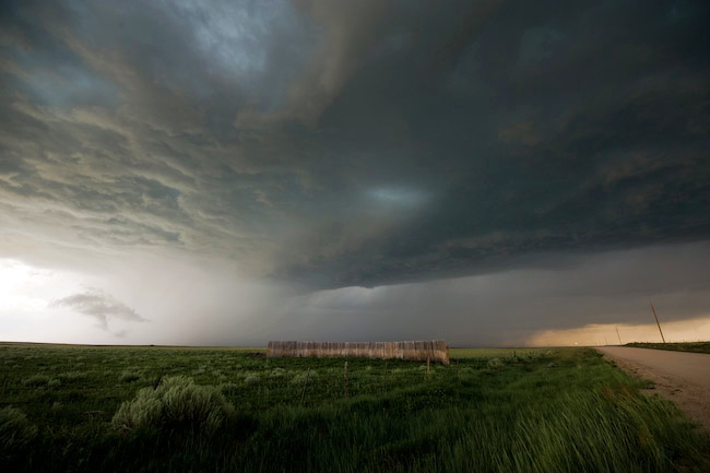
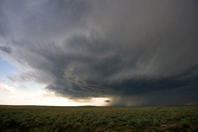
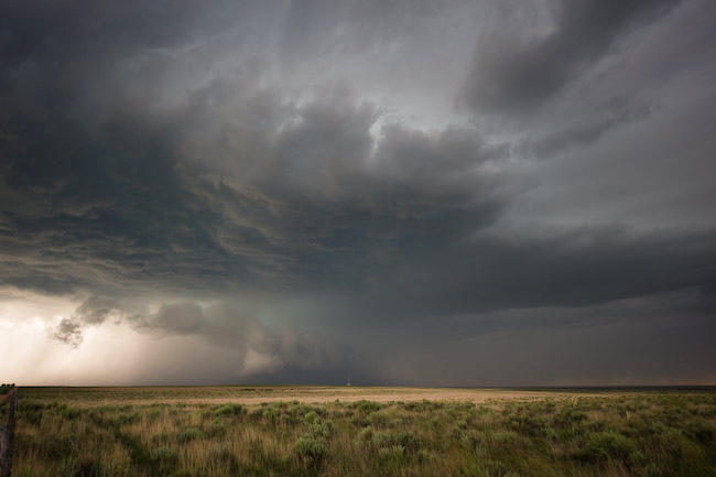
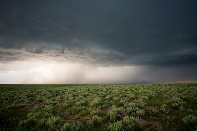
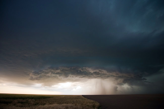
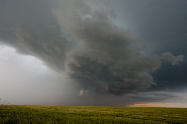
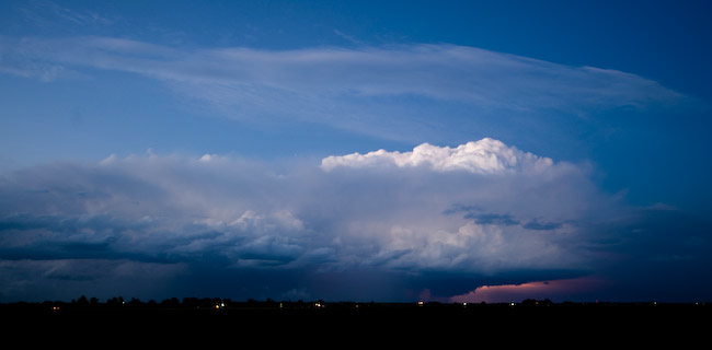
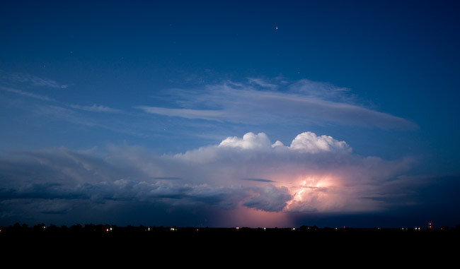
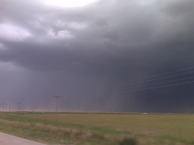
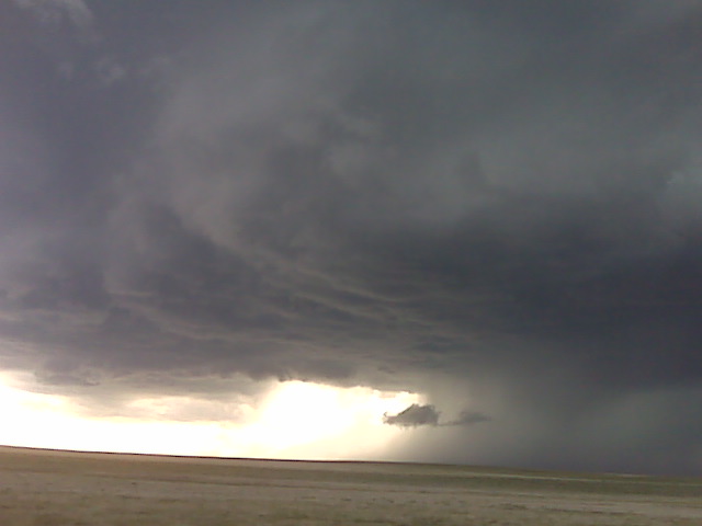
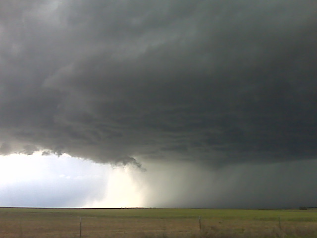
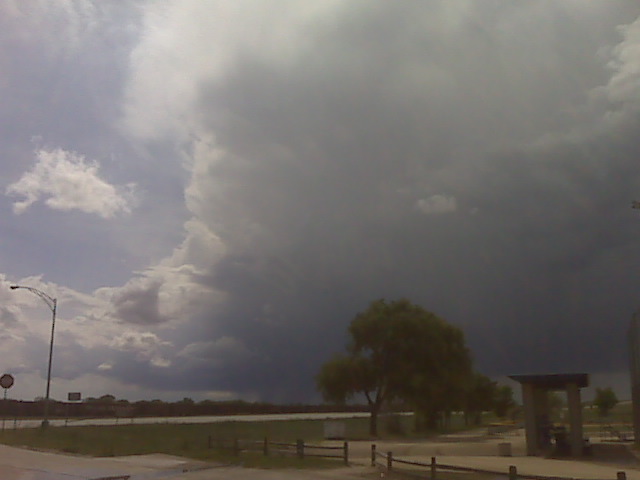
It didn’t take long for storms to initate along the Hwy 24 corridor southwest of Limon, which is the classic initation point for Palmer Divide storms.  We drove to Hugo, CO where we refueled and on our way.  Our target storm started getting better organized west of Hugo on our approach to Hwy 71.  From there we followed the high-based supercell southeast following Hwy 94 to Wild Horse.  At one of our stopping points along Hwy 94, we ran into a huge conglomeration of small gnats.  We think a small mesoscale boundary/wind shift brought these bugs in, because they just hit us without warning.  They were everywhere inside the Jeep, so it took the remainder of the chase to try and get rid of all these distracting gnats!  Anyway, the storm was largely outflow dominant as we followed it south and east from Aroya to Eads.  At one point, the structure of the supercell revealed a nice barrel shape to it.  Once we reached Eads, we actually drove south about 7 miles or so to try and get well south of the storm to see if we could observe more interesting cumulonimbus structure from afar.  Unfortunately, this didn’t work out so well so we drove back north to Eads then continued east on Hwy 96 toward Sheridan Lake.  The supercell had a rather steady-state outflow dominant structure its whole life, but it was pretty.  It was a challenge to shoot the storm against a very luminous backdrop.  Contrasts were harsh quite often, so I tried to shoot more structure looking north or north-northwest where there wasn’t an 8-stop luminosity difference between the dark storm and the really bright backdrop behind the storm.  We followed the storm on some farm roads southeast of Sheridan Lake until it got too dark and the storm was slowly weakening.  One last photography shoot location was along Hwy 50 where we finally got a good glimpse of the cumulonimbus top from a distance.  Occasional cloud-to-ground lightning illuminated some structure — even a lowering — as the storm moved away from us into Hamilton County, KS.

June 12, 2009

Fun chase of long-lived supercell off the Palmer Divide

Filed under: chase mode updates — Mike U @ 10:06 pm

The chase has ended, but we successfully chased and photographed a
persistent long lived supercell that formed southwest of Limon and
tracked to the Kansas border into northwest Hamilton County, KS. We
are heading to Lamar, CO for the night. Images to be uploaded early
tomorrow morning!


Mike Umscheid Photography

http://gallery.underthemeso.com

mesomike@gmail.com

Outflow dominant storm NE of Eads CO at 715pm MDT

Filed under: chase mode updates — Mike U @ 8:16 pm

(Sent by Mike’s Alltel Blackberry smartphone)

Supercell structure at 6pm MDT

Filed under: chase mode updates — Mike U @ 6:59 pm

(Sent by Mike’s Alltel Blackberry smartphone)

Super cell updraft at 504pm MDT

Filed under: chase mode updates — Mike U @ 6:05 pm

(Sent by Mike’s Alltel Blackberry smartphone)

Followng SW of Hugo CO

Filed under: chase mode updates — Mike U @ 5:56 pm

The supercell is high based but photogenic witrh another cell west of it about 30 or 40 miles
(Sent by Mike’s Alltel Blackberry smartphone)

Supercell on the palmer divide

Filed under: chase mode updates — Mike U @ 5:28 pm

(Sent by Mike’s Alltel Blackberry smartphone)

Storm gaining strength SW of Limon

Filed under: chase mode updates — Mike U @ 4:35 pm

(Sent by Mike’s Alltel Blackberry smartphone)

Early afternoon target update

Filed under: chase mode updates — Mike U @ 1:22 pm

Heading north on Hwy 287 at this time to Lamar, CO. Our updated
target is downstream of the Palmer Divide… roughly Kit Carson, CO.
I have reasonably high confidence in a decent supercell evolving off
the Palmer Divide late this afternoon/early this evening. Interesting
to note, we passed VORTEX-2 about a half hour ago, traveling in the
opposite direction… so they have obviously opted for the higher CAPE
option as discussed in the earlier forecast post. More later.


Mike Umscheid Photography

http://gallery.underthemeso.com

mesomike@gmail.com

Two targets in mind for Chase Day #2 (June 12)

Filed under: chase mode updates — Mike U @ 10:45 am

We are in Amarillo this morning with two targets in mind: The outflow
boundary from earlier morning storms draped west across northwest/west
central OK into the northern TX Panhandle. This region will be
underneath a maximum in 500mb winds with the highest CAPE upwards of
3000-4000 J/kg by late afternoon. So, target “A” is east-northeast of
here into northwest OK along this outflow boundary. Target “B” is
northwest of here where storms formed yesterday along the Hwy 50
corridor around La Junta. There are northeast winds this morning in
Springfield CO and Clayton NM, but these winds are expected to become
southeasterly later this afternoon. We are torn between the two
areas, and will make a final decision by Noon as to which area to
play. Stay tuned.

Mike Umscheid Photography

http://gallery.underthemeso.com

mesomike@gmail.com

« Newer PostsOlder Posts »

Powered by WordPress