High Plains Drifter


disclaimer:  "The meteorological views/forecast thinking expressed are those solely of the author of this blog
and do not necessarily represent those of official National Weather Service forecast products,
therefore read and enjoy at your own risk and edification!"

March 3, 2008

Chase Acct: March 2, 2008 (Western OK)

Filed under: Chase Accounts,Storm Chasing — Mike U @ 7:23 am

March 2nd was my first chase of the 2008 storm chase season.  I wasn’t planning to chase this day, given the fact that for awhile it looked like the best setup for supercells would be too far south.  After awaking early in the morning Sunday, and upon looking at some initial data concerning the day’s severe weather threat, the focus had really shifted to the north where a pronounced warm ridge in the low levels would advance northward into southwestern Oklahoma.  Mid 50s dewpoints were to be expected to the west and northwest of this warm nose, providing about 1000 to 1500 J/kg of surface-based CAPE.  Since it appeared there was a reasonable chance at supercells within 4 hours of Dodge City, I decided to make it a chase, and left around 8:30 for a target around the Mangum, OK area in the southwestern part of the state. 

I arrived in Sayre, OK early in the afternoon to clearing skies with bubbling cumulus to my south.  It was warming well into the 70s to my immediate south with a few lower 80s around Childress, TX.  I decided to hang out there in Sayre until things started to develop.  Between 1:30 and 2:00pm, the incipient storms were developing just to my north.  It was tough to decided what to do — whether to go after the first "blips" on radar, or just meander east and wait for more stuff to develop down the line, which I expected.  There was uniform instability/shear pretty much across all of western Oklahoma, which made picking a storm largely a guessing game, or whatever the most interesting echo was that was the easiest intercept.  I knew that anything developing north of me would be extremely difficult to intercept given the northeast storm motion of 35-45 mph.  I headed north out of Sayre then east towards Elk City.  Some of the updrafts to the north caught my attention but they were already 15-20 miles north of me and rapidly moving away.  I drifted east a little bit on I-40, stopping occasionally to figure things out.  There were numerous small cells — storms of little organization.  It was a mess to try and sort through. 

By 3:15, I made it as far east as Clinton, and decided to head south down Hwy 183.  I made it all the way to Rocky, south-southwest of Cordell, and finally off to my west was some pretty decent updraft structure with one of the storms closest to me.  I followed this storm, stopping occassionally for photos, from 3:45 to 4:30 when I reached a location about 11 miles east of Rocky.  The storm attained some rotation and had fairly decent updraft structure including a rear-flank downdraft.  As the storm was heading northeast, I decided to continue following it north on Hwy 54.  A tornado warning was issued for the storm between 4:45 and 5:00 for strong radar circulation to my northwest.  There was indeed broad rotation at cloud base with pretty impressive clear slot/rear flank downdraft structure, but I could never discern what I would consider rapid rotation.  I continued east on Hwy 152 to Eakly to stay ahead of the storm and put myself in position to intercept the next storm (which was also tornado-warned) immediately to the south.  Instead, after looking back again to the northwest and seeing a very ominous looking "mass" of cloud near the ground wrapped up behind the rear-flank downdraft, I decided to head north on Hwy 58 at Eakly.  What followed was a very interesting mass of cloud that very much resembled a large funnel cloud or even multiple funnels protruding to the surface in the proper location for tornado development behind the clear slot.  I was too far away and driving while this was happening (trying to get closer), so it was very difficult to ascertain what was going on.  Briefly, it certainly looked like a laminar "cigar" shaped funnel developed, descending quite low from cloud base.  It was changing shape quite a bit though.  It really appeared that tornadogenesis was really trying hard here, probably somewhere between Weatherford and Colony.  Eventually, this feature waned and the storm croaked as I headed north back towards the I-40. 

This would be the extent of the day’s chase pretty much.  Since it was still fairly early (only 5:30pm or so), I decided to head east to get ahead of the line in hopes of getting decent shelf cloud images.  I continued chasing until about 6:45 or so, awaiting the line of storms just outside of Minco.  The shelf cloud structure was less than inspiring, unfortunately, and it was also too dark for much photography.  Most of the lightning was embedded in the core of the storms, so there wasn’t much opportunity for lightning photography either.  The chase was done and headed to Clinton to stay the night.  I didn’t feel like driving for 3 hours back home in the dark against a 40-50mph head wind.


March 2, 2008

Project Greensburg & 2008 First Chase!

Filed under: Chase Forecasts/Outlooks,Storm Chasing — Mike U @ 7:48 am

Last Night was another night I won’t forget.  ~70 local residents, many of which from Greensburg, showed up at the Project Greensburg storm chaser fundraising event in Pratt, KS.  I was invited by Greg Stumpf and Mick Ptak, the event organizers, to give a 15-20 minute presentation on Greensburg in between the showing of chapters from the "Storms of 2007" DVD.  A $3100 check was presented to Greensburg Greentown from profits of the previous year’s DVD.  70-80 copies of the 2007 DVD were sold at the event last night at Pratt Community College, all the profits of which will also be donated to Greensburg Greentown.  A few other showings are planned, including the Central Plains Severe Weather Symposium in Lincoln, NE at the end of March.

Believe it or not, today is a chase day!  I have the day off, and today is a good day to get the storm chasing feet wet again.  A strong storm will eject out of New Mexico later on today and it looks like the best focus for possible supercell storms will be west central or southwest Oklahoma.  The tentative target right now is the Mangum-Altus area.  Storms may develop fairly early, which for early in the season, may not be a bad thing given early sunset.  I plan to depart around 8:30am or so.  I will put the website into "chase mode" probably by early afternoon or so. 

November 1, 2007

Discovery Channel’s “Storm Chasers”

Filed under: Editorial,Storm Chasing — Mike U @ 7:26 pm

Man, it’s been awhile since I’ve blogged!  I guess I just haven’t been in a writing mood recently — alas if it’s not something meteorological related or storm chasing, then I usually do not feel like writing about it.  Like a lot of other avid Discovery Channel (DSC) viewers, I have found the latest "Storm Chasers" series to be quite interesting — the latest in DSC’s "reality show" style of programming that has really grabbed viewers over the past couple years… along the lines of "Deadliest Catch", "Man vs. Wild", "Survivorman", among others — all of which I find very interesting to watch. 

"Storm Chasers" is a 4-part "reality" series that was filmed during a ~6 week period from late April through May 2007.  You can read more about it on DSC’s website.  As a storm chaser myself, it is easy scrutinize or pick at this program with a fine-tooth comb given my familiarity with storm chasing… although not necessarily on the research side of storm chasing — that said, much of the trials and drama that is portrayed in "Storm Chasers" is very much experienced by all storm chasers — research or not.  For this reason, I love the program.  I have not seen one documentary, made-for-teevee movie, theatre movie, etc. that has portrayed what storm chasing really is.  Just about all of "Storm Chasers" is really what you see happen to all storm chasers at some point — we all have to make the same forecast and tactical decisions to achieve our goals of the chase — whether they are research oriented trying to get as close to… or even in a tornado in TIV’s case — or fine-art photography of supercell storm structures like in my case (as you can see throughout my website). 

During their six-week stretch on the Plains, DOW, TIV, and the DSC crew made a visit to the National Weather Service in Dodge City where I work, and I had a chance to visit with Josh, Sean, and the rest of their team.  The DSC crew was interested in interviewing me about the Greensburg storm, for obvious reasons, during their visit.  15-20 seconds of this interview of me was included in episode #3 of "Storm Chasers", about 3/4 towards the end of the show. 

Their "bust" of May 4, 2007, the Greensburg Day, rings very familiar with many storm chasers.  We have all had busts like that.  To me, this was like me re-living the June 12, 2004 "Mulvane" day all over again.  On this particular day, we chased crap storms in an area of north-central Kansas near the Nebraska border where it appeared that supercell storms and tornadoes would thrive.  We actually had two targets that day — a southern target near Medicine Lodge as well… but we (Jay Antle and I) began the day up in Iowa, and we obviously opted for a closer target.  As it turned out, the southern target was the real winner on June 12, 2004 (from a storm chasing standpoint), much like the southern target was as well on May 4, 2007.  Our day ended relatively early in the evening on June 12th, but we were too far away to make it down towards the Wichita area, so a friend of mine I met up with decided to just head down to Salina and drown our sorrows of the chase by heading to the bowling alley to bowl a few games –  this is very similar to Sean Casey and the TIV crew drowning their sorrows at a local bar in Hays, KS on May 4th, 2007.  While at the bowling alley in Salina with my friend Christina that evening of June 12, 2004, there was a television on that we could see, and of course as we would know, they were showing severe weather coverage and video of this incredible, tall, photogenic tornado near Mulvane.  I couldn’t believe what I was seeing, sitting there in that bowling alley on a chase day bust, watching this incredible tornado about 2 hours south of where we were — again, this is very similar to the TIV crew watching the news unfold of the Greensburg disaster at the bar they were at in Hays that night, and seeing the incredible video of the Arnett, OK tornado (what the DSC calls the "Woodward" tornado in episode #3) shot by other storm chasers.  It was eerie how similar their fate was to mine of June 12, 2004.  For those who chase a long time, it happens to all of us.  It’s not easy to swallow.  I think the DSC did a fantastic job of portraying this kind of emotion that can be brought on storm chasers. 

I, for one, am a fan of "Storm Chasers", and even though DSC film crew has taken a lot of flack from the storm chasing community, they have put together a pretty darn good 4-episode series, even despite the limited success the DOW and TIV team hadin the 2007 season.  I think this may have opened it up for another season, as I’ve come across a number of people who have watched this series, and who have really liked what they have seen — in other words, I think there is indeed and audience for "Storm Chasers" like there is for some of the other popular DSC "reality" series — I don’t think many storm chasers will like this, but I do welcome it… it just means I won’t be taking my chase trip in May when the "hordes" are roaming about, but then again, I’m not all about "the tornado", just give me a photogenic supercell late in the season, and I am happy :)

Mike U


October 1, 2007

Sept 29th chase, photos

Filed under: Photography,Storm Chasing — Mike U @ 7:23 am

Here are a few photos from the western Kansas chase on Saturday, 9/29:

September 29, 2007

Storm chase Sat, Sept 29th

Filed under: Chase Forecasts/Outlooks,Storm Chasing — Mike U @ 3:19 pm

Target Benkleman, NE.  I am typing this afternoon from my target area in Benkleman, NE.  I failed to post a brief forecast, so I’ll do that now.  I decided to chase today after it appeared that decent severe threat may extend farther south than anticipated yesterday.  I had originally thought I would chase farther north after staying the night somewhere after yesterday’s chase, however since yesterday’s chase was rather close to home, I decided to semi-blow off today and just head back to Dodge after the chase.  I left Dodge City this morning around 10:30 or so and arrived here in Benkleman around 3pm.  There is a dryline extending north-south through this area and all the models suggest fairly vigorous convective development late this afternoon and this evening.  So I await here in Benkleman under mostly cloudy skies with a large band of cirrostratus clouds over this area.  Surface temperatures, however, have now warmed into the upper 80s here, so the clouds are of very little impact on heating.  We’ll see what happens, there’s a very nice, strong system centered over the Great Salt Lake region this afternoon, and strong lift will continue to spread east interacting with the warm/moist sector (where I am at!) anytime now. 

Sept 28th chase, brief summary/photos

Filed under: Chase Accounts,Storm Chasing — Mike U @ 9:26 am

Yesterday was a successful chase in western Kansas.  It took awhile for storms to become organized into supercell structures, but I finally intercepted an HP supercell north of Scott State Lake north of Scott City and followed it east as it began to get dark towards the Healy area.  After dark, another brief supercell formed between Dighton and Scott City, and I had some fairly nice success in photographing lightning illuminated structure with this storm (the last photo shown of the 3 below).  I’ll write a little more detailed account later, but right now, I need to get ready for today’s chase. 


September 28, 2007

Storm chase Fri, Sept 28

Filed under: Chase Forecasts/Outlooks,Storm Chasing — Mike U @ 10:42 am

Target: Eastern/Northeastern CO to far western Kansas.   There is a fairly strong subtropical jet streak moving towards the High Plains today.  This morning, there were lower to even mid 60s dewpoints advecting northward from western Oklahoma and the eastern Texas Panhandle.  A dryline will set up this afternoon along the KS-CO border area northward to western Nebraska.  By this evening, widely scattered storms are expected to break out along this dryline.  The question is where to target for the best location on the dryline.  I think I will head up towards the Goodland area and perhaps re-evaluate from there, leaving around noon or so perhaps.  Both the RUC and NAM are breaking out convective precip along the dryline farther south on the edge of the good upper flow, so I will have to watch out for that possibility as well.  I will probably chase Saturday, too, farther north in Nebraska… thus I may stay the night in Colby or McCook or something… it will be a seat-of-the-pants operation, as it usually is with storm chasing :)

September 20, 2007

Chase Acct: September 19 (Western KS)

Filed under: Chase Accounts,Storm Chasing — Mike U @ 10:07 am

Well, not a whole lot to report really from this chase.  My original target was west-central KS somewhere south of Goodland.  I left Dodge City around 11:30am and drove towards Garden City where I rested a little bit at the US-83/US-50 truck stop just north of town (I just came off midnight shifts, so I was kind of tired).  After snoozing in the parking lot for about 45 minutes, it came to about 1:30 or so, and I headed up towards Scott City where I grabbed some lunch.  I noted at this time that there was some convective development to my south, but it looked rather elevated to me, and there was quite a bit of mid level moisture involved, so I didn’t put a whole lot of stock into this and figured it wouldn’t amount to much.  After I got finished with lunch, a storm had exploded south of me between Garden City and Dodge City — go figure.  This storm did indeed look supercellular briefly on radar, but I figured I was too far away and by the time I got back down there, it wouldn’t be as good on radar… I figured the best that storm would offer would be short-lived.  So I continued on my plan as I expected more storms to develop farther northwest in my area.  By mid-afternoon, I thought the best area at the nose of mid-60s dewpoints and southeast winds…at the nose of the good warming as well…was pushing up into Sharon Springs area, so I decided to head west from Scott City.  Well, by this time, storms were indeed rapidly developing just south of Scott City, so I didn’t go very far west before turning back around.

The best storm of the day on this chase would be this storm that developed right near Scott City which moved north-northeast through Gove County.  I core-punched this north of Scott City, receiving no better than pea to 1/2 inch diameter hail along US83 near Lake Scott State Park.  Eventually, I got north of this precipitation area and finally in view of a nice updraft to my immediate northeast.  Looking at radar, this storm appeared to have anti-cyclonic shear to it…and based on its movement due north, I certainly believe that to be the case.  According to the forecast wind profile hodograph, cyclonic supercells were expected to more more east-northeast or almost due east.  A long east to west axis of updrafts were noted extending from primary storm updraft to my northeast through north through northwest.  I did observed a number of small, brief dusty-spinups as it appeared there was a nebulous convergence line in the area (there was a fine-line on radar).  None of these spin-ups were what I would call "rapidly rotating" though.  At roughly 4:05pm, I did observe a healthier looking dust-spinup to my northeast beneath the main updraft.  There was also a bit of a kink, or a notch, in the updraft base to also support this dust spinup.  It could be argued that this was a brief, weak tornadic spin-up, but the rotation at cloud base was never really all that strong.  I never thought this would be anything significant, and in less than a minute or two, this circulation was gone.  It was quite interesting, however, at the time, and did get some decent photos looking northeast from Hwy 83 near the Monument Rocks Landmark.

Eventually, this storm would weaken, and an outflow surge of southeast winds would blow out from this storm through the remainder of my target area over the next couple of hours through the Russell Springs and Oakley areas…then points west from there…effectively killing off any additional threat for supercell storms in this area, which I found dissapointing.  I got up towards Oakley and drove around a little bit trying to figure out what my next move would be (it was still before 5pm!), but it didn’t take long to realize that the rest of the photogenic storm day was shot, and I headed back home.  I got back to Dodge City just before 8pm or so.  Below are a couple of photos:


September 19, 2007

Storm chase Sept 19

Filed under: Chase Forecasts/Outlooks,Storm Chasing — Mike U @ 10:44 am

Target area NW KS.  Well, today is a chase day.  A warm front will be moving north through western Kansas this afternoon with fairly good dewpoints in the mid 60s present.  Low level and deep layer wind shear will support supercells today, especially the farther north you go into northwest Kansas.  The plan is to "ride the front" north until convection initiates, probably around the I-70 corridor, or at least that’s the idea.  I’ll be leaving around 11:30am or so, taking a leisurely drive up towards Oakley/Colby, grab lunch, catch a shut-eye (I just came off midnight shifts), and re-evaluate the situation.  I’ll put the front page into "chase mode" by early afternoon.
 

September 13, 2007

A storm chaser passes on

Filed under: Editorial,Storm Chasing — Mike U @ 7:21 pm

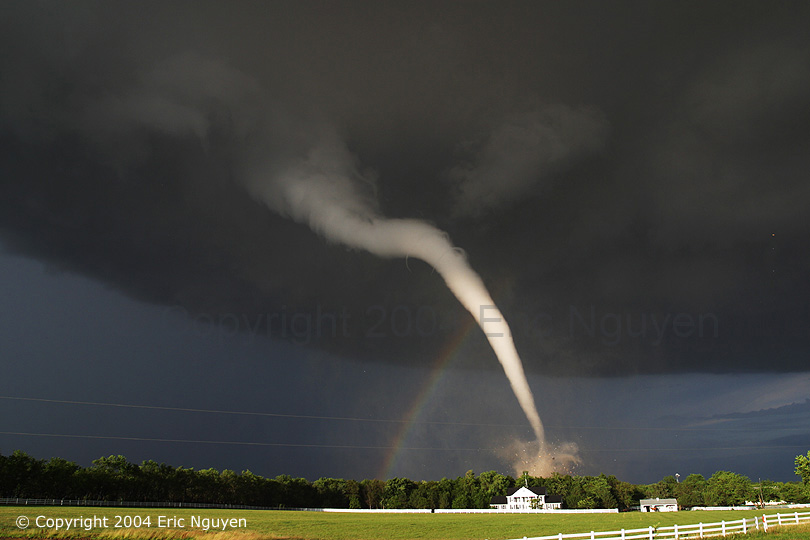
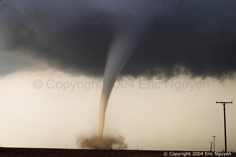
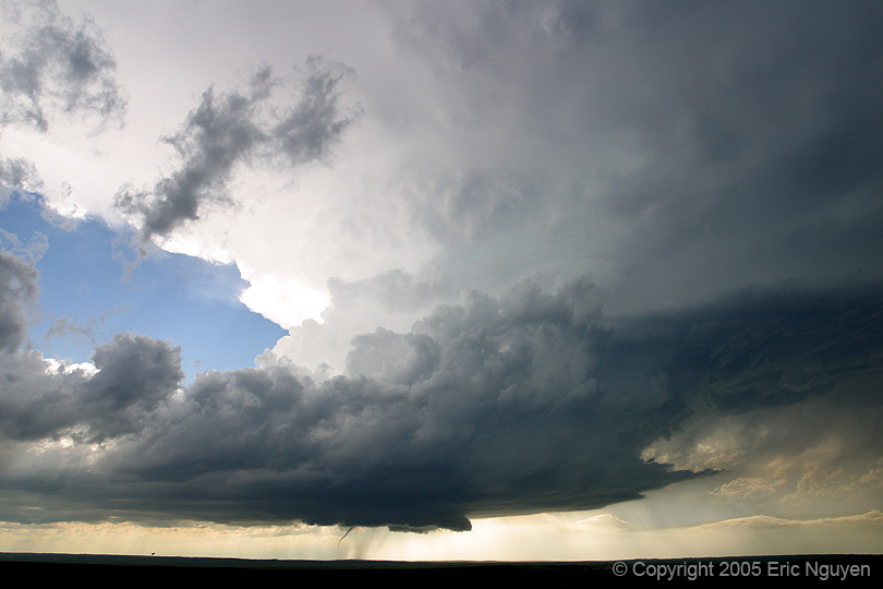
Eric Nguyen, 29The entire storm chasing community was shocked last week to learn that Eric had become extremely ill following unknown circumstances surrounding the attempt to take his life due to apparent major clinical depression.  We all learned of his dire condition late last week through a good friend of Eric’s (Amos Magliocco), who also is a popular storm chaser amongst the community.  Eric passed on on Sunday, September 9th, and the entire storm chasing community is quite shocked and extremely saddened.  We don’t really like to "classify" storm chasers amongst the community, but we all know who the "elite" were.  Eric was certainly one of the elite.  He had a gift to forecast storms and an even more special gift to get to the right spots to achieve some of the best storm photography the world has known, even at his young age.  While I did not personally know Eric very well, I have certainly met him a couple times, the most memorable time being at the 2002 Storm Chaser Convention in Denver — it was an extremely windy weekend with like blowing dust and tumbleweeds everywhere around the DIA Holiday Inn..  I forget who was all out there in that parking lot where there were just piles and piles of tumbleweeds of which we kicked and threw and mangled.  I remember distinctly taking a picture of Eric holding one of the tumbleweeds in the air in this all-serious demeanor like we were at war with the tumbleweeds.  Unfortunately, this photo, along with many others of family and friends I had around 2000-2002 were lost — nowhere to be found, after the CD they were on became corrupt… you can thank my very poor job of backing up stuff in my college days.  At any rate, I think Eric will always be remembered through one special photograph he took in 2004 — a photograph that made the Smithsonian Magazine.  There are two storm chasers whose work I admire the most, and I take with me when I am out photographing storms myself — that is Eric and Mike Hollingshead.  I know Mike quite a bit better than Eric since Mike and I have exchanged more e-mails and instant messages about photography over the years.  I have chased many of the same storms as Eric Nguyen — most notably in recent years:

Eric did an incredible job of maintaining superb website showing his collection of storm photography work.  I know I checked it often for updates, if nothing more than to make me more jealous of his photography skills!  His website is preserved so everyone can enjoy his storm chasing accounts and incredible imagery:

www.mesoscale.ws

Memorial StormTrack Thread 


« Newer PostsOlder Posts »

Powered by WordPress