High Plains Drifter


disclaimer:  "The meteorological views/forecast thinking expressed are those solely of the author of this blog
and do not necessarily represent those of official National Weather Service forecast products,
therefore read and enjoy at your own risk and edification!"

June 16, 2009

Day 5 (June 15): Southwest KS HP-Supercell, etc.

Filed under: Chase Accounts,Chase Trip 2009,Latest Chases,Storm Chasing — Mike U @ 10:42 am

HP-Supercell Structure Spearville to Kinsley, KS — Beautiful Mammatus at sunset Pratt, KS — Astronomical twilight storms near Haviland, KS

Not much time for a detailed report given time constraints (we have to hit the road again).  It was another fine day of storm photography on the 15th.  We followed the HP-supercell that first initiated northwest of Dodge City.  It became a beast of an HP supercell as it tracked from Spearville to Offerle to Kinsley as we followed it along Hwy 50.  At Kinsley, we headed south and continued to photograph the structure from southeast of Kinsley to Trousdale to Hopewell to Pratt.  We broke off the storm at Pratt then headed south toward Medicine Lodge taking a scenic way home.  After a pit stop in Medicine Lodge, we noticed a new storm developed north of Greensburg.  We retrated our steps back to Pratt on Hwy 281.  When we reached Pratt, a beautiful sky full of vivid mammatus greeted us.  We sat at a farm road just west of Hwy 281 a couple miles northwest of Pratt to photograph this atmospheric spectacle.  Just phenomenal!  After sunset, we drove back west toward Dodge City when another cluster of small storms formed with intracloud lightning.  The lightning illuminated structure was quite nice.  I took advantage of the low light capability of my Nikon setup (D3 + 14-24mm f/2.8 lens).  Results were very good.  Here are three images from this day:

June 15, 2009

Day 4 (June 14): Eastern Colorado Storms

Filed under: Chase Accounts,Chase Trip 2009,Latest Chases,Storm Chasing — Mike U @ 8:58 am

Evan, Jay, and I saw the end of the Karval, CO supercell(s) as we were sorely out of position earlier in the afternoon up along I-70 near Siebert. We busted south and west to get to tail-end charlie, but by the time we got there, the best of the show was likely over. We did catch some of the striated barrel updraft of the eastern supercell as we were driving east toward Karval. Ugh I wish we were closer. Best images of the day for me were daytime CG lightning from the high-based linear storms north of Limon overlooking a farmstead on a dirt road north and east of Limon. Obviously, am disappointed in Leaving DDC at damn near Noon missing the supercell and tornado in Haskell county. I over-analyzed this one. D’oh!

June 14, 2009

Day 3 (June 13): Southeastern CO-Southwestern KS Supercell

Filed under: Chase Accounts,Chase Trip 2009,Latest Chases,Storm Chasing — Mike U @ 8:20 am

Kim to Pritchett, CO to Richfield to Hugoton, KS Long-lived supercell with brief tornado

Evan, Jay, and I had one long day. Intercepted the Kim to Pritchett, CO to Richfield, KS and beyond supercell. We observed numerous gustnadoes south of Pritchett, but as significant updrafting was beginning to occur above these dust whirlies. Soon, without much warning at all, a very nice and somewhat tall translucent dust tube extended from a compact dusty debris cloud upwad a good distance. This was no ordinary gustnado. We all three believe this was indeed a legit tornado, ~15 SSE Pritchett, CO at about 6pm MDT. Bookbinder and I got a few pretty good images, which will be posted by tomorrow morning at the latest. After this, the storm spewed out too much outflow, so we tried to blast east a good distance for structure. Some of the dust back in the storm was really opaque. Pretty hairy stuff. When we got to the KS border, we realized that getting gas was moving high on our priority list. We wanted to stay ahead of the storm though on our way to the next large enough town — Hugoton. So we went north on Hwy 27 from Hwy 51 to Richfield. We stopped a mile or so south of where Hwy 27 jogged east to Richfield to photograph incredible green vault color to our west. Beautiful. But we underestimated how close this was to us, and we figured we could get to the east jog in time. We miscalculated. We ate it. Golfball to 2″ diameter hail overtook us 6 miles west of Richfield. I have some spiders on the glass as a result. D’oh! We took Hwy 51 back south with some jaw-dropping structure to our west. Beautiful bell-shaped updraft with some of that vertical striations that most undoubtedly suggest 2.5″+ diameter hail. Then there was the dust. Wow. Inflow dust was just unbelievable. We drove through a couple inflow jets with less than 1/8 mile visbility. We eventually got out ahead of the storm enough on Hwy 56 to get more jaw dropping, menacing structure to the west-northwest with ground-scrapping lowerings/wall cloud. The kicker was the inflow dust jets — two of them streaming into the updraft from different locations and rising into the supercell. It was something I had really never seen before… two separate inflow dust jets going up into the supercell structure. Wow!!! At any rate, we continued to follow this beast watching a left-split race north as the main supercell was moving east. We thought these storms would merge between Hugoton and Liberal, but the left-split continued to race right on by. Our last photography location was west of Liberal with some shelf cloud structure in the waning nautical twilight. Met up with Scott Blair in Liberal for some fantastic McDonalds (sigh) since no other restaurant on Pancake avenue wanted to stay open past 10. Back to Dodge City tonight with more in store on this trip!

June 13, 2009

Day 2 (June 12): Eastern Colorado “Palmer Divide” Supercell

Filed under: Chase Accounts,Chase Trip 2009,Latest Chases,Storm Chasing — Mike U @ 8:27 am

June 12th yielded far better results than the previous day.  Evan, Jay, and I started the day off with a hearty breakfast at the Big Texan steak ranch in Amarillo.  We were initially torn between two targets:  1) Western Oklahoma along a decent looking outflow boundary where CAPE would be much higher or 2) upslope across eastern Colorado.  Each had their pros and cons, but in the end we chose the eastern Colorado target, which was a wise choice.  Given the dearth of upper level forcing, it seemed the only reliable way to force convection would be due to elevated heating.  Primary elevated heating sources for High Plains severe storms initiation are 1) Raton Mesa along the CO-NM border 2) Palmer Divide that extends east from Palmer Lake/Monument, CO north of Colorado springs, and 3) Cheyenne Ridge which extends east along the WY-CO border from Cheyenne.  The anticipated late afternoon wind field and moisture situation at the surface suggested to us that the best of these 3 would be the Palmer Divide.  It was encouraging to see the 12z NAM and GFS both force convection in this area.  Our target from Amarillo, TX was Kit Carson, CO.

It didn’t take long for storms to initate along the Hwy 24 corridor southwest of Limon, which is the classic initation point for Palmer Divide storms.  We drove to Hugo, CO where we refueled and on our way.  Our target storm started getting better organized west of Hugo on our approach to Hwy 71.  From there we followed the high-based supercell southeast following Hwy 94 to Wild Horse.  At one of our stopping points along Hwy 94, we ran into a huge conglomeration of small gnats.  We think a small mesoscale boundary/wind shift brought these bugs in, because they just hit us without warning.  They were everywhere inside the Jeep, so it took the remainder of the chase to try and get rid of all these distracting gnats!  Anyway, the storm was largely outflow dominant as we followed it south and east from Aroya to Eads.  At one point, the structure of the supercell revealed a nice barrel shape to it.  Once we reached Eads, we actually drove south about 7 miles or so to try and get well south of the storm to see if we could observe more interesting cumulonimbus structure from afar.  Unfortunately, this didn’t work out so well so we drove back north to Eads then continued east on Hwy 96 toward Sheridan Lake.  The supercell had a rather steady-state outflow dominant structure its whole life, but it was pretty.  It was a challenge to shoot the storm against a very luminous backdrop.  Contrasts were harsh quite often, so I tried to shoot more structure looking north or north-northwest where there wasn’t an 8-stop luminosity difference between the dark storm and the really bright backdrop behind the storm.  We followed the storm on some farm roads southeast of Sheridan Lake until it got too dark and the storm was slowly weakening.  One last photography shoot location was along Hwy 50 where we finally got a good glimpse of the cumulonimbus top from a distance.  Occasional cloud-to-ground lightning illuminated some structure — even a lowering — as the storm moved away from us into Hamilton County, KS.

June 12, 2009

Day 1 (June 11): Eastern TX Panhandle Bust

Filed under: Chase Accounts,Chase Trip 2009,Latest Chases,Storm Chasing — Mike U @ 7:45 am

Evan Bookbinder, Jay Antle, and I decided on a chase target in the eastern TX Panhandle in favor of eastern Colorado mainly because I enjoy taking a chance every now and again, and I thought we could get an isolated beautiful supercell somewhere east of Plainview/Lubbock given the not-so-hot 700mb temps, great deep layer shear, and the nose of moderately high CAPE.  The result of this decision was a bust.  We were fairly excited about a storm that formed northwest of Silverton during the late afternoon hours around 4:30pm CDT or so.  Unfortunately, the storm died a horrible death as it moved away from its source of convergence and into higher CIN airmass to its east.  We were also watching an area near Floydada to our south where a mesolow developed.  Some aggressive attempts at congested cumulus were noted, but in the end — nothing.  It was sort of painful watching supercells thrive in southeast Colorado, the more obvious upslope play today.  We took a gamble at something isolated and largely to ourselves (the majority of other chasers were up in Colorado) and we lost.  Below are a few images if the little storm that couldn’t:

June 10, 2009

Chase Acct: June 7, 2009 (Southeast NE-Northwest MO)

Filed under: Chase Accounts,Latest Chases,Storm Chasing — Mike U @ 7:56 pm

Pawnee City, NE Supercell & Oregon to Amity, MO Supercell

Robin and I left North Platte around 9:30am with a target of Hebron, NE in mind.  I really didn’t envision us ending the day along the I-35 corridor in northwestern Missouri, though!  …but it was worth it.  We photographed two photogenic supercells, the first of which developing near the KS-NE border southwest of Pawnee City.  This storm showed some signs of tornadogenesis early on when it was southwest of Pawnee City, however it struggled against some of its own outflow.  Nevertheless, this was probably the most photogenic supercell I’ve photographed in southeastern Nebraska.  We had a decision to make as we continued east on Hwy 8  on approach to Salem and Falls City — do we continue our intercept of the original storm or do we go after much better looking development east of us — a much more difficult intercept.  The atmosphere made the decision for us.  The southern supercell took over while our original storm was falling apart.  The backside of the southern supercell was spectacular.  The convection was like an atom bomb going off in front of us.  As we crossed the Missouri River at Rulo, we continued to get closer, approaching the hook echo region of the supercell from the back side.  We got into some of the precipitation as we approached Oregon.  None of the precipitation was hail…. but as we drove into Oregon, that’s all we saw on the ground.  Lots of giant hail.  We didn’t stop in town in favor of trying to get ahead of the storm, but in retrospect, I wish we would have stopped to photograph some of these hail stones.  They were absolutely huge, and we didn’t miss this hail fall by much — maybe as little as 5 to 10 minutes.

We reached I-29 with the hail core just barely to our east, and we managed to make it to Hwy 36 at St. Joseph where we continued east.  We then headed north on Hwy 6 toward Clarksdale where we refueled and continued on our way.  We stopped a couple miles south of where Hwy 6 curved to the east (about 6 miles west of Amity) where we photographed the supercell structure and wrapping rain curtains.  The wrapping rain curtains to our NNE was significant.  There was likely a substantial ground circulation amidst this wrapping rain curtain area, but it could not tighten up into a tornado circulation.  It was close, though!  We back-tracked to Hwy 36 and continued east, stopping at times to photograph the structure to our north.  This was some of the finest storm structure I’ve ever seen this far east — certainly the best Missouri storm structure I’ve photographed.  I was impressed — it was almost like chasing a storm on the High Plains — very contrasting colors with good visibility.  As we approached I-35 it was getting to be close to 9:00pm and we had to end the chase given the drive we had to make back home.  I had a very fun time these past 3 days chasing with my good friend Robin Lorenson.  Certainly another reminder for sure how much easier it is to multi-task having a chase partner — since I chase solo so often.  Thanks Robin!  Some images from this chase below:


June 9, 2009

Chase Acct: June 9, 2009 (Dodge City, KS)

Filed under: Chase Accounts,Latest Chases,Storm Chasing — Mike U @ 11:13 pm

The One-Hour Pure Gentleman’s Chase — Dodge City, KS Supercell

I worked the day shift on June 9th, and I got off shift at 4:00pm.  I had planned all along to work overtime given severe weather development across our forecast area.  That being said, by 4:00pm, there was nothing on radar across all of our forecast area, so I agreed to be called back if I was needed back for help.  After a 20-minute nap, I got a call from Matt Crowther asking about a new storm developing southwest of DDC.  I didn’t know anything about it at the time (about 4:30pm by now), so a quick glance at radar had me intrigued.  It had a nice little shape to it and was moving in the general direction of DDC.  So, I decided to go after it, only a 15 mile drive to the southwest from my duplex to the updraft seen in the first image.  As this was moving northeast, I had to keep moving northeast too… back toward Dodge City.  I took north bypass through the north part of town all the way to the US-283 junction, about 2.5 miles northeast of the Dodge City airport.  It was at that time that one of my evening shift co-workers called me back in.  It was at this time that I photographed images #2 through#5 below of the awesome updraft structure and menacing near-ground activity (in images #4 and #5, you can see the KDDC WSR-88D radome in the distance!).  The tall precip shaft adjacent the updraft was beautiful!  After I shot these images, I drove to the office…. toward this supercell.  I didn’t make it to the WFO DDC driveway before the golfball size hail.  Heavy and hard golfball to 2″ diameter hail pelted me as I entered the WFO parking lot.  The last two images in this series below are from the WFO parking lot.  What an awesome 1-hour, 30-mile round trip gentleman’s chase!!


June 7, 2009

Chase Acct: June 6, 2009 (Southwest NE)

Filed under: Chase Accounts,Latest Chases,Storm Chasing — Mike U @ 7:36 am

Robin Lorenson and I photographed three different supercells across southwestern Nebraska.  Our target was Ogallala to Sidney to Julesburg, which allowed us to hang around Ogallala for the better part of the afternoon along with Matt Crowther, Scott Bell, and Dave Blanchard.  The first supercell we photographed was a high based well-sculpted “cinnamon swirl” supercell updraft as it tracked along I-80 from Brule to just northwest of North Platte before weakening.  Robn and I stuck with this a little too long, while Matt Crowther and company broke off sooner in favor of new development back toward Julesburg, CO.  Matt’s decision to break off that initial storm paid off, as they managed to get fantastic images of the 2nd supercell that tracked south of Ogallala.  Robin and I caught the last glimpses of the supercell structure just after sunset from a viewing point a couple miles east-southeast of Elsie, NE.  Matt and Scott joined us at this location and we watched a 3rd supercell track basically along the same track as supercell #2.  There was just enough remaining twilight for my Nikon D3 to take advantage of, so I set it up on the tripod and shot continuous 5-second exposures of lightning illuminated structure… beautiful bell-shaped updraft with a wonderful convective top above.  This was just a beautiful sight!!  A very rewarding day on the high plains with the storms essentially to ourselves as all the other chasers targeted much farther east with little in the way of results.


June 6, 2009

Chase Acct: June 5, 2009 (Southern NE Panhandle)

Filed under: Chase Accounts,Latest Chases,Storm Chasing — Mike U @ 8:12 am

This is very brief with a more detailed account to be written later on next week.  My chase partner Robin Lorenson and I left Salina, KS about 8:45am for a target somewhere around Sidney, NE to Sterling, CO.  We missed the La Grange, Wyoming 25-minute tornado event by about 30 minutes. We were simply late. Other storm chasers had the same fate as I’m finding out (including Bill Hark, who we chewed the fat with for probably too long in retrospect in Sterling!! ;-) It was great to catch up with you again though, Bill!).  However many others were not late, who were already up along I-80 in the early afternoon — including Vortex-2.  Some fine High Plains storm photography, though, ensued as we followed the supercell as it evolved over the next several hours from south of Harrisburg to north of Dalton to southwest of Oshkosh by late-evening twilight.  Below are a few images from this chase:


May 27, 2009

Chase Acct: May 25, 2009 (KS/CO Border)

Filed under: Chase Accounts,Latest Chases,Storm Chasing — Mike U @ 11:32 pm

May 25, 2009 Tribune, KS Vicinity Storms & Brief Glimpse of a Non-Supercell Tornado

I decided to chase this day with the hopes of intercepting a non-supercell (landspout) tornado along a nearly stationary north-south surface boundary.  Surface temperature/dewpoints were expected to be in the mid 70s over mid 50s dewpoints in the area of interest which Lamar, CO to Tribune, KS.  I set off from Dodge City at 9:45am (CDT) after a whopping 1.5 hours of sleep following a midnight shift, hopefully arriving in the target area around Noon.  I knew that storms would form very early given a non-existent cap. The trick was to get on storms early in their updraft-dominant phase before evolving more upscale into a more complicated outflow dominant mess.  The first storms of the day developed along a north-south axis from near Burlington to Cheyenne Wells, and I hoped to reach the southern end of this first development near Cheyenne Wells.  I arrived in Cheyenne Wells to a signficantly weakened storm.  I didn’t hang around Cheyenne Wells long before realizing I needed to get back southeast toward newly developing sharp-looking towers — about halfway between Cheyenne Wells and Tribune very near the state border.

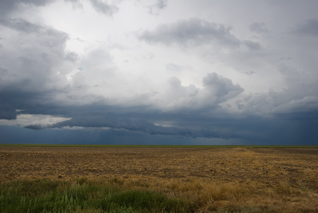
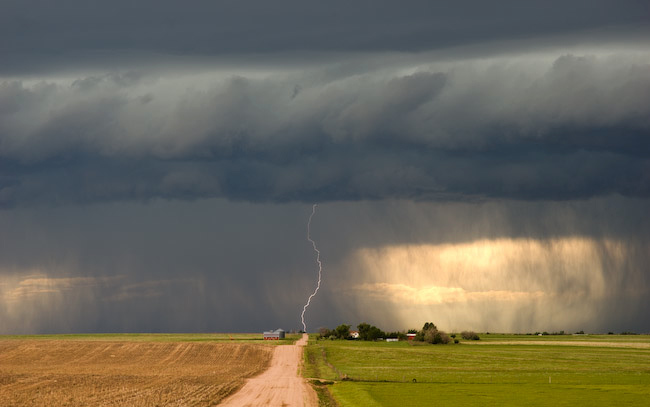
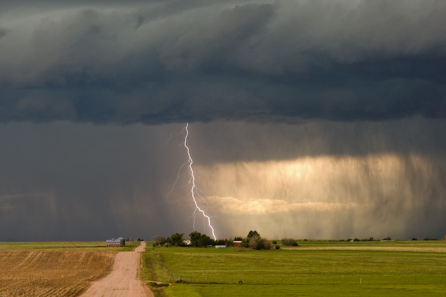
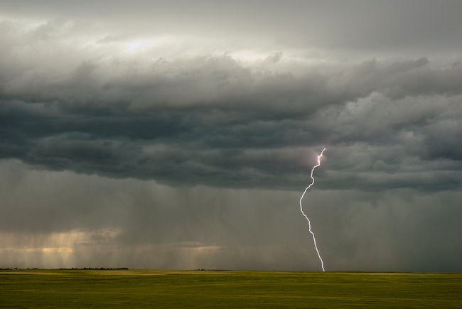
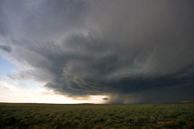
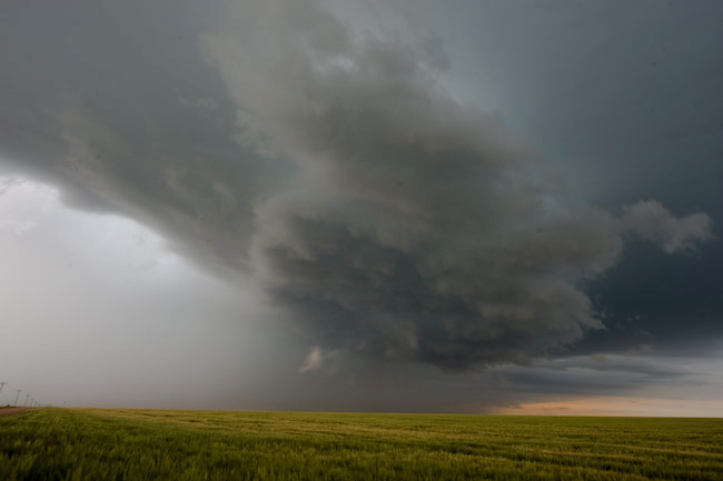
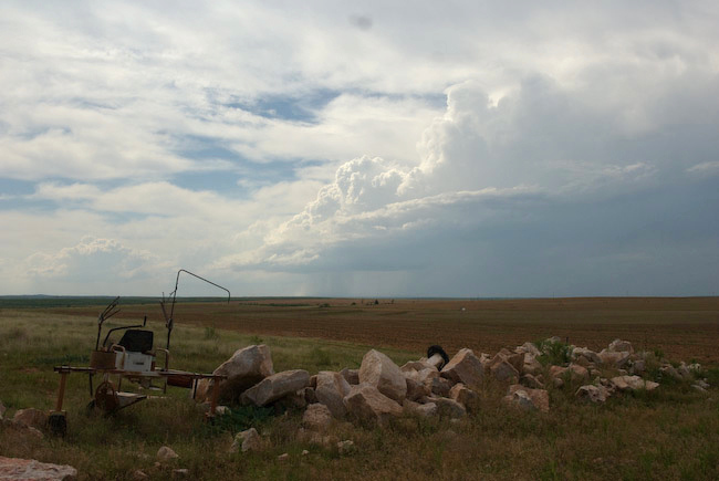
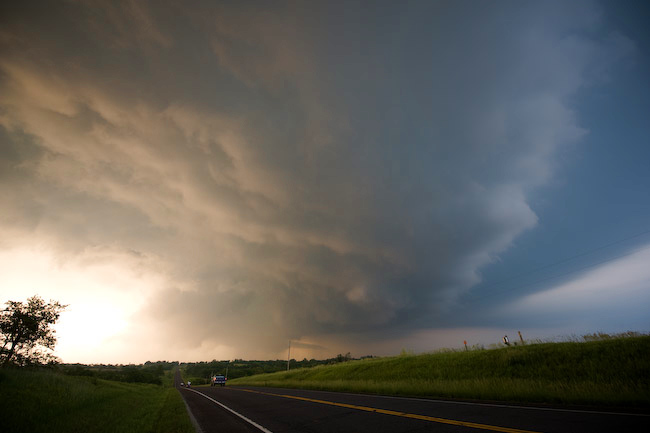
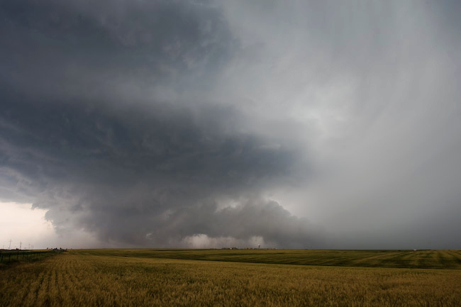
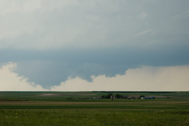
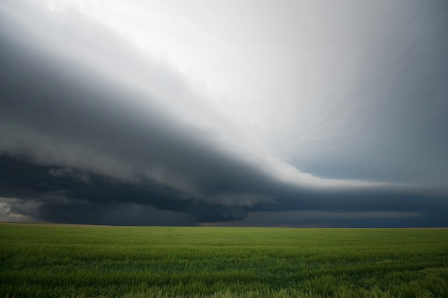
I decided to head east on an unpaved, but well graded farm road northeast of Sheridan Lake, CO.  The newly formed updrafts had high bases to the east and northeast.  Eventually the northern one filled in with precipitation, but I continued to trudge east.  I stopped for a short time to photograph the darkening mass off to the northeast with an interesting embedded updraft base feature.  I photographed this with some oil wells in the foreground very near the state border at around or shortly before 2pm CDT.  After this, I continued east on the farm road to get closer to the more southern updraft area of newer cells, but the road became increasingly soft and messy, so I turned around and retreated back west.  I eventually headed back south to Towner, CO and then east on Hwy 96 into Greeley County, KS.  At this point, I was getting increasingly tired and impatient with the disorganization of everything, so I decided to just bag the chase and head back home so I could get some sleep.  Well, as I was writing this off, a new updraft surge was looking rather interesting to my north as I was approaching Tribune.  Sometime between 2:30 and 2:40pm CDT, the updraft base to the north looked rather well organized, and I could make out a fairly well-defined high-based funnel cloud.  It was such a small funnel relative to the distance from the cloud base to the surface that I just simply wrote it off as an insignificant funnel — however the shape persisted for at least a couple minutes.  I was too busy driving to try to get north and closer to the updraft area, so I never stopped to get a photo of this feature.  As it turned out, this was actually a landspout tornado that Greely County sherrif confirmed.  I got a call from Chris Foltz at WFO Goodland seeking confirmation of this event (as he noticed my position on Spotter Network).  I did not confirm a tornado from this feature, but did advise him that I observed what certainly looked to be a legit funnel cloud looking to my north while I was just a few miles west of Tribune.

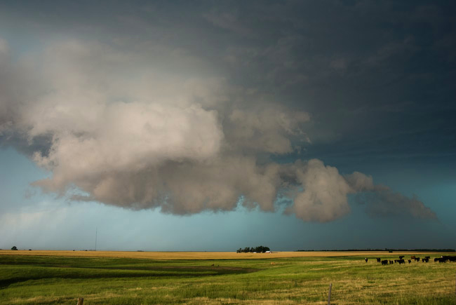
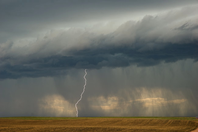
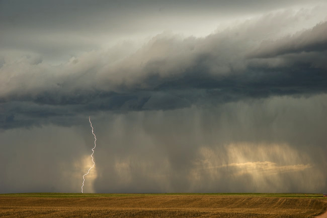
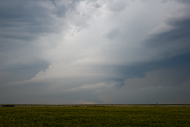
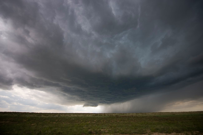
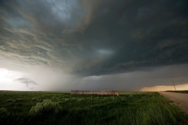
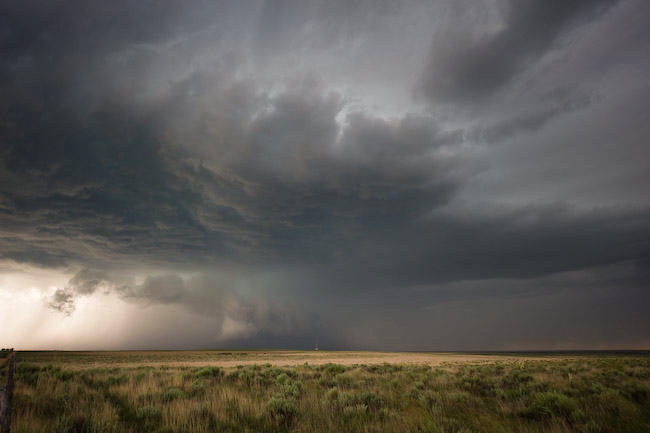
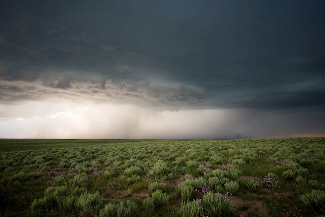
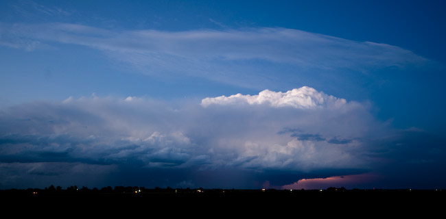
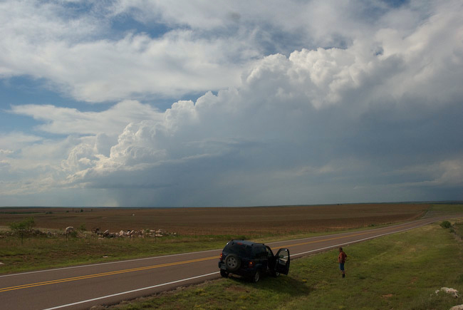
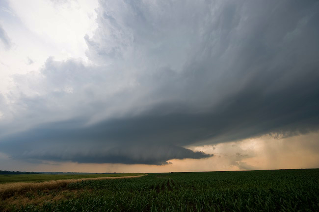
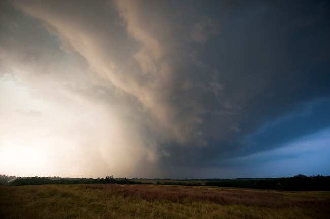
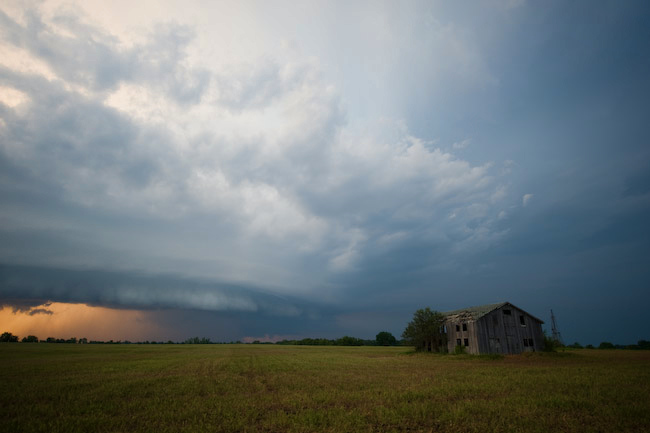
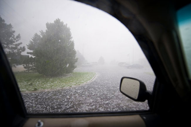
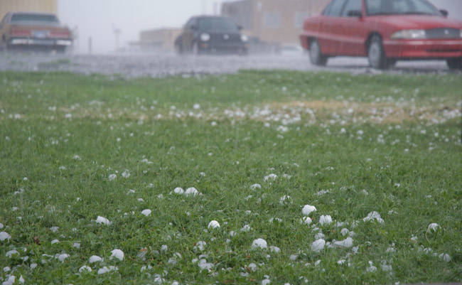
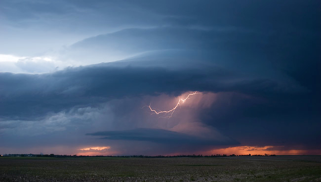
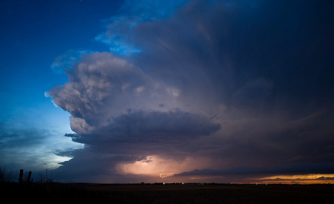
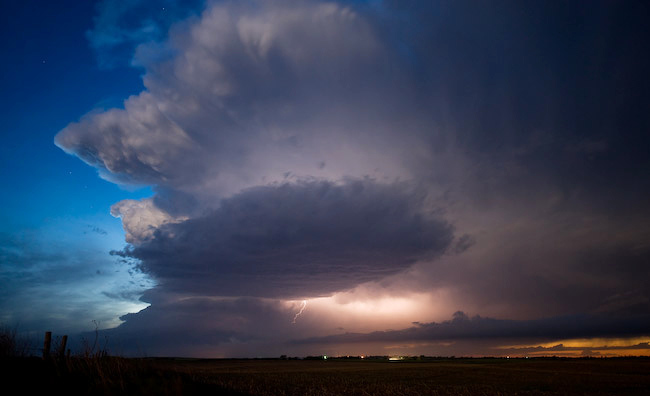
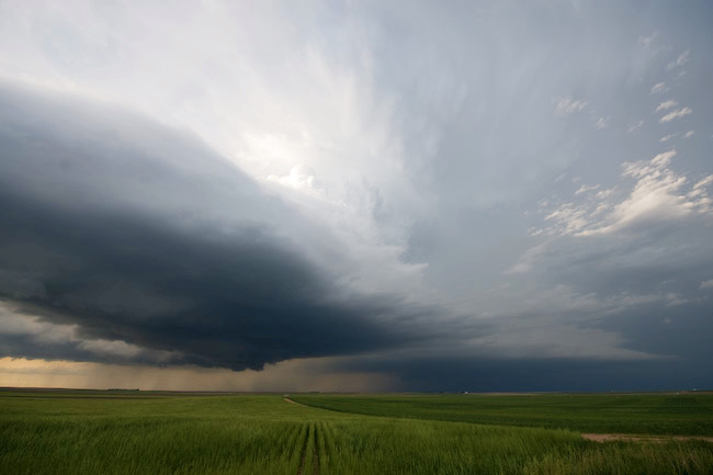
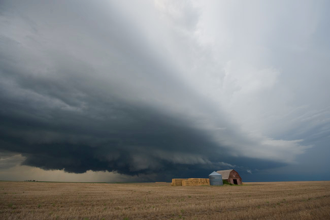
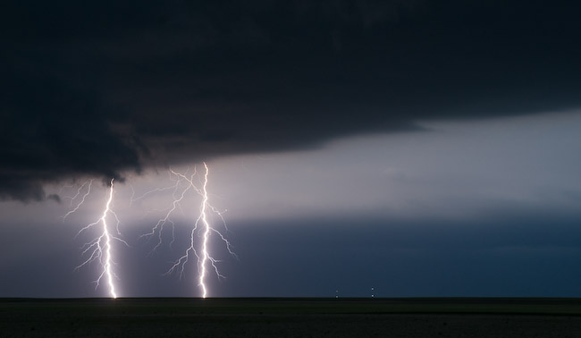
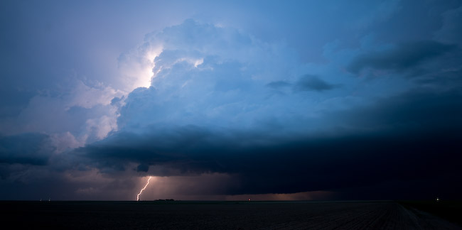
I finally got north of Tribune and no longer observed this funnel cloud.  The entire storm base was looking more and more uninteresting with time, so I then backtracked into Tribune.  I had thoughts a second time of just heading back home… but then a fairly stout cell formed to my west-southwest, near Sheridan Lake.  This storm had a a 50dbz core on radar up to about 25 thousand feet, which was certainly better than most of the other storms I was observing northwest of Tribune up to that point.  I could also make out a fairly healthy updraft base and pseudo lowered area way off in the distance.  I thought what the hell and decided to head back west on Hwy 96.  I didn’t get any farther than about 7 miles west of Tribune before another newly developed storm took my interest south of Tribune to my east-southeast!  I just decided to sit still there west of Tribune and watch things for awhile.  Storm updraft then began to my northwest at around 3:40pm, and I photographed this for a little bit along Hwy 96.  This new storm formed an interesting “mustache” type outflow cloud structure beneath the base which was somewhat photogenic.  I then headed north on a farm road just to the north side of Horace where I photographed this storm a little bit more.  It was at this point, around 4:15pm CDT, when I met up with the Greeley County sherrif.  He described the earlier tornado event to me and described what he saw as a small funnel, a dust debris area in the field, and nothing in the middle — fitting the classic landspout tornado description.  He said it lasted some 3 or 4 minutes.  After I was done photographing from this location, I finally decided I had enough and began my trek back home.

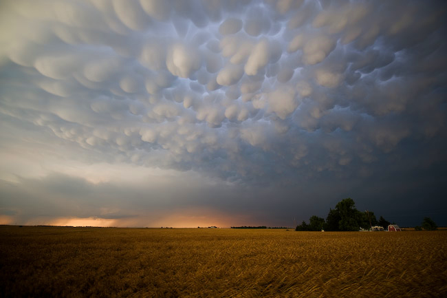
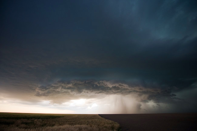
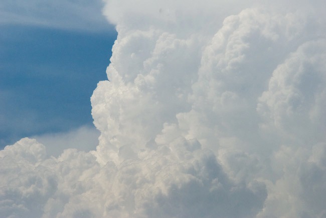
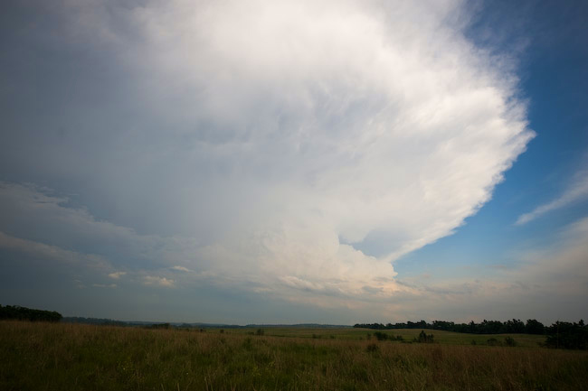
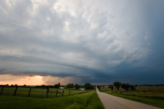
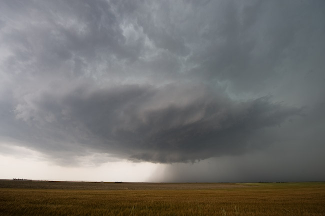
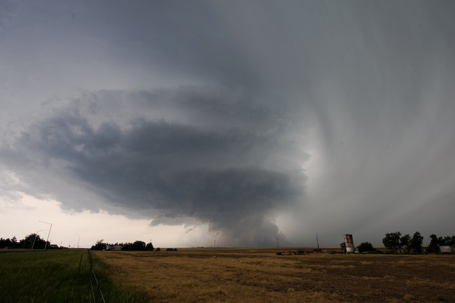
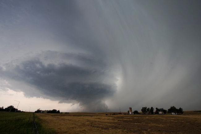
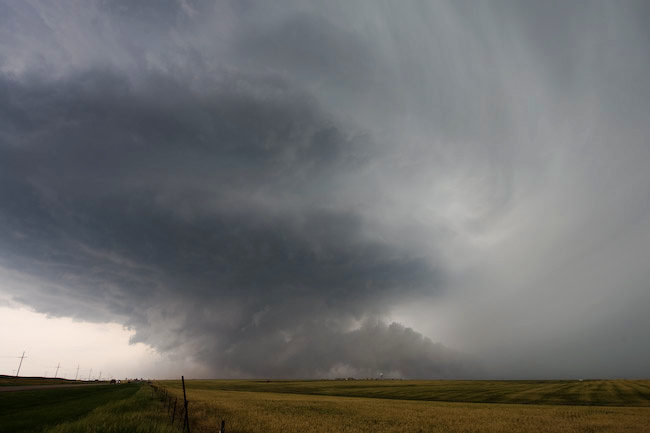
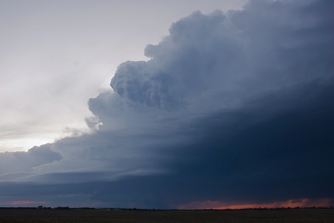
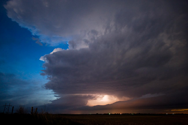
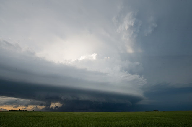
I reached Garden City at around 6:00pm to a surprisingly well-developed updraft to my east with pretty damn good structure.  Instead of taking Hwy 50 back home, I wanted to follow this storm since it looked so appealing visually from the backside.  This cell behaved like a left-split supercell, moving to the north-northwest during its brief life as a well-organized storm.  I stopped to photograph this updraft a few miles east of Garden City…then decided to get closer to the storm and hopefully either get into some hail or photograph more structure from closer in.  By the time I reached about 10 miles northeast of Garden City, the storm rapidly collapsed between 6:30 and 6:45pm.  After that, I finally make my final leg back home to Dodge City, in time for about an hour and a half more sleep and my next 10pm-6am shift.  All in all, not a fantastic chase photographically speaking, but my forecast verified:  There was, indeed, a landspout tornado, however brief it was, northwest of Tribune.  I just was not in the right position at the time of the event.


« Newer PostsOlder Posts »

Powered by WordPress