The One-Hour Pure Gentleman’s Chase — Dodge City, KS Supercell
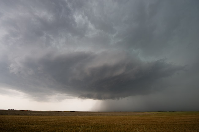
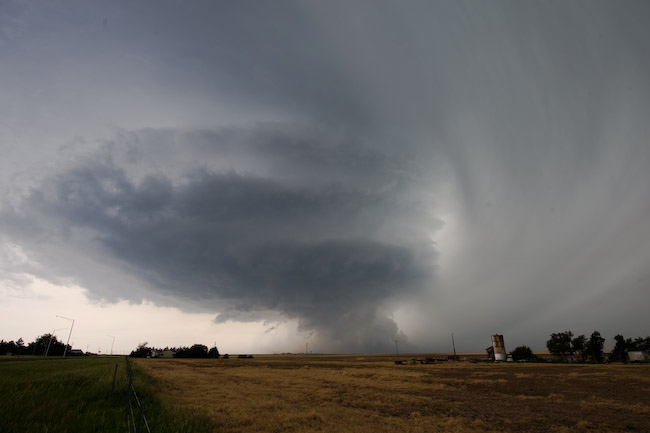
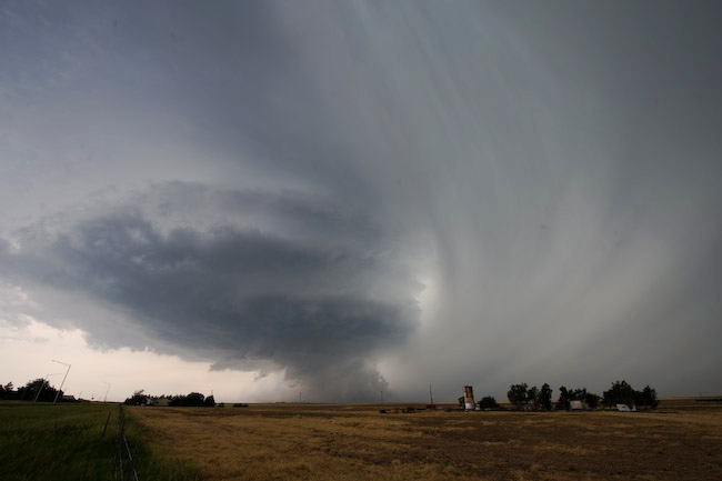
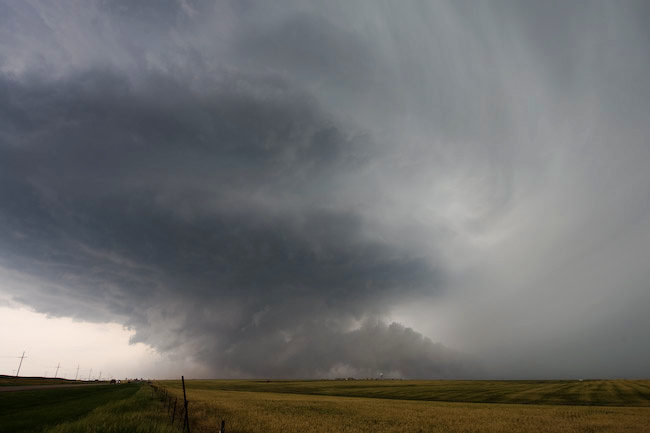
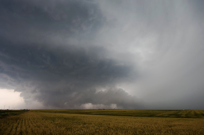
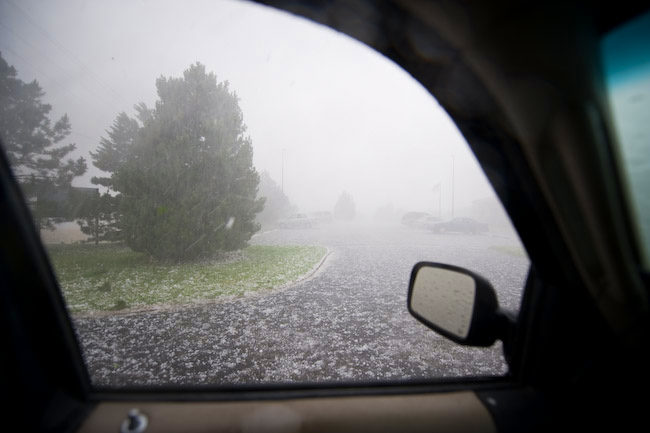
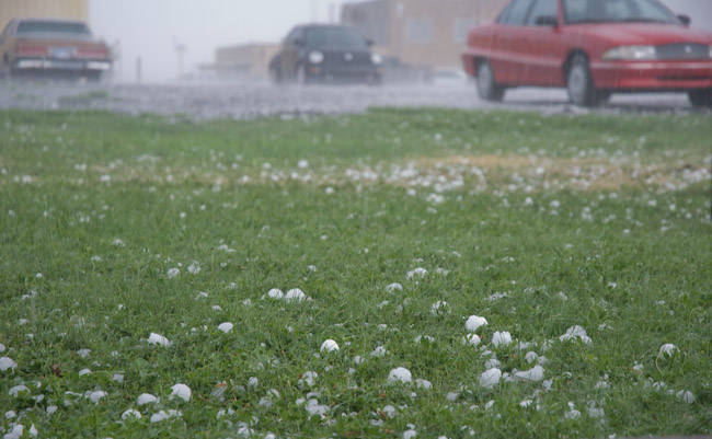
I worked the day shift on June 9th, and I got off shift at 4:00pm. I had planned all along to work overtime given severe weather development across our forecast area. That being said, by 4:00pm, there was nothing on radar across all of our forecast area, so I agreed to be called back if I was needed back for help. After a 20-minute nap, I got a call from Matt Crowther asking about a new storm developing southwest of DDC. I didn’t know anything about it at the time (about 4:30pm by now), so a quick glance at radar had me intrigued. It had a nice little shape to it and was moving in the general direction of DDC. So, I decided to go after it, only a 15 mile drive to the southwest from my duplex to the updraft seen in the first image. As this was moving northeast, I had to keep moving northeast too… back toward Dodge City. I took north bypass through the north part of town all the way to the US-283 junction, about 2.5 miles northeast of the Dodge City airport. It was at that time that one of my evening shift co-workers called me back in. It was at this time that I photographed images #2 through#5 below of the awesome updraft structure and menacing near-ground activity (in images #4 and #5, you can see the KDDC WSR-88D radome in the distance!). The tall precip shaft adjacent the updraft was beautiful! After I shot these images, I drove to the office…. toward this supercell. I didn’t make it to the WFO DDC driveway before the golfball size hail. Heavy and hard golfball to 2″ diameter hail pelted me as I entered the WFO parking lot. The last two images in this series below are from the WFO parking lot. What an awesome 1-hour, 30-mile round trip gentleman’s chase!!
Hey Mike! What a great account! I love the fact you can drive just SW of town, and see that, and then get back to your office! Such a storm would be a rare occurrence here in London!
cheers,
Paul.
Comment by Paul Knightley — June 10, 2009 @ 3:31 am