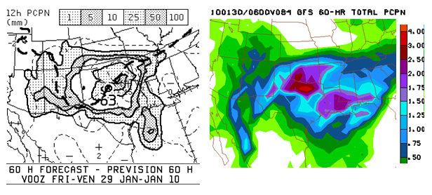
More snow now instead of sleet a bit farther southeast?! That is what the latest trend is in the NAM and GFS models. Yesterday’s model runs had a bit more impressive warm layer aloft, but this morning’s runs are colder farther southeast in the critical warm layer aloft (centered at 800mb). Any sleet will likely rapidly change to snow mid-late morning now as far southeast as Erick to Clinton, OK. If this trend holds, and these locations see more P-Type = SN, then MAJOR LEAGUE accumulations are likely in excess of 12″ over a fairly large area… and even upwards of 18 to 20″ in sweet spot! I firmly believe that there will be at least a 3-6 hr period of blizzard conditions as well. Model 10-meter winds are typically too light in these situations. Just look back at the Christmas Eve Oklahoma Blizzard. No one really expected blizzard conditions in Oklahoma City 24 hours prior to the event. My early evening thinking now, the day before departure, is now reserving two-night stay (maybe even a third night, Friday Night, if worse case scenario pans out) at a hotel along I-40 in west-central Oklahoma. I managed to get a shift swap at work, so I am not due back to Dodge City until afternoon/evening Saturday. Check out these ridiculous QPF forecasts from the Canadian model and GFS model:
