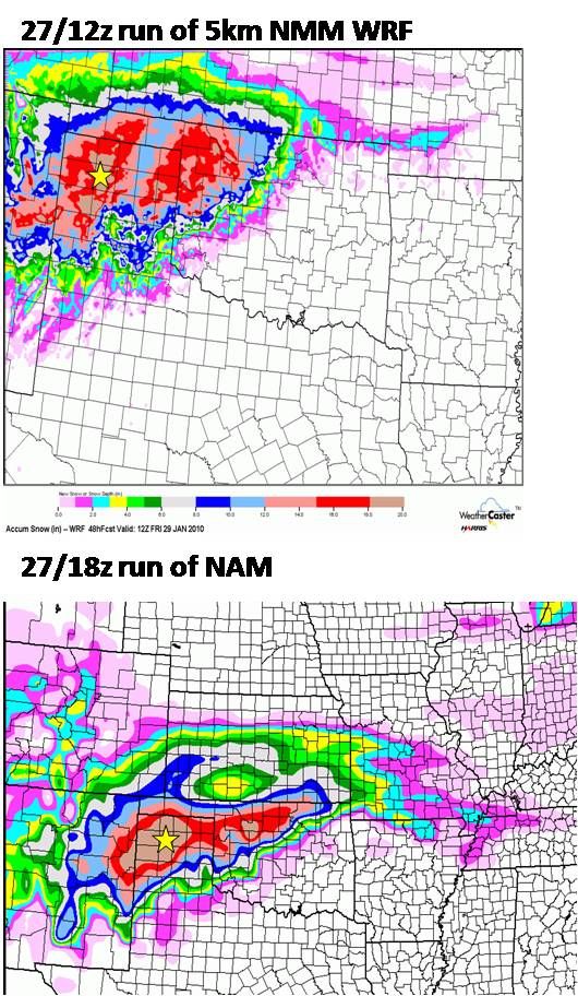
Arrived in Dumas this afternoon. I have arrived at my two-day temporary stay of residence here in Dumas. Coming into town, the temperature was 61 degrees, but the leading edge of the storm was starting to become evident as high, dense cirrus was quickly moving in. The forecast still appears to be on track. I think the snow will start in earnest sometime between 6 and 8am. Before then, there will probably be off and on light sleet/snow mixture for a couple hours before sunrise perhaps. Below is a two-panel chart of 48-hr snowfall accumulation from the 12z Hi-res NMM WRF and the 18z NAM model. The yellow star denotes where I am at (Dumas, TX). This is a snowfall accumulation algorithm using the Kuchera method. The grey bullseye area around Dumas is 18″ according to this algorithm from these two models and red is 15″+

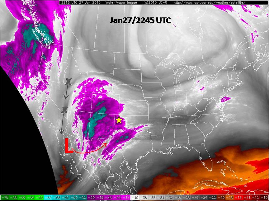
Here is a water vapor satellite image showing the storm. The primary low is at the base of the trough over the far northern Gulf of California. It will progress eastward this evening before rounding the corner and heading northeast into SW TX as the upstream “kicker” potential vorticity (PV) anomalies continue to move south to the base of the trough:
