High Plains Drifter


disclaimer:  "The meteorological views/forecast thinking expressed are those solely of the author of this blog
and do not necessarily represent those of official National Weather Service forecast products,
therefore read and enjoy at your own risk and edification!"

January 28, 2010

Southern Plains Winter Storm 2010 Jan 28 [post 10]

Filed under: 2010 Jan 28 — Mike U @ 6:45 am

The fun begins at about 7:30am! This radar image is nuts.  A lot of the yellow and orange (40 to 45 dbz) returns are due to snow falling into the warm layer.  Water-coated snowflakes are highly reflective.  This is called “bright banding”… and there is vertical continunity to the 40-45dbz band as you go up in elevation angle.  This huge, heavy precipitation area is moving north at about 35 mph, and the leading edge will reach Dumas at around 7:30 or so.
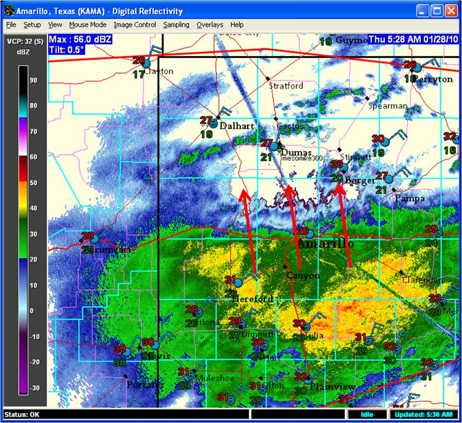
20100128-3

No Comments »

No comments yet.

RSS feed for comments on this post. TrackBack URL

Leave a comment

Powered by WordPress