first chase of the season — non-severe storms, Gove County, Kansas
My first attempt at a long-winded chase account was just erased after 30+ minutes of writing, and I’m not up to re-writing it… the upshot of it was that I chased quasi-linear multicell storms, of the non-severe variety, late in the evening on Thursday, April 15th. I intercepted the storms just northwest of Quinter before heading south again on various farm roads of eastern Gove County. The best images came around 8:15pm or so…
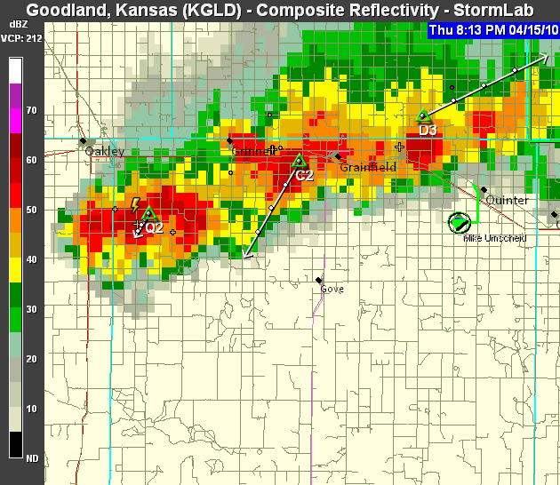
…around the time of sunset when I photographed beautiful colors with a cloud-base lowering present associated with the strong updraft (with cell “D3″ in the above radar image). After the colors waned, I headed farther south on more county roads approaching Hwy 4. The chase was pretty much over by that time as the storms had no more photographic interest due to weakening and no ambient light left. Images below! (NOTE TO SELF: next time, draft your write-up in Wordpad, not the WordPress blog post window!!! Ugh.)
This is a WPSimpleViewerGallery
Subsevere or not, Mike, I always get excited when I see you out on some storms, knowing some amazing pictures will be the result!
Comment by Dann Cianca — April 19, 2010 @ 10:08 am