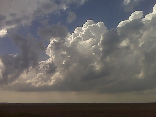
Looking wnw from north central south dakota. Tornadic supercell is likely in this area this evening
disclaimer: "The meteorological
views/forecast
thinking expressed are those solely of the author of this blog
and do not necessarily represent those of official National Weather Service forecast products,
therefore read and enjoy at your own risk and edification!"
and do not necessarily represent those of official National Weather Service forecast products,
therefore read and enjoy at your own risk and edification!"
May 22, 2010
Storms about to develop
1 Comment »
RSS feed for comments on this post. TrackBack URL
Makes you wonder why Vortex chose to blow off this day. After today there are only slight chances for tornadoes sunday and monday, then ridging for several days. The road network up there is good too. Anyway, with that much cape, warm front and 60kts at 500mb, you just cant blow off days like this.
Comment by Jonathan Finch — May 22, 2010 @ 5:59 pm