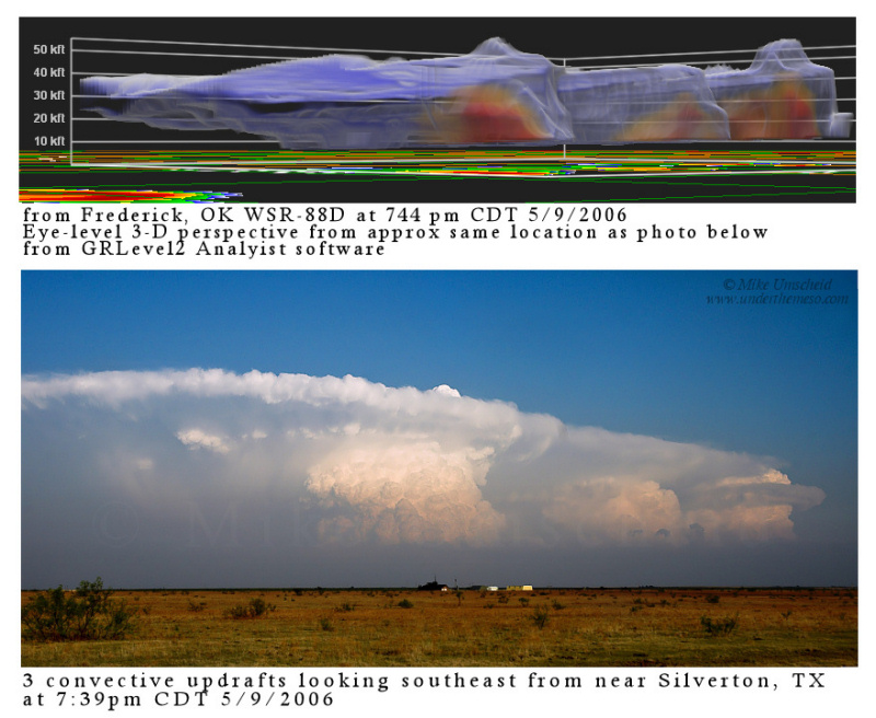
We just installed the new GRLevel2 Analyist software at work, which is a 3-D rendering software of 88D radar imagery. Along with level-II archive data available from NCDC, you can have a lot of fun going back and looking at old supercell events rendered in 3-D. It’s amazing some of the storm structures you can easily pick out with some of this data. I’m going to try and recreate some eye-level 3D renditions of level-II radar data of storms I chased, especially ones with impressive storm structure that I photographed. Here is a sample below of just what I’m talking about:
disclaimer: "The meteorological
views/forecast
thinking expressed are those solely of the author of this blog
and do not necessarily represent those of official National Weather Service forecast products,
therefore read and enjoy at your own risk and edification!"
and do not necessarily represent those of official National Weather Service forecast products,
therefore read and enjoy at your own risk and edification!"
October 19, 2006
No Comments »
No comments yet.
RSS feed for comments on this post. TrackBack URL
