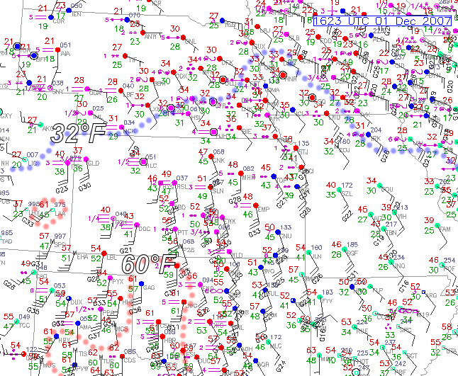
So much for appreciable precipitation in SW Kansas. Well, it’s now late morning amidst dense fog here in Dodge City, as surface moisture has rapidly surged north into the remnant shallow cold airmass. The freezing line has shifted way north into Nebraska by now. We observed very light freezing rain and freezing drizzle here in Dodge City from roughly 3:30-6:30am. Total precipitation measured at the airport (from the ASOS) was a whopping 0.01". Up at Hays, it looks like only 0.03" was measured at the AWOS station. Hays went above freezing at roughly 5:30am, several hours sooner than thought. The warm, moist air really surged north rapidly this morning. There were pretty much no impacts across this area from freezing precipitation, as a result. Now we wait on the wind… we’ll see how this aspect of the storm verifies. I was expecting far southwest KS to see some 60 mph gusts later on this afternoon. Now, the real winner (or loser) of this storm from the winter precipitation aspect is Iowa into adjacent southern Minnesota. Major icing going on now across Central Iowa from what it looks like per obs and radar. Here is the Nowcast Thread on Stormtrack forum from other storm chasers and genuine weather weenies talking about that. Back to the high plains region, It’s already 60°F in Lamar, CO from the downslope. Below is the 16z (10am CST) surface chart: