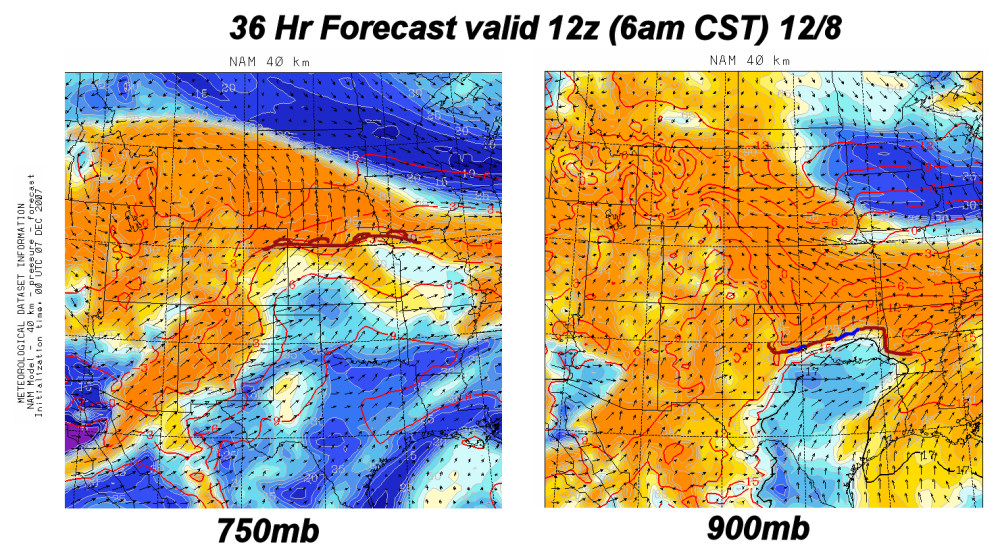
Slow-moving storm = prolonged winter weather. Here’s the first post of probably many, as another interesting winter storm is developing out over the Southwest. For western Kansas, it appears as if the biggest concern initially will be with freezing drizzle late Friday into Saturday. The first "wave of energy" will prompt snow development from eastern Wyoming into western Nebraska Friday night and Saturday. A shallow cold airmass will ooze south, with sub-freezing temperatures at the surface expected to overspread  Southwest Kansas, including Dodge City. Included in this post is the NAM 36-hr forecast at 750mb (roughly 6500ft above Dodge City elevation) and 900mb (rougly 1100ft above Dodge elevation). Warm air aloft will overspread the shallow cold air at the surface, which is illustrated in Img 1 by the NAM model. Just north of the shallow cold airmass, substantial warm air advection and moisture will allow the development of drizzle/freezing drizzle, depending on the surface temperature.
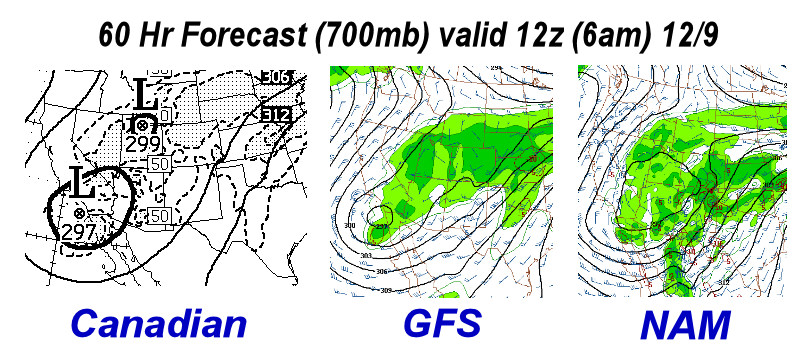
Beyond Saturday, the forecast is real fuzzy, as the upper trough stalls out over the Desert Southwest with smaller scale disturbances rotating around the upper trough axis. The individual mid-upper level jet streaks will dictate the lower level response and subsequent significant precipitation development. From a pattern recognition standpoint, given the configuration of the upper trough with substantial warm air advecting north in the 800-700mb layer coupled with shallow arctic air near the surface, a significant ice storm may be had over some (or a lot!) of the central Plains, including much of Kansas. Img 2 is a 3-panel model comparison among the Canadian, GFS, and NAM at 60 hours valid 6am Sunday 12/9 at 700mb. Here are some of the 12-hour precipitation accumulation from the GFS, NAM, and Canadian models for Dodge City, Saturday through Tuesday:
Model: ending 6pm Sat || 6am Sun || 6pm Sun || 6am Mon || 6pm Mon || 6am Tue || Total
GFS: 0.02 || 0.50 || 0.01 || 0.00 || 0.30 || 0.00 || 0.82
NAM: 0.01 || 0.01 || 0.10 || 0.21 || —- || —- || 0.33
Can: 0.00 || 0.00 || 0.08 || 0.00 || 0.20 || 0.24 || 0.52
*NAM model only goes out to 84 hours.