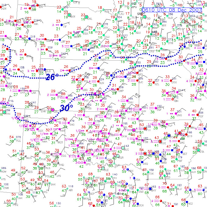
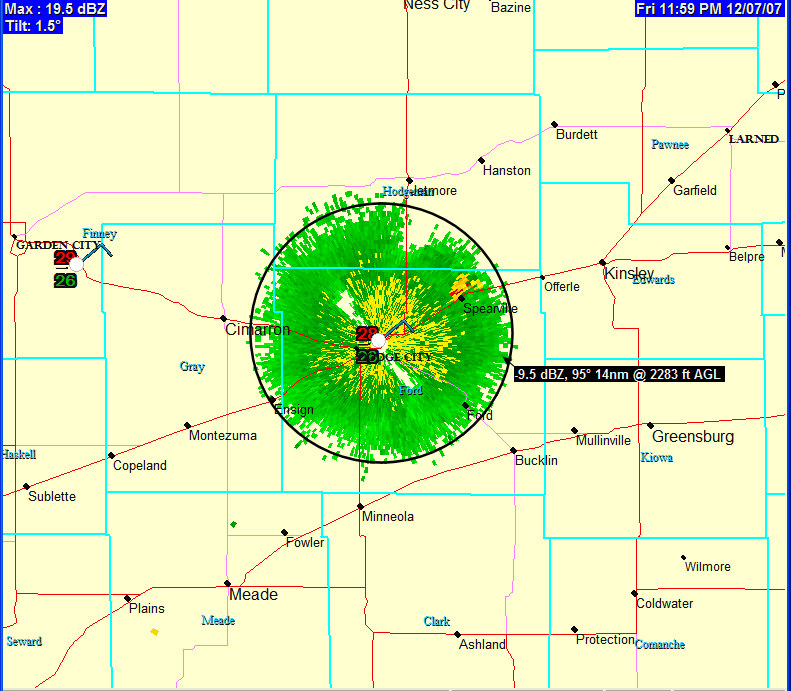
 It’s getting icy out there! Well it’s midnight, and upon stepping outside, it doesn’t take much to lose your step. About 3/4 of my driveway is icy vs. wet, although the street itself is still just wet as the road temperature is probably still just barely above freezing. Air temperature is hovering between 28 and 29F (see midnight surface plot in Img 1). I’ve also attached to this post a radar image from midnight showing the freezing drizzle. Freezing drizzle has a unique signature on radar, since it is such a shallow, near-surface layer of precipitation formation. You can only detect drizzle or freezing drizzle usually out to about 30-40 miles or so, at the lowest elevation slice. The radar image I attached (Img 2) is a 1.5° elevation slice, thus can only detect drizzle
  out to about 15 to 20 miles. Radar reflectivity is always really low (usually below 0 dBZ) with drizzle considering the drop size diameter of the water droplets that make up drizzle. Heavier drizzle can range from 5 to 10 dBZ or so. The freezing drizzle that is occurring now is creating about -5 to 0 dBZ, with heavier bursts up to +5 dBZ. There is a thin coating of ice on all exposed surfaces. When I go to work at 8am, I am not exactly looking forward to the drive, as road temperatures will probably drop another degree such that there will be more freezing on roads.
disclaimer: "The meteorological
views/forecast
thinking expressed are those solely of the author of this blog
and do not necessarily represent those of official National Weather Service forecast products,
therefore read and enjoy at your own risk and edification!"
and do not necessarily represent those of official National Weather Service forecast products,
therefore read and enjoy at your own risk and edification!"
December 8, 2007
Great Plains Winter Storm Dec 8-10 [post 4]
No Comments »
No comments yet.
RSS feed for comments on this post. TrackBack URL