 No rest for the weary following the ice storm. Bring on the snow! Nice little surprise setup (in that, I mean we weren’t exactly seeing this nice of a system > 4 or 5 days out) could bring much of southern Kansas a swath of 4 to 9" of snow, including here in Dodge City. Right now, if the latest 00z runs of the Canadian, NAM, and RUC models verify, we should see 4-6" of snow here in Dodge City. It looks like impressive lift will be over Dodge from roughly 1pm to 9pm tomorrow… probably maxed out around late afternoon. A surface low will eventually strengthen to the southeast, so we may see some 20-30mph wind gusts from the north-northeast by midnight tomorrow night as the pressure gradient increases… to help blow the snow around a little bit.
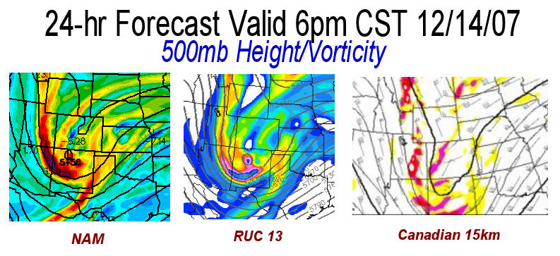
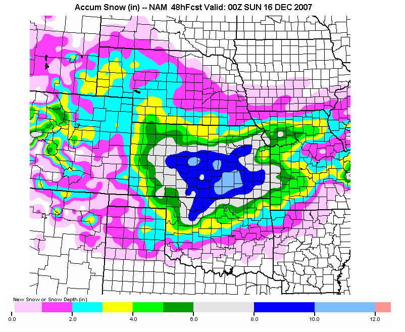
  In Img 1, I show the 500mb (mid level of the troposphere) Height and Vorticity pattern (basically showing the storm in the mid levels) from 3 model forecasts at 24 hours. A vorticity max (where the colors max out at the base of the height trough), taking a path to the south of Dodge City is favorable for snow here. These three forecasts look quite favorable. Img 2 shows the run total snow accumulation forecast from the NAM model. I hope that verifies!
disclaimer: "The meteorological
views/forecast
thinking expressed are those solely of the author of this blog
and do not necessarily represent those of official National Weather Service forecast products,
therefore read and enjoy at your own risk and edification!"
and do not necessarily represent those of official National Weather Service forecast products,
therefore read and enjoy at your own risk and edification!"
December 14, 2007
Kansas Snow, Dec 14-15 2007 [post 1]
No Comments »
No comments yet.
RSS feed for comments on this post. TrackBack URL