North of arnold looking west
disclaimer: "The meteorological
views/forecast
thinking expressed are those solely of the author of this blog
and do not necessarily represent those of official National Weather Service forecast products,
therefore read and enjoy at your own risk and edification!"
and do not necessarily represent those of official National Weather Service forecast products,
therefore read and enjoy at your own risk and edification!"
April 28, 2010
Chase update
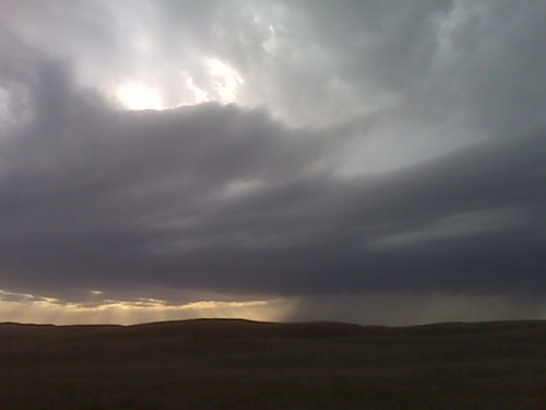
Time is 5:53 PM. Pretty good looking up draft based to my north west, it’s moving north east into the sand hills. So the plan is to go north at Paxton or Sutherland to try and stay ahead. We’ll see if this develops.
[ Transcribed by MyCaption ]
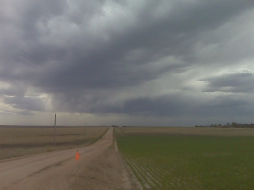
chase update 4/28 12:45pm cdt
Great view overlooking Lake McConaughy, already some initial cumulus
development in the distant west-northwest. Obviously, it’s way early
still, so I’m gonna go grab some lunch in Ogallala. Mid 40s dewpoints
are coming up into this area, and with continued convergence and
pooling we may see some 48 or 49 dewpoints by early this evening,
which would support around 1000 J/kg CAPE.
Chase Trip Day Five (Apr 28) Forecast
Chase day across western Nebraska. While the prospects look quite marginal, I will be storm chasing today. Low level moisture will be very marginal for organized strong/severe storms, however strong convergence and frontogenetic forcing will provide sufficient lift to generate storms…perhaps as far south as I-80 near Sidney, NE. I will be heading to Ogallala from Thedford where I will have lunch and re-evaluate my next move. For what it’s worth, the new NAM has just over 1000 J/kg of surface-based CAPE in a small area near Ogallala by 00z, but I think the models (especially the RUC with it’s upper 50s dewpoints) may be over predicting the dewpoint increase by 00z (7pm CDT), therefore in reality, with mid44 or 45 dewpoints at best converging in this small area, seems more like 700 or 800 J/kg would be more realistic… still enough for a loosely organized strong, perhaps isolated severe storm given the very good wind shear profile.
Chase Trip Day Four (Apr 27) Summary [21 images]
Landscape photography in the Nebraska Sand Hills.

I left Dodge City around 7:30am with the idea of some landscape photography around the sand hills of Nebraska later on in the afternoon and evening. After a brief visit to the North Platte NWS forecast office and lunch, I made my way to Thedford. After checking into the motel and about a 20-minute catnap, I began my little tour of southern Cherry County. While Cherry County is loathed by storm chasers given the vast expanse of nothingness and a dearth for roads, it is quite scenic. Rolling hills and ancient dunes of grass covered sand make up this landscape. It is a very expansive ranching country and there are several very scenic unpaved and one-lane paved county roads. I decided on a route that took me north from Seneca then west through ranchland to state highway 97. I then proceeded back to the southeast on Brownlee road then back southeast on Seneca road completing a nearly 65-mile loop. There were several large ponds of water with an assortment of waterfowl and other birds present. I was surprised to find a couple of swans in one of the ponds. I am not sure if they were Trumpeter or Tundra swans though, since they are so similar in appearance. Countless windmills and cattle, of course, given the ranching land use, which made for good elements in a number of my images. Scattered cirrus clouds also completed the composition on a number of images versus just an ordinary bland blue sky.

I was also scouting out some potential moonrise locations to shoot from. I wanted to get a good telephoto (~400mm focal length) image of the moon rising with sand hills and/or a lone windmill in the distance for perspective. What was troublesome, however, was that on the eastern horizon, the cirrus was thicker, and I wasn’t sure if that was going to ruin my moonrise opportunity or not. Moonrise was 8:12pm, and the moon was about 97% full, rising just a little bit before the sun setting. Sunset colors in the sky were not to be had, since the sun was setting behind thick cirrus to the west as well. I was fairly bummed about that, and given my pessimism, I just totally abandoned the idea of a decent moonrise, and just resumed my trek back south to Seneca and highway 2. Well, lo and behold, looking off to the east-southeast at about 8:20 was the big moon off the horizon. Crap! I was fortunate to be in a good spot, though, and I quickly pulled off and set up the tripod to get a few images of the moon with the sand hills (vertical compositions). I then went on my merry way about another mile or so when I spotted a distant windmill which was almost perfectly located with the moon about 25 minutes after moonrise. This was the first time I’ve ever set the tripod up on top of my jeep, because I needed to get a little more elevated since the top of the windmill was only barely clearing the horizon line. It was just enough of an increase in height, shooting from atop my jeep, to get this shot of the moon and the windmill.. another vertical composition. All in all, I was rather pleased with this 4 and a half hour shoot across southern Cherry County!
Begin: Dodge City, KS
End: Thedford, NE
Day Four Mileage: 481 mi.
Trip Mileage: 1770 mi.
21 images from this day’s shoot:
This SimpleViewer gallery requires Macromedia Flash. Please open this post in your browser or get Macromedia Flash here.
This is a WPSimpleViewerGallery
This is a WPSimpleViewerGallery
April 27, 2010
Chase Trip Day Four (Apr 27) Forecast
Storm chasing “down day”, landscape photography of the sand hills. I am currently en route to the sand hills of Nebraska, typing from a rest area along I-80 near Maxwell. I will be staying in Thedford tonight, and I should be arriving there by late afternoon after a lunch in North Platte. I plan to do some “golden hour” landscape photography of the sand hills along either US 83 or State Hwy 2. Both are beautiful drives through the sand hills. It will be interesting to see how much green-up there is in the hills. I may also go out late during the night like I did a couple nights ago and take advantage of near-full moonlight once again.
Looking ahead:
Tomorrow still appears to be a chase day in the Nebraska Panhandle. The latest NAM model still generates convective storms in near 1000 J/kg inflow airmass. Not sure of a specific target yet, I’ll figure that out later tonight or early tomorrow morning, but it will probably be a late show as the main upper level support will still be to the west… but low level frontogenesis will be strengthening across the Nebraska Panhandle by late afternoon and especially early evening. There should be organized strong to isolated severe in this good frontogenetic forcing area.
Thursday. On paper, this appears to be the best day of my chase vacation. I am liking the increased low level moisture depicted by the NAM east of the dryline in south central KS and western Oklahoma. Outstanding shear profile in the deep 0-6km layer as well as lowest kilometer. There could be a couple tornadoes with dryline initiated storms. Cold front forcing farther north doesn’t look so hot for tornadic supercells with mode quickly becoming a line from central KS north into central/eastern Nebraska. Given the neutral to cold advection in the 500-700mb layer by late afternoon early evening from the west… I foresee the dryline becoming active as far south as northwest Oklahoma. I could very well be targeting very near Dodge City on Thursday… or points just southeast of there. How about Protection, KS? It’s a great starting point on days like this with fantastic mid-upper winds from the southwest overspreading the warm, moist sector.
Friday… not sure where the effective boundary will be positioned Friday. I am thinking… and hoping… it slows down enough to keep North Texas in play around the Dallas-Ft Worth metroplex… we’ll see. This weekend looks confusing. The deep moisture is scoured out to the Gulf and the southeast states per all the models…but some residual moisture will linger about the plains amidst very chilly temperatures aloft. GFS does convect over the western Plains this weekend in some re-established weak low level convergent flow. Toward the end of my vacation, Monday 3rd and Tuesday 4th, the deep moisture may try to make a run back into my chasing domain (West or Southwest TX), but this is still pretty far out.
April 26, 2010
Chase Trip Day Three (Apr 26) Summary [no images]
Drive to Dodge City. Hopefully this will be the most boring summary of my vacation. This was just a simple drive day from Amarillo to Dodge City. I plan to stay here at home tonight and save at least one hotel expense on this trip. I left Amarillo in a chilly north wind with temperatures in the lower 40s. It was most definitely a non-convective atmosphere, that’s for sure. I drove straight through without stopping for anything photography wise. Camera was in the bag all day, so no photos to share from this day. Sorry! I will “get outta Dodge” once again tomorrow, though. I will head up into the Nebraska sand hills for a landscape photography shoot at sunset and perhaps more moonlight landscape photography as well. More on this in tomorrow’s post.
Begin: Amarillo, TX
End: Dodge City, KS
Day Three Mileage: 282 mi.
Trip Mileage: 1289 mi.
Chase Trip Day Two (Apr 25) Summary [14 images]
Palo Duro Canyon at night under near-full moonlight

There isn’t a whole lot to talk about concerning the second day of my chase/photography vacation. I made a last minute decision to abandon the idea to stay south (Carlsbad Caverns and Guadalupe Pass for Day 2 and chasing Central/South Texas Day 3). Trends in the models were less and less favorable for an isolated supercell in an area I feel comfortable chasing. This ultimately turned out to be a good decision, because at the time I am typing this summary, storms developed south of Waco and by sunset were east of I-35 between Austin and Houston.
Instead, on Day 2 I decided to drive out toward the Palo Duro Canyon/Caprock Canyons area. I was initially somewhat intrigued at the possibility of an isolated storm in a pathetic 500 J/kg CAPE environment, and I leisurely drove across the far southern Texas Panhandle watching cumulus struggle to develop into towering cumulus in the lower to mid 30s dewpoints…despite quite chilly temperatures aloft. I reached Caprock Canyons state park, but it was about 6:00pm by that time. I didn’t spend a whole lot of time here, though, as I was feeling pretty fatigued from the long drive from Roswell. At around 7:00pm, watching the last of the cumulus dissipate, I decided to take the scenic Highway 207 drive north. About 20 miles north of Silverton, I stopped for a little bit to photograph some of the flooded farm fields from a recent heavy rain event. I was thinking initially of just driving straight to Dodge City. I then changed my mind and decided that, since there was a near-full moon, I would do some late night photography of the Palo Duro Canyon… so I drove over to Amarillo for a late dinner and got a motel room for the night. I slept from about 10:00pm to 1:00am and then set out to the Palo Duro Canyon via Wayside. I spent about an hour and a half photographing some of the same farm fields with water as well as the Palo Duro Canyon at a picnic area and roadside pull off on the south side of the canyon along Highway 207.
Begin: Roswell, NM
End: Amarillo, TX
Day Two Mileage: 389 mi.
Trip Mileage: 1007 mi.
14 images from this day’s shoot:
This SimpleViewer gallery requires Macromedia Flash. Please open this post in your browser or get Macromedia Flash here.
This is a WPSimpleViewerGallery
This is a WPSimpleViewerGallery
chase trip update 4/26 4:30pm
Back in Dodge City, but only for a short time. I arrived in Dodge around 3:30pm or so, stopping by work briefly to pick up some mail I was expecting and checked the latest forecast models. The ECMWF hi-res was interesting regarding Thursday. It was really holding the front back farther northwest…strongly suggesting a more northern possible target Thursday… thus it won’t be so bad to chase Wednesday across the Nebraska Panhandle. The ECMWF does hint at some convective initiation by 00z as far south as Sidney, NE early evening Wednesday. So, then plan now is to depart Dodge first thing tomorrow morning and make Tuesday a drive day to the Nebraska sand hills… and plan on a sunset shoot in the desolate sand hills. I may even consider another overnight moonlit landscape shoot on the sand hills if skies are clear… which I’m pretty sure they will.