High Plains Drifter


disclaimer:  "The meteorological views/forecast thinking expressed are those solely of the author of this blog
and do not necessarily represent those of official National Weather Service forecast products,
therefore read and enjoy at your own risk and edification!"

June 7, 2009

Chase Acct: June 6, 2009 (Southwest NE)

Filed under: Chase Accounts,Latest Chases,Storm Chasing — Mike U @ 7:36 am

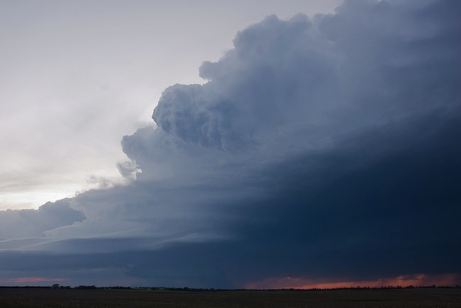
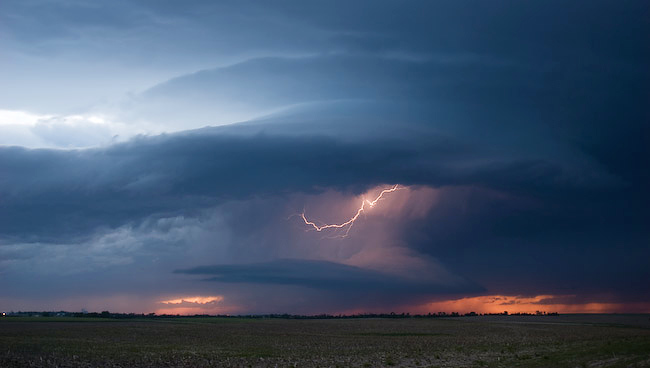
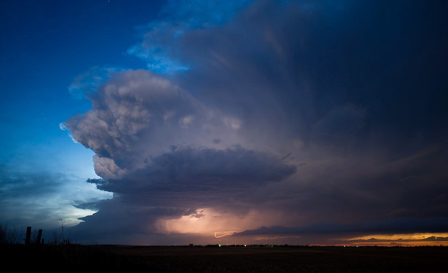
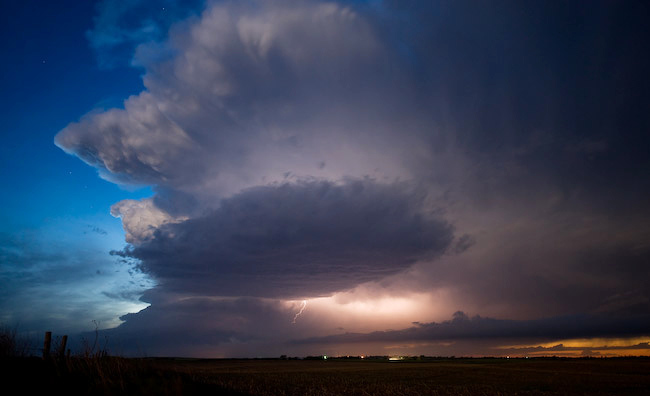
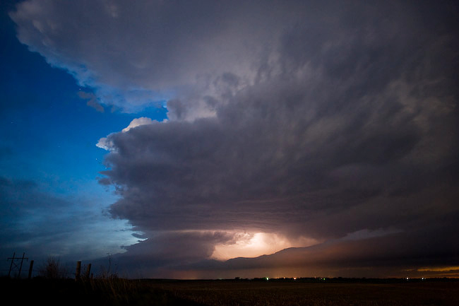
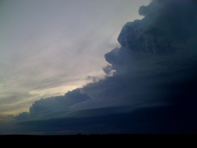
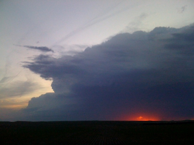
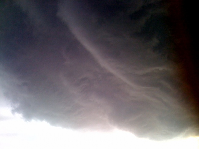
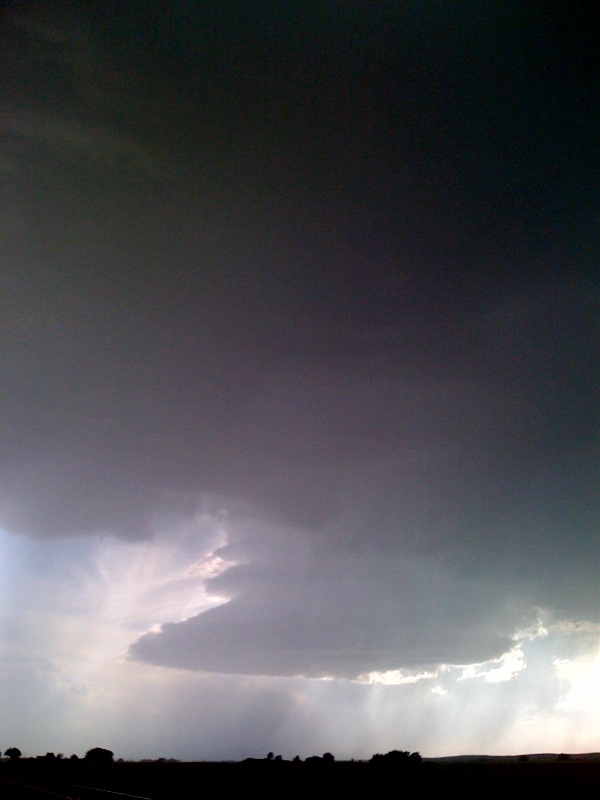
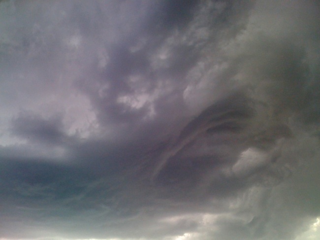
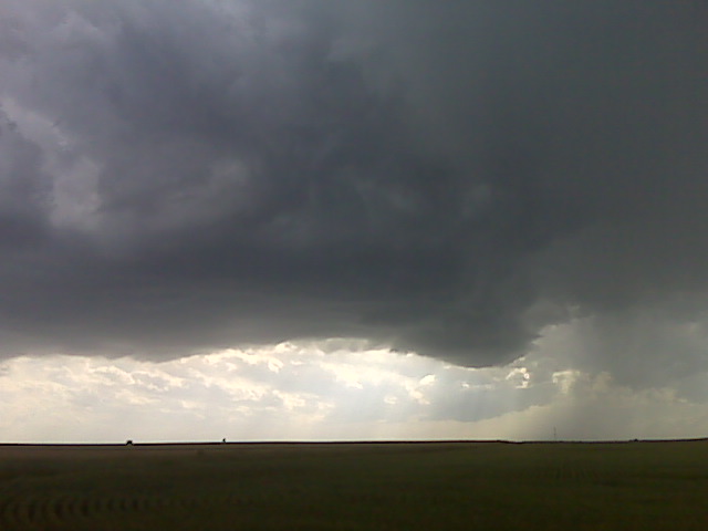
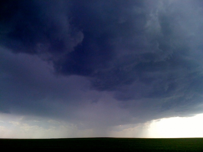
Robin Lorenson and I photographed three different supercells across southwestern Nebraska.  Our target was Ogallala to Sidney to Julesburg, which allowed us to hang around Ogallala for the better part of the afternoon along with Matt Crowther, Scott Bell, and Dave Blanchard.  The first supercell we photographed was a high based well-sculpted “cinnamon swirl” supercell updraft as it tracked along I-80 from Brule to just northwest of North Platte before weakening.  Robn and I stuck with this a little too long, while Matt Crowther and company broke off sooner in favor of new development back toward Julesburg, CO.  Matt’s decision to break off that initial storm paid off, as they managed to get fantastic images of the 2nd supercell that tracked south of Ogallala.  Robin and I caught the last glimpses of the supercell structure just after sunset from a viewing point a couple miles east-southeast of Elsie, NE.  Matt and Scott joined us at this location and we watched a 3rd supercell track basically along the same track as supercell #2.  There was just enough remaining twilight for my Nikon D3 to take advantage of, so I set it up on the tripod and shot continuous 5-second exposures of lightning illuminated structure… beautiful bell-shaped updraft with a wonderful convective top above.  This was just a beautiful sight!!  A very rewarding day on the high plains with the storms essentially to ourselves as all the other chasers targeted much farther east with little in the way of results.


June 6, 2009

Sunset supercell north of Grant, NE

Filed under: chase mode updates — Mike U @ 9:28 pm

Robin Lorenson

Robin Lorenson Photography
www.robinlorensonphoto.com
660.287.0950

Intercepting sunset supercell north of Grant, NE

Filed under: chase mode updates — Mike U @ 9:15 pm

Robin Lorenson

Robin Lorenson Photography
www.robinlorensonphoto.com
660.287.0950

Filed under: chase mode updates — Mike U @ 7:40 pm

Have been photographing a cinammon swirl supercell updraft along I-80
corridor. We are continuing east as it approaches North Platte, NE. We
noticed new storm development to the west on radar.

Robin Lorenson
Robin Lorenson Photography
www.robinlorensonphoto.com
660.287.0950

Under belly of a high plains supercell updraft, Ogallala, NE.

Filed under: chase mode updates — Mike U @ 7:12 pm

Robin Lorenson

Robin Lorenson Photography
www.robinlorensonphoto.com
660.287.0950

Small tiered meso, 2 miles W of Odallala, BE

Filed under: chase mode updates — Mike U @ 6:56 pm

Robin Lorenson

Robin Lorenson Photography
www.robinlorensonphoto.com
660.287.0950

Updraft west of Big Springs, NE

Filed under: chase mode updates — Mike U @ 6:31 pm

Robin Lorenson

Robin Lorenson Photography
www.robinlorensonphoto.com
660.287.0950

New updraft base forming near Chappell NE

Filed under: chase mode updates — Mike U @ 6:17 pm

(Sent by Mike’s Alltel Blackberry smartphone)

Being patient

Filed under: chase mode updates — Mike U @ 6:04 pm

We are sitting wnw of big springs, ne first following a left-mover storm. New updrafts are forming back to the sw again w pof julesburg. I like the upstream dewpoints at LBF and MCK. If these storms can survive the next hour or so we may be in business. More later.
(Sent by Mike’s Alltel Blackberry smartphone)

Newly developed storm W of Julesburg, CO

Filed under: chase mode updates — Mike U @ 5:33 pm

Robin Lorenson

Robin Lorenson Photography
www.robinlorensonphoto.com
660.287.0950

« Newer PostsOlder Posts »

Powered by WordPress