Evan Bookbinder and Jay Antle will arrive in Dodge City some time this evening in preparation for our first chase day, tomorrow, June 11. It appears our first day will not be too far from southwestern Kansas: Raton Mesa or just north of there, about a 3 to 4 hour drive from Dodge City. Thereafter, the pattern looks excellent for High Plains storm chasing/photography for much of the trip! More later!
disclaimer: "The meteorological
views/forecast
thinking expressed are those solely of the author of this blog
and do not necessarily represent those of official National Weather Service forecast products,
therefore read and enjoy at your own risk and edification!"
and do not necessarily represent those of official National Weather Service forecast products,
therefore read and enjoy at your own risk and edification!"
June 10, 2009
June 9, 2009
Chase Acct: June 9, 2009 (Dodge City, KS)
The One-Hour Pure Gentleman’s Chase — Dodge City, KS Supercell
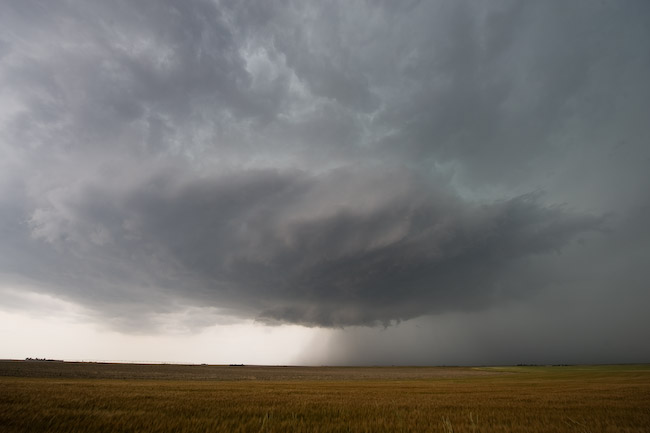
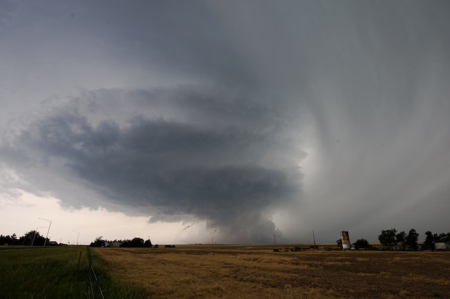
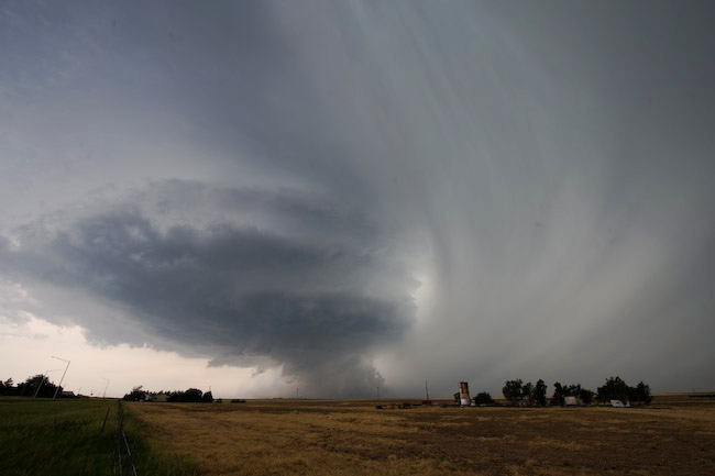
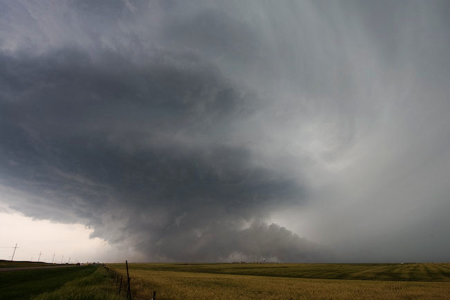
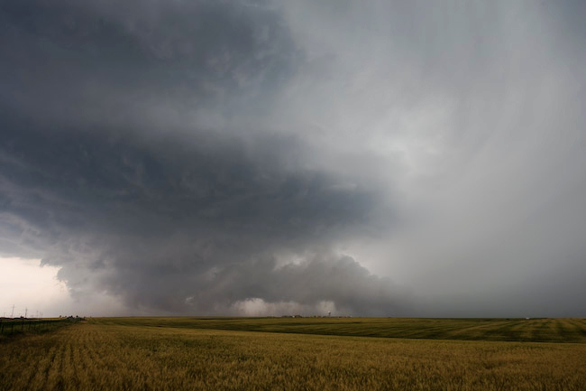
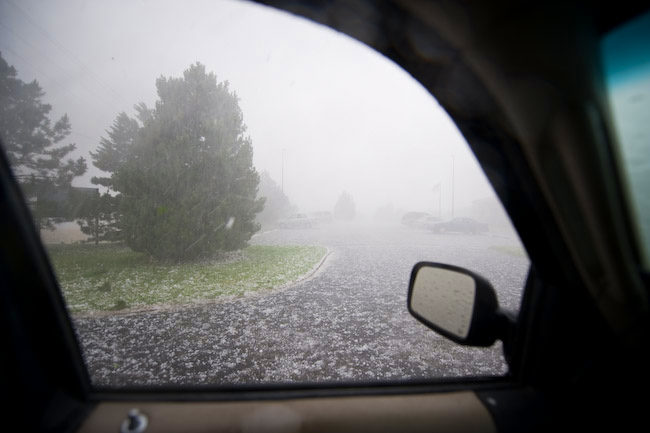
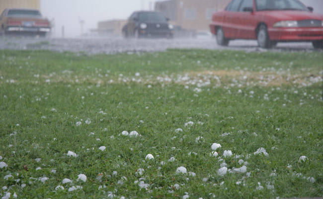
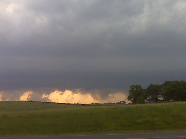
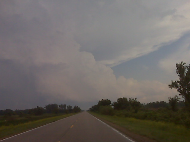
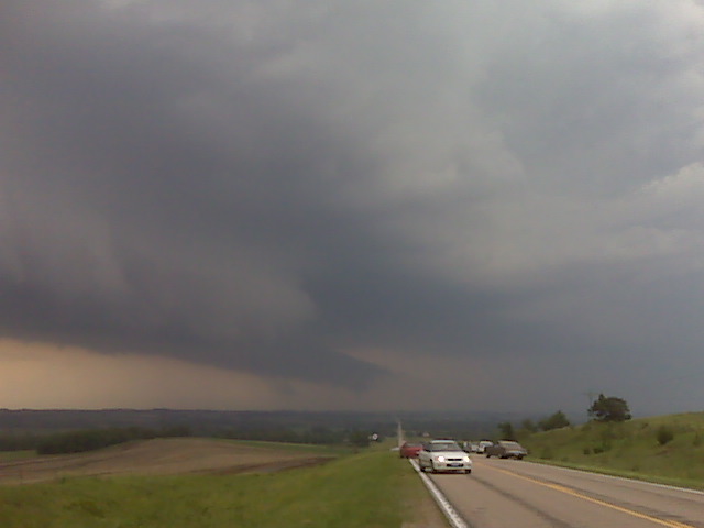
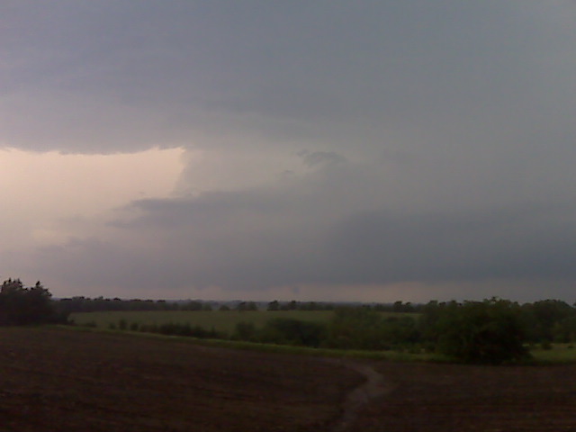
I worked the day shift on June 9th, and I got off shift at 4:00pm. I had planned all along to work overtime given severe weather development across our forecast area. That being said, by 4:00pm, there was nothing on radar across all of our forecast area, so I agreed to be called back if I was needed back for help. After a 20-minute nap, I got a call from Matt Crowther asking about a new storm developing southwest of DDC. I didn’t know anything about it at the time (about 4:30pm by now), so a quick glance at radar had me intrigued. It had a nice little shape to it and was moving in the general direction of DDC. So, I decided to go after it, only a 15 mile drive to the southwest from my duplex to the updraft seen in the first image. As this was moving northeast, I had to keep moving northeast too… back toward Dodge City. I took north bypass through the north part of town all the way to the US-283 junction, about 2.5 miles northeast of the Dodge City airport. It was at that time that one of my evening shift co-workers called me back in. It was at this time that I photographed images #2 through#5 below of the awesome updraft structure and menacing near-ground activity (in images #4 and #5, you can see the KDDC WSR-88D radome in the distance!). The tall precip shaft adjacent the updraft was beautiful! After I shot these images, I drove to the office…. toward this supercell. I didn’t make it to the WFO DDC driveway before the golfball size hail. Heavy and hard golfball to 2″ diameter hail pelted me as I entered the WFO parking lot. The last two images in this series below are from the WFO parking lot. What an awesome 1-hour, 30-mile round trip gentleman’s chase!!
June 7, 2009
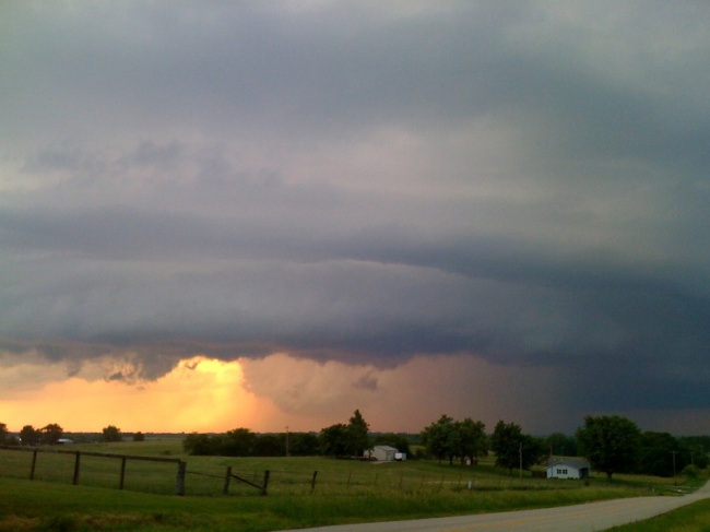
Heading home after a long, successful chase
Wow, what a fun chase. By far the most photogenic supercell I’ve seen
in Missouri. As much as I dislike the state, I gotta say, it put on a
nice little show this evening! We concluded chasing around 9:00pm
east of Cameron, MO and are heading back to Salina to drop Robin
off… and I will continue my drive into the wee-hours of the morning
to Dodge since I start back up on day shifts tomorrow at 10:00am.
–
Mike Umscheid Photography
http://gallery.underthemeso.com
mesomike@gmail.com
Tornadoc supercell north of Cameron, MO
Robin Lorenson
Robin Lorenson Photography
www.robinlorensonphoto.com
660.287.0950
Looking wsw fro a few miles w of pawnee city ne
(Sent by Mike’s Alltel Blackberry smartphone)
Awaiting convective development
Sitting in Beatrice NE along with matt crowther and scott bell waiting for storms to form. Very high cape/instability here just east and southeast of surface low. More later
(Sent by Mike’s Alltel Blackberry smartphone)
Midday update
As I type at 12:20pm, we are driving east on I-80 between Grand Island
and York. Latest 1km Vis and surface obs suggest an area of
convergence and cyclonic vorticity near Concordia. There is a kink in
the stratus field which indicates the surface low location as well.
This is the best play today I think. We will head south toward
Belleville and probably wait there. There is a band of mid level
cloud which is about to move over the target area which will probably
work against surface-based convective initiation, however, it is still
extremely early in the day (chase mode wise) and this will probably
move on out by late afternoon (I hope). We shall see. More later.
–
Mike Umscheid Photography
http://gallery.underthemeso.com
mesomike@gmail.com