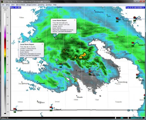
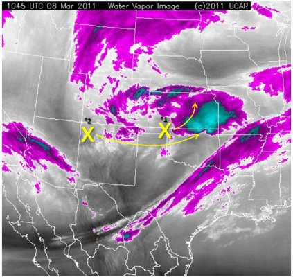
Sleet showers continued through the night. Warm advection centered around 850mb prevailed through the night, keeping the warm layer aloft in-check, and keeping the precipitation type sleet all through the night (after it had changed back over from the first snow band late last evening). As of the pre-dawn hours this morning, the highest snowfall totals were 3 to 4 inches from Syracuse to Scott City (see Figure 1 below). The initial potential vorticity (PV) max (‘x’ #1 in Figure 2) was lifting out into central Kansas as of 1100 UTC (5:00am CST), yielding subsidence now across southwest Kansas, including Dodge City (outside of a few widely scattered sleet showers along and south of the Arkansas River). The next mid level PV anomaly, anotated ‘x’ #2 i Figure 2, will move south of southwest Kansas later on today, providing another shot at light accumulating precipitation, which will most likely be in the form of snow with cold advection finally prevailing at around 850mb eroding the warm layer aloft.
disclaimer: "The meteorological
views/forecast
thinking expressed are those solely of the author of this blog
and do not necessarily represent those of official National Weather Service forecast products,
therefore read and enjoy at your own risk and edification!"
and do not necessarily represent those of official National Weather Service forecast products,
therefore read and enjoy at your own risk and edification!"
March 8, 2011
No Comments »
No comments yet.
RSS feed for comments on this post. TrackBack URL

