Chase Summary:
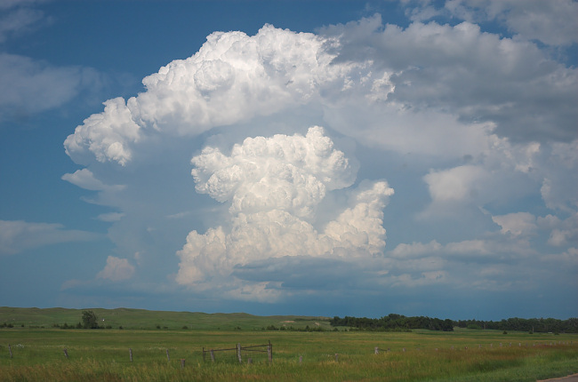
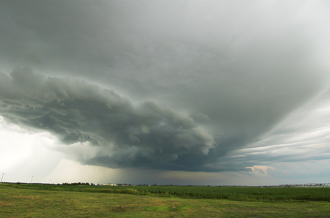
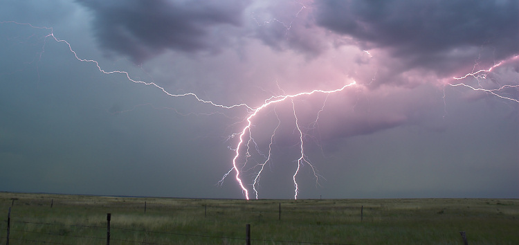
Vince and I arrived in eastern Cherry County, NE by mid-afternoon to very promising conditions for supercells… strong southeast winds, warm temperatures well into the 80s and dewpoints around 65-66 degrees. The mid level winds were also sufficient around 30-35 knots or so for deep layer bulk shear values around 45-50 knots or so. We took a very scenic one-lane paved road northwest towards the Merriman Reservoir southwest of Valentine where we awaited convective initiation. Data and observations were suggesting initiation was imminent just to our northeast back near Valentine, so we opted to head into town where we re-fueled and began the chase. We realized we needed to head southeast on US-20 (instead of due east out of Valentine) with incredible convection off to our due east. This storm exploded right in front of our eyes about 25-30 miles east of us. We arrived on-scene to a well-developed dark base wth lowerings off to our north-northeast from near Long Pine. Rotation was definitely evident, but somewhat broad at cloud base. Rear-flank downdraft clear slots would develop and fill in, redevelop and fill back in…cycling new circulations quite often. This would be the story with this storm… there just wasn’t quite enough low level wind shear to get the job done it appeared, but boy it was close. We came to a stopping location again a few miles up the road just outside of Bassett where we were really close to the back edge of the old occluded portion of the storm with high contents of cyclonic shear. Cloud rotation would be strongest, and in more than one spot on the cylonic shear side of the rear-flank downdraft/occlusion downdraft area. I thought there was indeed a potential for a brief tornado from one of these old mesos if it just stretched vorticity enough. We saw several small funnels from this intense area of cyclonic shear on the backside. Our surface winds were fun to observe… out of the northwest… quite warm too… and extremely gusty/variable in speed. For a brief moment, we had wind speeds around 40-50 mph from the northwest… that were warm… only followed by dead-calm winds about a minute later!! This told me that it was trying really hard at the surface to tighten a circulation to potentially tornado scale. Again… it was close, but no cigar there just outside of Bassett. We continued south on Hwy 183 about 8 mile south of Bassett where we headed east again to get closer to the updraft region and old occluded backside again. Once again, we had very interesting attempts at tornadogenesis from an old circulation… the cyclonic shear side was just rich with vorticity and it was just fascinating watching scud fragments rotating and rising to the small occluded base becoming a rapidly roating entity almost to the point of tornadogenesis. By this time, RFD was cooler as more rain cooled air was being ingested, and we began to become more disinterested with the storm… plus the fact it was moving away from us in a very poor section of road network. We bailed and headed back to Bassett where we re-evaluated the situation… we thought about chasing the big complex west of us with all sorts of mesocyclone indications on radar back over the area where we staged earlier in the afternoon (Merriman Reservoir). It was getting to be 8:30pm, however, and things were becoming more of a mess with MCS taking shape. We settled for lightning photography (Vince with video) a few miles north of Bassett on Highway 7…then called it a chase and drove through the incredible rain and extremely bright lightning on our way to Winner, SD for the night. What a fun chase for our first day!